Arturo Announces Strategic Partnership with Vexcel
Arturo will leverage Vexcel’s high-resolution imagery to help insurers identify vulnerable property characteristics, respond to claims and underwrite policies with greater accuracy
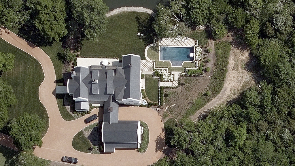
Below is a news release on our partnership to provide Arturo several aerial imagery products, including True Ortho, Oblique, DSM, and Gray Sky imagery in the U.S. and Australia.
CHICAGO (Sept. 8, 2022) – Arturo, the proptech company that delivers intelligent analytics from individual property to portfolio, announced today that it signed Vexcel Imaging, the leader in aerial imagery data, large-format aerial cameras and photogrammetry software, to be a lead imagery provider for its solutions. As part of the agreement, Vexcel will provide Arturo with true ortho imagery, oblique imagery and digital surface models (DSMs). In addition, “Gray Sky” imagery — or imagery taken after a catastrophic event occurs — will be available for use.
![]()
High-fidelity property insights derived from imagery are an increasingly critical asset for property insurers who are challenged to assess and identify vulnerable property characteristics during the underwriting and quoting process, so they clearly understand their resting risk. Arturo’s partnership with Vexcel offers the unparalleled imaging capabilities modern insurance carriers seek in today’s rapidly evolving property market. It will also allow insurers to create risk and property damage mitigation strategies with their policyholders as well as faster, more accurate responses to claims after a catastrophe.
“This is a hard market for insurance. Carriers are caught between gauging their risk correctly up front and contending with the reality of increasingly volatile catastrophic weather events. Property insurers are tasked more than ever to have a thorough understanding of a property’s risk while also keeping costs down, so if an event does occur they can both keep regions insurable and their customer response rapid and efficient,” said Greg Oslan, chief executive officer for Arturo. “We spent a lot of time collaborating with Vexcel to both ensure a partnership that was beneficial to our mutual customers and provide us greater flexibility in working with our insurance clients across the policy lifecycle. We recognized that not all imagery is created equal nor all machine learning analytics which is why coupling Arturo’s AI property intelligence solutions with Vexcel’s imagery will allow insurers to stay a step ahead of natural catastrophes, so they can accurately underwrite future policies and manage future claims with ease.”
“After much testing and rigorous analysis, we are pleased that Arturo has standardized on our best-in-class imagery to unlock better property insights for insurers,” said Rob Agee, chief operating officer at Vexcel Imaging. “Our focus at Vexcel is to provide consistent, accurate and high-resolution imagery to customers who need a scalable solution in multiple countries. Using its AI and ML, Arturo analyzed properties in a variety of locations and found the results they needed to understand property risk and intelligence.”
Vexcel and Arturo’s collaboration will initially provide imagery for the United States and Australian markets. Arturo will be discussing this imagery relationship in more detail at InsureTech Connect in Las Vegas on September 20-22 at booth #2341.
About Arturo
Arturo combines AI and machine learning models with property images to help businesses decide with intelligence from the property to portfolio level. Across the insurance, lending, securities and real estate markets, Arturo empowers customers with on-demand, accurate property characteristics and predictive analysis to tackle the biggest property challenges with efficiency, accuracy and confidence. Discover more at arturo.ai.
About Vexcel
For 30 years, Vexcel’s award-winning technology has led the photogrammetry and remote sensing industry. Using its professional-grade UltraCam sensors and a dedicated fleet of aircraft, Vexcel operates the world’s largest aerial imagery and geospatial data program. Vexcel collects imagery in 25+ countries—including rural and urban areas in the contiguous United States. It provides a wide variety of high-resolution products from Oblique to True Ortho, DSM to Multispectral and Property Attributes. Its cloud-based aerial data improves workflows across a variety of industries. More at vexceldata.com.
Also on: Business Wire