High Resolution
Aerial Imagery in Australia & New Zealand
Bring your projects into focus with high-accuracy imagery, 3D models, and AI-enhanced data.

Bring your projects into focus with high-accuracy imagery, 3D models, and AI-enhanced data.
Bring your projects into focus with high-accuracy imagery, 3D models, and AI-enhanced data.
Vexcel publishes aerial imagery and data in 45+ countries and territories, including Australia, Canada, France, Germany, India, Japan, Spain, United Kingdom, and the U.S.
No data shifts, no headaches. Vexcel matches its aerial collections against ground control points for mapping-grade accuracy and a pixel-to-data match across its products.
Add imagery and geospatial data into your everyday workflows by using Vexcel Viewer, Vexcel APIs, Image Services for ArcGIS, MapControl SDK, WMTS, and more.

AI has a blind spot. It can’t see or understand high-res details about Planet Earth. We built a platform to help. Meet Vexcel Intelligence.

Virtually tour your site with multiple views in high detail of 7.5cm resolution.

Get top-down views of urban, suburban, and rural regions in 7.5-15cm resolution.

Explore 80+ AI-derived attributes for buildings, properties, and roadways.

Detect and classify land cover and vegetation with color-infrared imagery.

Use DSM and DTM data for surface analysis, digital twins, and more.

Access imagery from major natural disasters, including hurricanes, wildfires, and tornadoes.
 https://vexceldata.com/wp-content/uploads/2026/03/North-Plantations-WA-24.848160-113.668405-1.jpg
720
1280
vexcel
https://vexceldata.com/wp-content/uploads/2021/12/VEXCEL-Data-Program.png
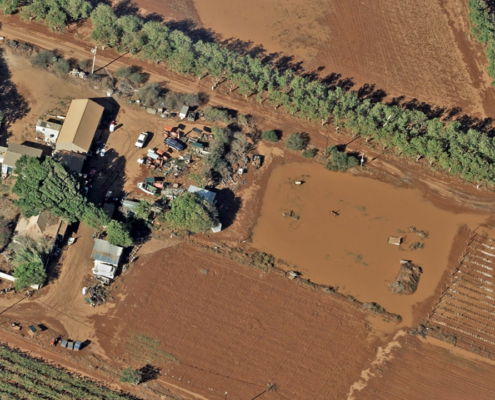
vexcel2026-03-31 11:10:292026-07-06 10:29:57Gray Sky: Cyclone Narelle, Australia
https://vexceldata.com/wp-content/uploads/2026/03/North-Plantations-WA-24.848160-113.668405-1.jpg
720
1280
vexcel
https://vexceldata.com/wp-content/uploads/2021/12/VEXCEL-Data-Program.png
vexcel2026-03-31 11:10:292026-07-06 10:29:57Gray Sky: Cyclone Narelle, Australia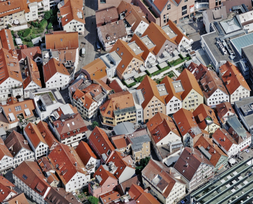 https://vexceldata.com/wp-content/uploads/2026/03/Reutlingen-Germany-48.491980-9.209701.jpg
720
1280
vexcel
https://vexceldata.com/wp-content/uploads/2021/12/VEXCEL-Data-Program.png
vexcel2026-03-10 01:00:172026-03-10 09:48:27Vexcel Announces 2026 Global Aerial Imagery Collection Plan
https://vexceldata.com/wp-content/uploads/2026/03/Reutlingen-Germany-48.491980-9.209701.jpg
720
1280
vexcel
https://vexceldata.com/wp-content/uploads/2021/12/VEXCEL-Data-Program.png
vexcel2026-03-10 01:00:172026-03-10 09:48:27Vexcel Announces 2026 Global Aerial Imagery Collection Plan https://vexceldata.com/wp-content/uploads/2026/02/Screenshot-2026-02-24-at-8.40.45-AM.png
774
975
vexcel
https://vexceldata.com/wp-content/uploads/2021/12/VEXCEL-Data-Program.png
vexcel2026-02-24 11:40:212026-04-02 12:17:39Introducing Vexcel Intelligence: AI for the Real World
https://vexceldata.com/wp-content/uploads/2026/02/Screenshot-2026-02-24-at-8.40.45-AM.png
774
975
vexcel
https://vexceldata.com/wp-content/uploads/2021/12/VEXCEL-Data-Program.png
vexcel2026-02-24 11:40:212026-04-02 12:17:39Introducing Vexcel Intelligence: AI for the Real World![]()
Large-format UltraCam cameras & sensors.
vexcel-imaging.com
Aerial surveys by fixed-wing aircraft.
kasurveys.com
Aerial imagery and data for government and business.
vexceldata.com