High Resolution & Up-to-Date
Aerial Imagery for Financial Services
Vexcel provides high-resolution imagery and AI-derived property insights to support portfolio analysis, asset monitoring, loan underwriting, and investment decisions.

Vexcel provides high-resolution imagery and AI-derived property insights to support portfolio analysis, asset monitoring, loan underwriting, and investment decisions.
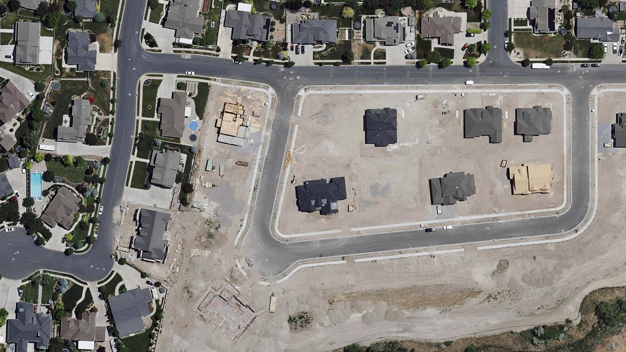
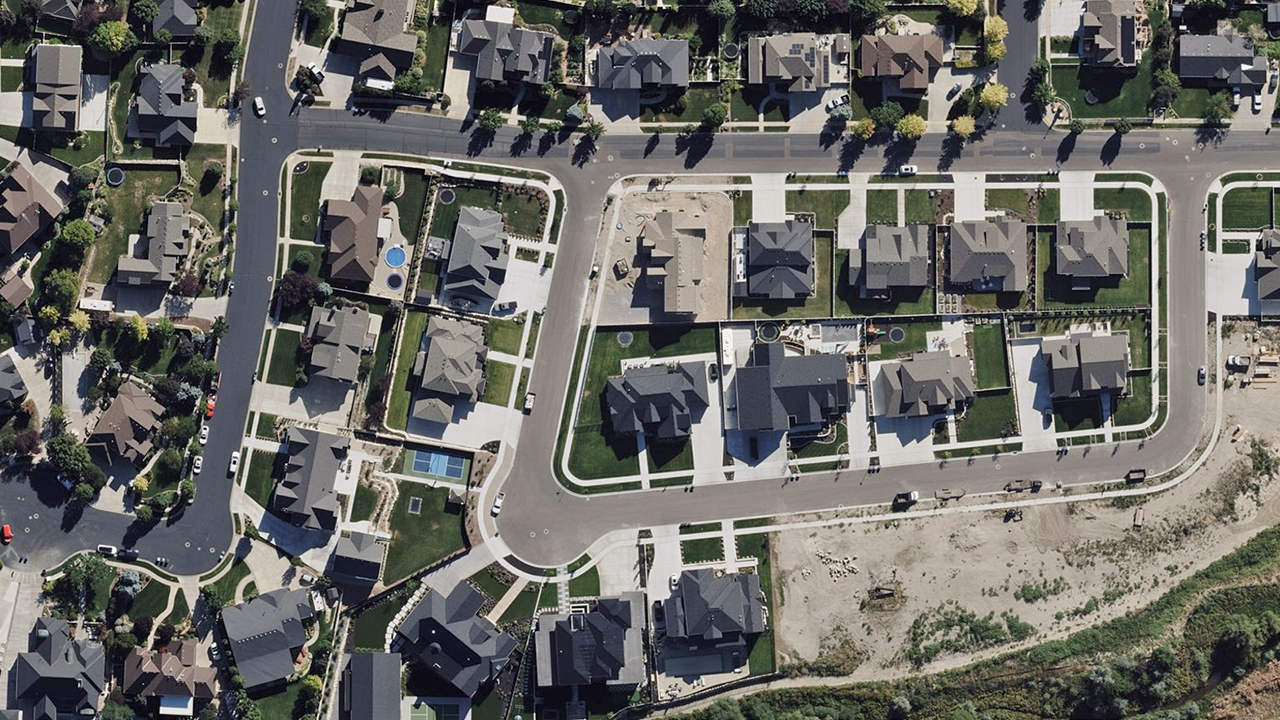
When securing property information for your portfolio, access to highly detailed aerial imagery is essential for understanding both recent conditions and historical trends. Vexcel collects high-resolution imagery in 40+ countries and provides current and historical views of properties, including in 49 U.S. states.
Get up-to-date insights on buildings, roof conditions, swimming pools, landscaping, vegetation, decks, and more. Plus, see a property’s surroundings for a complete and accurate view.

When it comes to securing information on properties for your portfolio, having access to detailed aerial imagery is beneficial for understanding current condition and history. Vexcel collects imagery in 40+ countries, including current and historical imagery for properties in 49 states across the U.S. View roof condition, swimming pools, garage, landscape, vegetation, deck, and location relative to surroundings to get the full picture of a property.

When it comes to securing information on properties for your portfolio, having access to detailed aerial imagery is beneficial for understanding current condition and history. Vexcel collects imagery in 40+ countries, including current and historical imagery for properties in 49 states across the U.S. View roof condition, swimming pools, garage, landscape, vegetation, deck, and location relative to surroundings to get the full picture of a property.

When it comes to securing information on properties for your portfolio, having access to detailed aerial imagery is beneficial for understanding current condition and history. Vexcel collects imagery in 40+ countries, including current and historical imagery for properties in 49 states across the U.S. View roof condition, swimming pools, garage, landscape, vegetation, deck, and location relative to surroundings to get the full picture of a property.

With multiple property views, property analysts and loan holders can better monitor assets and spot changes. Vexcel delivers frequent collections globally and captures urban areas in the U.S. up to three times per year.
These additional views supercharge change detection, allowing you to pinpoint property damage, reduce portfolio exposure, and identify opportunities in growing areas—keeping you ahead of risks and market shifts.
Explore a Q&A with banking analyst David Harberson on how the broader banking space and financial professionals can unlock the potential of using aerial imagery for its portfolios.

Following a major disaster such as a hurricane, tornado, or wildfire, Vexcel collects Gray Sky imagery and publishes Damage Assessments of impacted properties.
Use this data to understand the full scope of an event, assess the impact on your portfolio, and determine what restoration services may be needed to bring a property back to value.


Vexcel provides a comprehensive library of high-resolution imagery to support property evaluations and loan due diligence. Review commercial and residential properties, track assets, and manage portfolios with greater insight. Our aircraft-based imagery captures more detail than satellites, providing sharper property analysis.
Vexcel uses AI to extract property features, and our flexible business models let you apply your own. The accuracy and consistency of our imagery support precise AI and ML applications, helping financial professionals generate actionable decisions.
Vexcel proactively collects imagery using a fleet of aircraft equipped with market-leading camera sensors that have set the industry standard for 30+ years. Every pixel and data point undergoes world-class processing and is delivered as various products to better understand ground truth on properties, including:


Bring imagery and data where you need it. The Vexcel Platform provides APIs, SDKs, and other services, making it easy to integrate with your in-house and partner applications.
Q: How is aerial imagery used in financial services?
Vexcel’s current and detailed aerial imagery helps financial services firms better understand properties, assets, and surrounding conditions at scale. Banks, lenders, investors, and financial analysts use Vexcel imagery for portfolio analysis, property review, mortgage underwriting, site selection, risk analysis, and investment due diligence workflows.
Q: What property details are available for portfolio analysis?
Vexcel imagery and AI-derived property data help financial services teams review rooftops, pools, surrounding structures, vegetation, property additions, and other visible property characteristics. Vexcel’s Elements AI data also provides attributes such as building footprints, roof condition, roof material, roof shape, and other property insights across large portfolios.
Q: Can Vexcel imagery support mortgage and loan underwriting?
Yes. Vexcel imagery helps lenders and underwriters review residential and commercial properties without always sending inspectors into the field. Financial institutions use Vexcel imagery to better understand property condition, surrounding risks, property changes, and other visible characteristics during mortgage and loan underwriting workflows.
Q: How does historical imagery help with investment due diligence?
Vexcel historical imagery helps financial services teams review how properties and surrounding areas have changed over time. Investors and analysts use timestamped imagery to identify development trends, property modifications, infrastructure growth, site conditions, and other changes that may impact investment decisions and risk analysis.
Q: In how many countries does Vexcel provide property imagery?
Vexcel provides high-resolution aerial imagery in 45+ countries and territories. Vexcel’s broad coverage supports financial services workflows across cities, regions, and country-wide property portfolios with consistent, time-stamped imagery.
![]()
Large-format UltraCam cameras & sensors.
vexcel-imaging.com
Aerial surveys by fixed-wing aircraft.
kasurveys.com
Aerial imagery and data for government and business.
vexceldata.com