Accurate, Current & High Resolution
More Aerial Imagery in More Places
Bring your projects into focus with high-accuracy imagery, 3D models, and AI-enhanced data that’s ready to use.

Bring your projects into focus with high-accuracy imagery, 3D models, and AI-enhanced data that’s ready to use.
Bring your projects into focus with high-accuracy imagery, 3D models, and AI-enhanced data that’s ready to use.
Vexcel publishes aerial imagery and data in 45+ countries and territories, including the U.S., Canada, UK, Germany, France, Italy, Australia, New Zealand, and Japan.
No data shifts, no headaches. Vexcel matches its aerial collections against ground control points for mapping-grade accuracy and a pixel-to-data match across its products.
Add imagery and geospatial data into your everyday workflows by using Vexcel Viewer, Vexcel APIs, Image Services for ArcGIS, MapControl SDK, WMTS, and more.
Supercharge how your AI understands the Earth with the world’s most trusted aerial imagery and geospatial data.


Take a virtual walk around your area of interest with multiple perspectives in high resolution.

From cities to rural areas, access ortho imagery ranging from 7.5 to 15cm resolution.

Explore 80+ AI-derived attributes for buildings, properties, and roadways.

Detect and classify land cover and vegetation with color-infrared imagery.

Use DSM and DTM data for surface analysis, 3D modeling, digital twins, and more.

Access imagery from major natural disasters, including hurricanes, wildfires, and tornadoes.
 https://vexceldata.com/wp-content/uploads/2026/01/Netherlands-Promo-image.jpg
576
826
Angie Brewster
https://vexceldata.com/wp-content/uploads/2021/12/VEXCEL-Data-Program.png
Angie Brewster2026-01-15 10:53:472026-01-15 14:05:55Adaptive Motion Compensation: Motion Happens. Blur Doesn’t Have To.
https://vexceldata.com/wp-content/uploads/2026/01/Netherlands-Promo-image.jpg
576
826
Angie Brewster
https://vexceldata.com/wp-content/uploads/2021/12/VEXCEL-Data-Program.png
Angie Brewster2026-01-15 10:53:472026-01-15 14:05:55Adaptive Motion Compensation: Motion Happens. Blur Doesn’t Have To.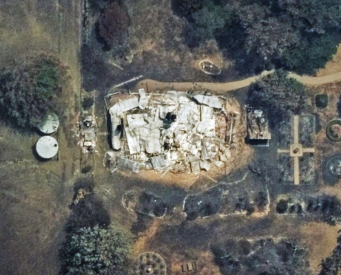 https://vexceldata.com/wp-content/uploads/2026/01/Ruffy-VIC-AU-36.947503-145.519940_ortho.jpg
720
1280
Angie Brewster
https://vexceldata.com/wp-content/uploads/2021/12/VEXCEL-Data-Program.png
Angie Brewster2026-01-13 21:12:292026-01-20 13:16:40Gray Sky: Victoria Bushfires
https://vexceldata.com/wp-content/uploads/2026/01/Ruffy-VIC-AU-36.947503-145.519940_ortho.jpg
720
1280
Angie Brewster
https://vexceldata.com/wp-content/uploads/2021/12/VEXCEL-Data-Program.png
Angie Brewster2026-01-13 21:12:292026-01-20 13:16:40Gray Sky: Victoria Bushfires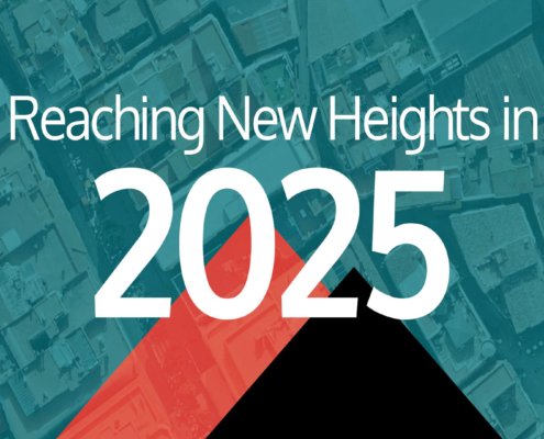 https://vexceldata.com/wp-content/uploads/2026/01/EOY-Intro-image-1.jpg
1080
1656
Angie Brewster
https://vexceldata.com/wp-content/uploads/2021/12/VEXCEL-Data-Program.png
Angie Brewster2026-01-05 15:47:352026-01-06 11:35:112025 in Review: Reaching New Heights
https://vexceldata.com/wp-content/uploads/2026/01/EOY-Intro-image-1.jpg
1080
1656
Angie Brewster
https://vexceldata.com/wp-content/uploads/2021/12/VEXCEL-Data-Program.png
Angie Brewster2026-01-05 15:47:352026-01-06 11:35:112025 in Review: Reaching New Heights![]()
Large-format UltraCam cameras & sensors.
vexcel-imaging.com
Aerial surveys by fixed-wing aircraft.
kasurveys.com
Aerial imagery and data for government and business.
vexceldata.com