High Resolution
Orthomosaic Imagery
Map, measure, and monitor change with accurate, top-down imagery in Australia and 40+ other countries. Power property insights, AI analysis, and more.
Map, measure, and monitor change with accurate, top-down imagery in Australia and 40+ other countries. Power property insights, AI analysis, and more.
Vexcel provides a suite of off-the-shelf ortho products for professionals who need consistent, accurate, and cost-effective imagery. Captured by fixed-wing aircraft, our ortho imagery delivers the ideal blend of resolution, quality, and coverage without the high costs of custom collections. With regular refreshes and a historical library, here’s a snapshot of our three orthomosaic products:
Not sure whether to choose drone, satellite, or aerial imagery? Each has trade-offs, but aerial ortho imagery collected by fixed-wing aircraft, like Vexcel’s, offers many industries the ideal balance of detail, accuracy, and coverage.
Here’s why professionals choose Vexcel orthos:
Higher Resolution: View parcels, buildings, roads, and land features with up to 16 times better resolution than the best available satellite imagery.
Greater Scale: Access consistent imagery across cities and regions without the limited coverage or airspace restrictions of drone programs.
Reliable Accuracy: Imagery is captured, processed, and aligned to specifications and ground control points for consistent accuracy across all orthophoto products.
Vexcel’s orthomosaic imagery helps answer critical questions: What changed? What’s there? What’s next? From insurance to infrastructure to autonomous driving, orthos support faster decisions, stronger remote assessment, smarter analysis, and more across industries.
Vexcel’s ortho imagery gives you the full picture from national overviews to individual properties. See ground truth clearly and make confident, up-to-date decisions with imagery that matches your scale of work.
Access current and historical imagery to monitor changes at the property level. From storm damage to new construction, Vexcel helps you track and view timestamped imagery to see what’s changed.
Vexcel’s high-resolution ortho imagery is aligned to ground control points and meets ASPRS accuracy standards, making it ideal for measuring area, distance, and structure features. Get reliable data for property inspection and analysis.
Vexcel’s high-resolution ortho imagery is aligned to ground control points and meets ASPRS accuracy standards, making it ideal for measuring area, distance, and structure features. Get reliable data for property inspection and analysis.
Vexcel maintains over 29,000 survey-grade ground control points worldwide. These reference points ensure accurate, consistent alignment across our ortho imagery.
Save time and staff resources by virtually touring properties and assets.
Utilities managers, for example, can inspect poles, stations, vegetation encroachment, and more using high-resolution ortho imagery.
Save time and staff resources by virtually touring properties and assets.
Utility managers, for example, can inspect poles, stations, vegetation encroachment, and more using high-resolution ortho imagery.
Eliminate guesswork with accurate, cloud-free ortho imagery that’s colour-balanced and stitched for immediate use. Vexcel’s ortho imagery supports planning, design, and HD mapping for better infrastructure decisions.
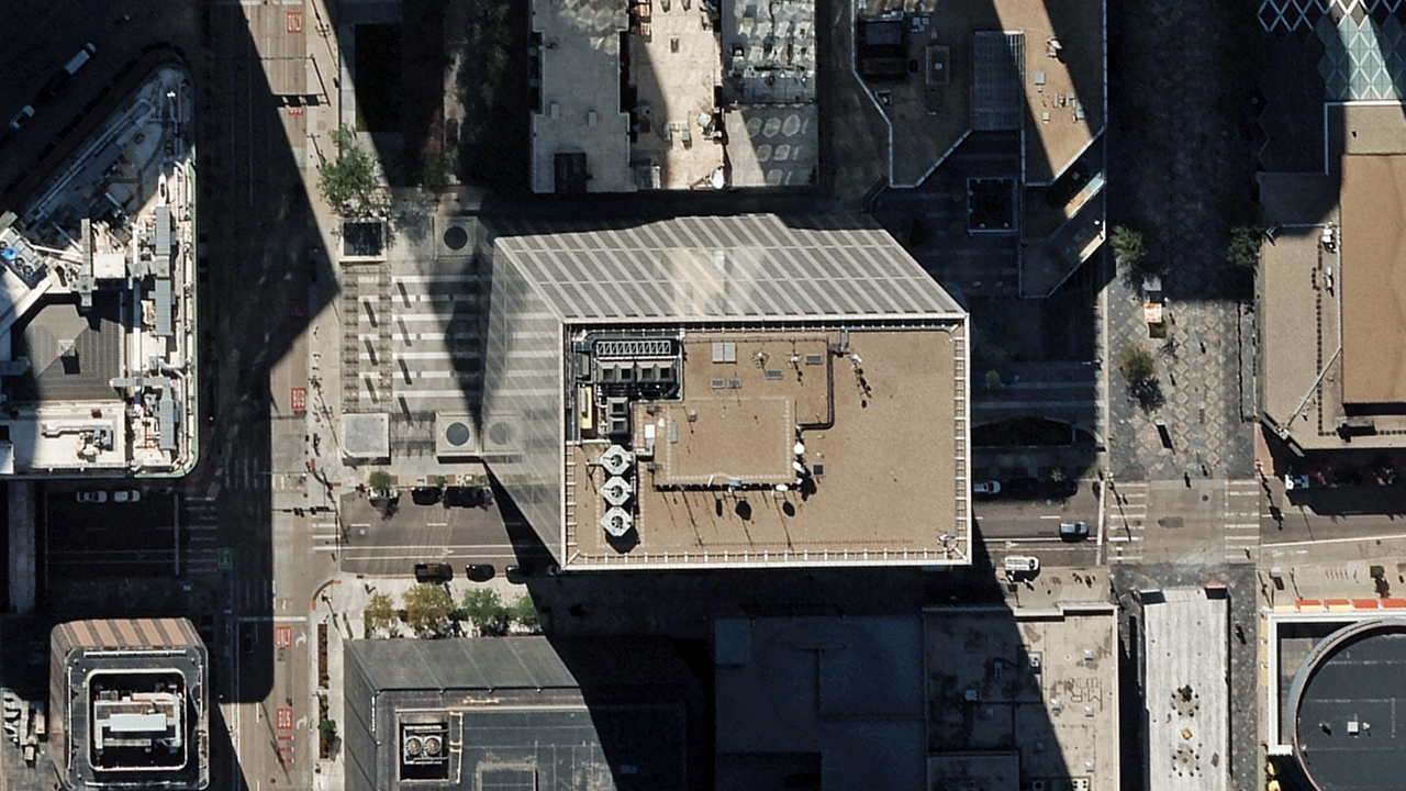
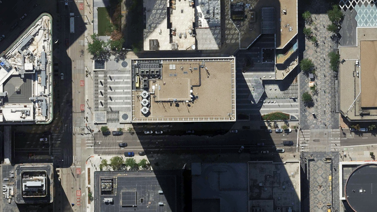
Due to camera angles, tall buildings can look like they’re leaning in raw imagery. Vexcel fixes that with TrueOrtho. We fly cities with more overlap. We stitch and process with strict QA standards.
The result? More accurate views like no building lean in this before and after.


Quality data fuels AI and machine learning, and companies rely on Vexcel orthos to extract meaningful features for properties, roads, mapping, and more.
Here’s an example of a few attributes extracted from a residential property in Texas.
Bring Vexcel imagery into your preferred platform using our APIs, MapControl SDKs as well as standard map and imagery services. Or explore it directly in the Vexcel Viewer.
We also optimize our imagery to work with trusted partners like Esri to help with seamless integration.