Gray Sky: Tornado in Louetta, TX

Imagery Published
Wednesday, November 26, 2025
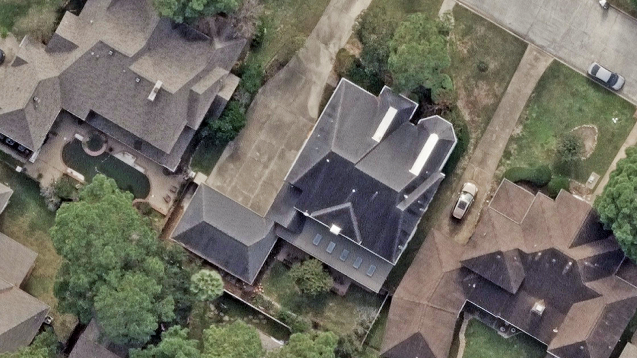
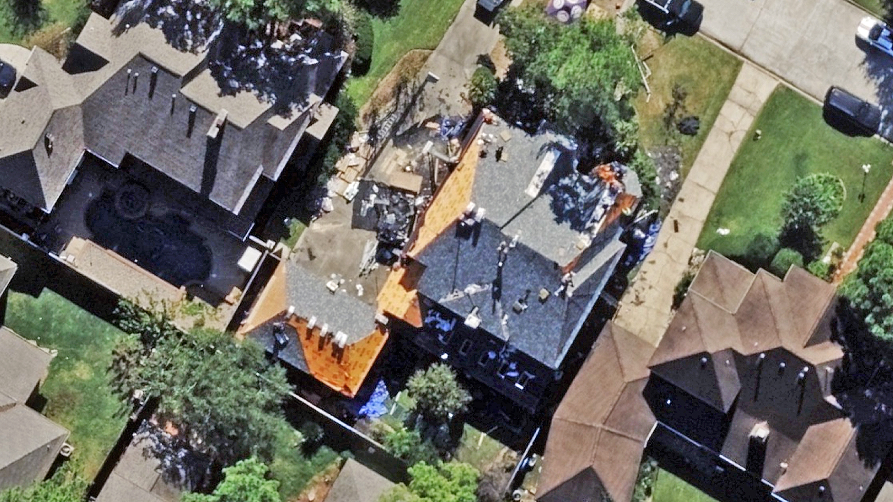
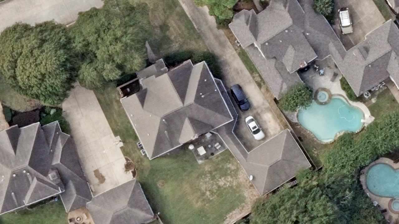
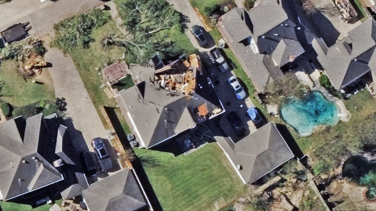
High-resolution aerial imagery from our Gray Sky response to the tornado that hit just outside of Houston is now available via the Vexcel Platform and partner sites. This 7.5cm ortho and oblique imagery focuses on the most severely damaged areas where at least 100 structures have been impacted.
Customers can now view and analyze the tornado imagery plus Damage Assessment analytics to support response and assessment efforts.
Below are examples of before-and-after images of properties suffering damage from the tornado. If you need imagery from this event, please connect with our team via the form below.