
Gray Sky: Old Trails, Autumn Lane & Fairview Fires, Washington
Imagery now available.
Overview
Our Gray Sky team has been monitoring wildfires in the Columbia Basin region of Washington since the Old Trails Fire began over the weekend near Spokane. As conditions evolved, two additional fires, Autumn Lane and Fairview, also broke out in the greater Spokane area. Our team deployed aircraft to collect aerial imagery across all three fires in support of emergency response, recovery, and property-level damage assessments.
We continue to monitor conditions as these fires remain active. Our thoughts are with the communities affected by the fires.
August 6, 2026
Second Collection & Damage Assessments Published
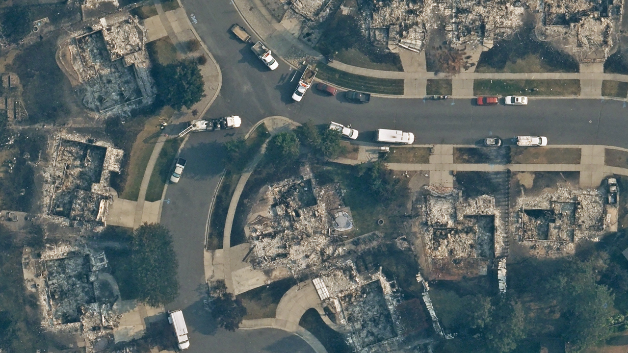
On Tuesday evening, our Gray Sky team activated for a second collection of high-resolution aerial imagery over the Spokane County, Washington fire complex. With less smoke and a lower flight altitude, the flight crew successfully captured imagery across portions of all three active fires: Old Trails, Autumn Lane, and Fairview.
As of early Thursday morning, ortho and multispectral imagery is now available in the Vexcel Platform and select partner platforms.
This collection covers approximately 266 km² (103 sq mi) across the greater Spokane area, including the Spokane River corridor and surrounding communities.
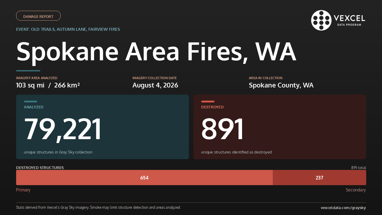
Vexcel’s damage intelligence team reviewed more than 79,000 structures in our Gray Sky collection across the Spokane Complex fires and identified 892 with damage. Of those, 891 were completely destroyed and one sustained moderate damage. Property-level damage assessments are also available for all structures in the August 4 collection.
August 3, 2026
Imagery Published
High-resolution 10cm ortho and multispectral imagery has been published in the Vexcel Platform and select partner platforms. Due to the density of smoke during this collection, visibility may be limited in certain areas.
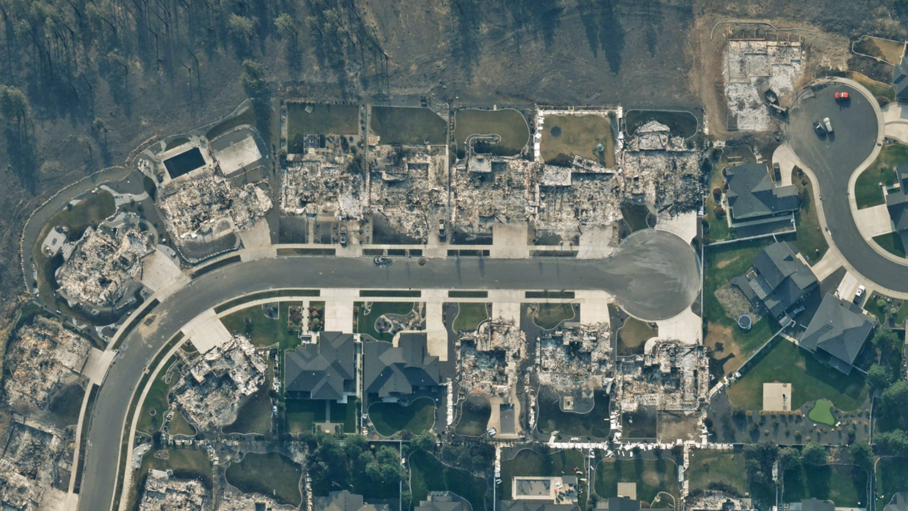
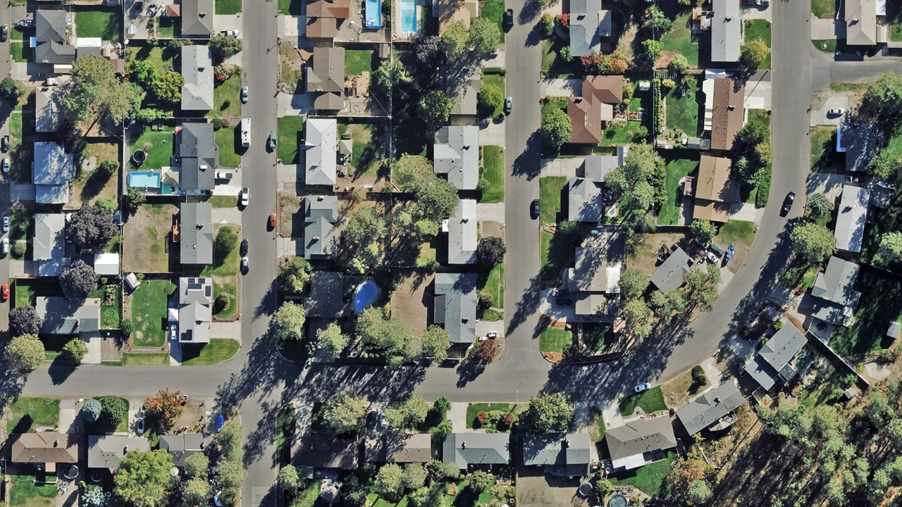
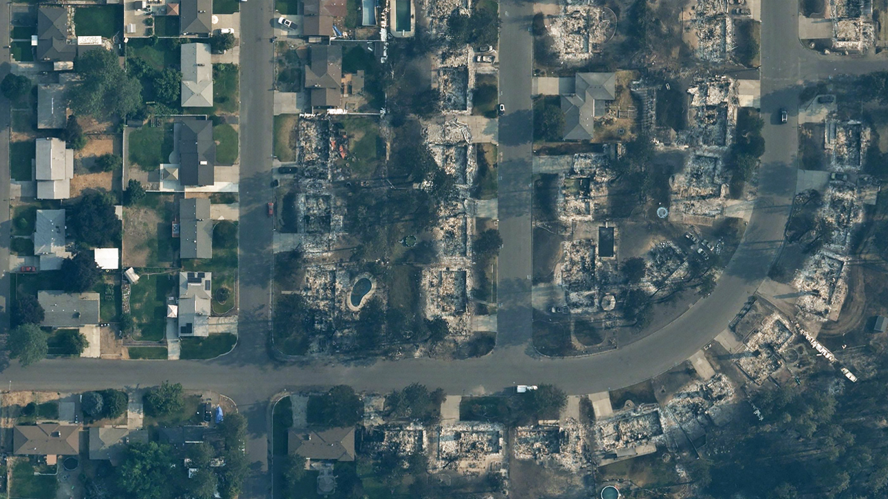
The imagery provides updated visibility into the fire’s impact across the City of Spokane, Spokane County, Washington. When compared with previous Vexcel imagery collections, the imagery helps identify what changed over time.
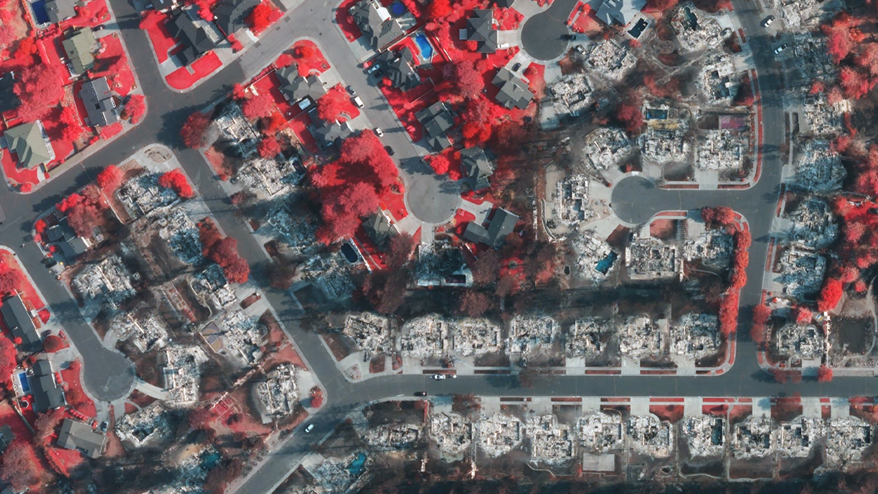
Multispectral imagery provides another way to understand the fire’s impact. Unlike standard aerial imagery, it distinguishes healthy vegetation from burned and damaged areas, making it easier to see burn patterns, identify affected vegetation, and understand the overall extent of the fire.
August 2, 2026
Old Trails Fire Imagery Collected
As weather and smoke conditions allowed, our Gray Sky flight crew captured 10cm aerial imagery across approximately 56 km² (21.7 sq mi) covering portions of the City of Spokane, Spokane County, Washington. Smoke remained over portions of the fire during the collection.
The fire remains active, and we continue to monitor conditions and will publish additional imagery as needed.
Request Access
Please let us know if you need imagery for your response and recovery. Please fill out our contact form below.





