One Source. Many Uses. Stronger Communities.
Local and state governments carry a heavy responsibility: keeping communities safe, fair, and functioning while working within limited budgets. But when each department purchases its own datasets, it often leads to duplication, silos, and inconsistent results.
A more effective approach is for multiple departments to share the same imagery source. With one program in place, every team, such as tax assessors, public safety officials, transportation planners, can work from the same view of the community. Flexible delivery and licensing from Vexcel make it possible to tailor that program to each department’s needs, without the extra cost or complexity of separate contracts.
This shift isn’t just about efficiency. It’s about helping governments build stronger, more resilient communities with the resources they already have.
Tax Assessment: Fair and Transparent Valuations
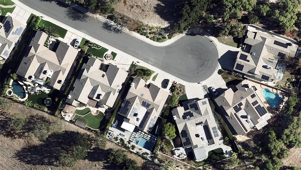
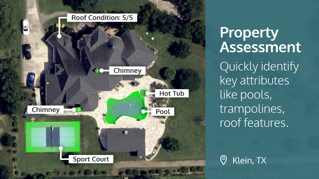
Property tax assessors are tasked with ensuring fair and accurate valuations across thousands of parcels. That’s no easy job when properties are constantly changing. New additions, pools, solar panels, or renovations can all impact value.
Vexcel’s high-resolution aerial imagery makes it easier to detect these changes without sending staff into the field for every property. Assessors can quickly verify updates, improve accuracy, and reduce disputes, while also increasing transparency with residents.
The value extends beyond the assessor’s office. With Vexcel’s flexible licensing, the same trusted imagery can also be accessed by planning or zoning departments—ensuring everyone works from a consistent, authoritative view of the community. And with flexible delivery options, including Esri integrations, cloud access, and MapControl for CAMA systems, assessors can access imagery seamlessly within the platforms they already use.
Vexcel imagery doesn’t stop at pixels. Governments can also leverage Property Attributes, an AI-ready dataset derived from imagery that identifies building footprints, roof types, pools, solar panels, and more—further supporting accurate and fair valuations.
Public Safety & E911: Faster, Safer Response
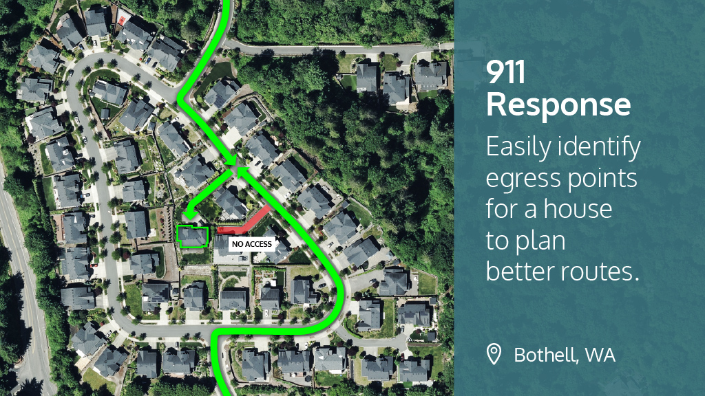
Every second counts in an emergency. Dispatchers and first responders need accurate, up-to-date information about buildings, roads, and access points to get people the help they need.
Vexcel’s nationwide aerial imagery program, refreshed regularly across 49 states, provides a reliable foundation for 911 mapping and supports modernization efforts like Next Generation 911. With consistent, highly accurate imagery, emergency teams can confirm addresses, understand building layouts, and plan safer routes with confidence.
Flexible licensing makes it easier for public safety teams to benefit from the same imagery library already in use by assessors or planners, eliminating the cost and complexity of duplicate contracts. And with direct delivery into dispatch systems and GIS platforms, mission-critical data is always accessible when it matters most.
In the aftermath of natural disasters, Vexcel’s Gray Sky program delivers timestamped before-and-after imagery, enhancing situational awareness and helping emergency managers allocate resources more effectively.
Transportation: Smarter Planning and Maintenance
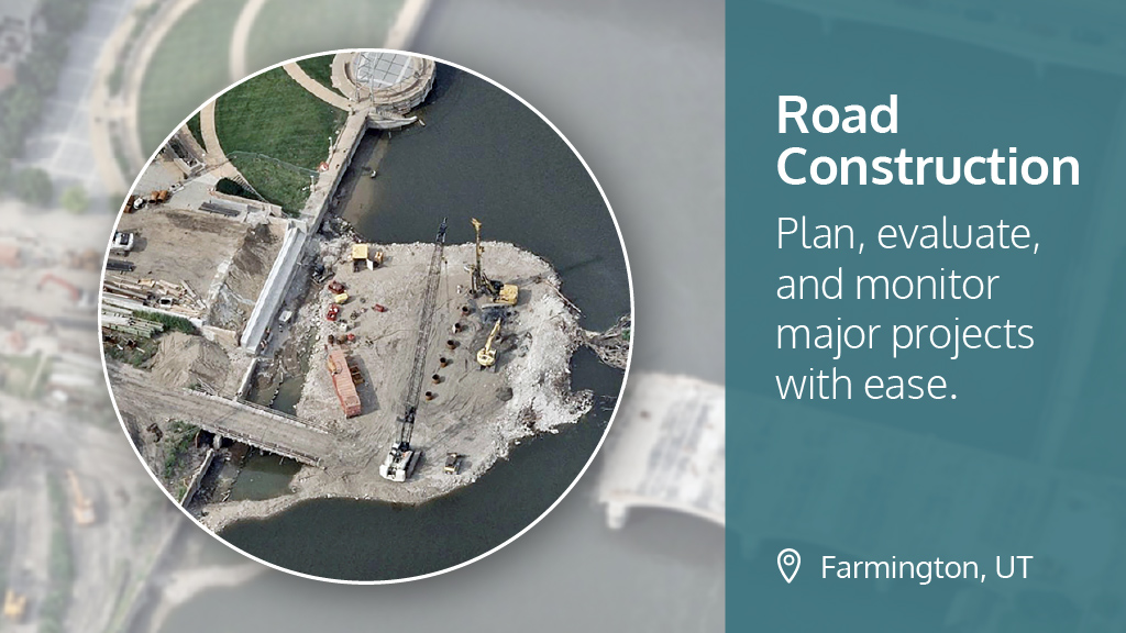
Departments of Transportation oversee a vast network of highways, bridges, and local streets. Monitoring conditions, planning upgrades, and tracking construction progress all require clear, consistent views of infrastructure.
Vexcel’s high-resolution imagery supports DOT efforts by giving engineers and planners a current perspective on road networks and surrounding areas. Whether it’s evaluating a major interstate expansion or planning local resurfacing, one trusted imagery source can inform every stage of decision-making.
With flexible delivery, imagery can be integrated directly into CAD, GIS, or enterprise systems, allowing teams continue to work in the tools they know best. And thanks to cross-departmental licensing, DOT staff can draw from the same authoritative imagery library used by assessors and public safety officials, maximizing the value of every investment.
Conclusion: One Provider, Many Missions
When agencies rely on separate data sources, the result is inefficiency, added expense, and inconsistent decisions. Vexcel’s aerial imagery program changes that. By sharing one trusted source of imagery, governments can reduce duplication, eliminate silos, and give every department—from assessment to public safety to transportation—a consistent, authoritative view of their communities.
Flexible delivery and licensing make it simple to tailor access across agencies, so each team gets what it needs without extra contracts or complex workflows. With coverage in 49 states, highly accurate imagery, and programs designed specifically for government use cases, Vexcel has your area is covered. See how one trusted source of imagery can power smarter decisions and stronger communities.


