available in 30+ countries
20+ building & roof attributes
99% buildings in U.S.
Superior Imagery for Accurate Output
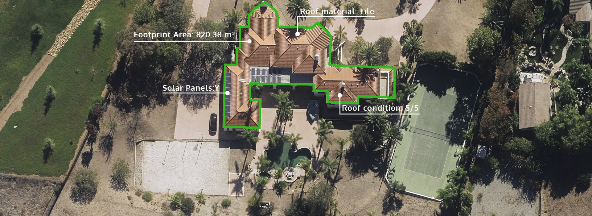
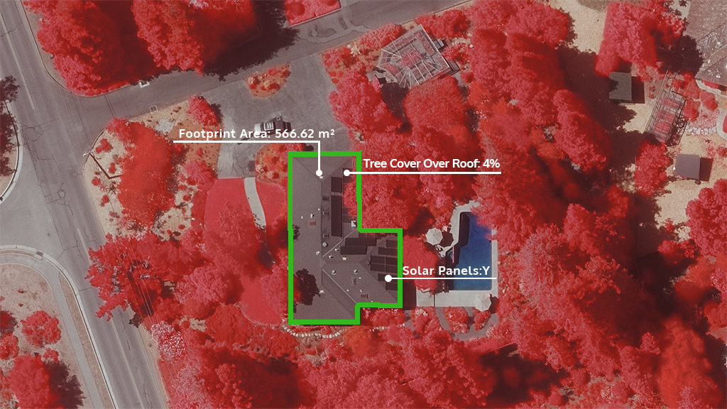
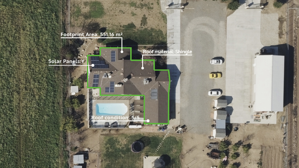
We’ve applied machine learning across our aerial content library so you get accurate, highly detailed attributes for built structures. With multiple elements identified, you can improve your view of a building and quickly identify footprint, roof information, and defensible space details.
Valuable Building Insights in Seconds
Through Vexcel’s signature endpoints (APIs and web-based application, Viewer) and your location coordinates, get easy access to available attributes for the closest building or structure. Plus, when viewed alongside Vexcel’s high-resolution aerial imagery, you get trusted ground truth, clearly seeing what currently exists–not just on recent imagery–but on historical images as well.
Trusted Data for Smarter Decision-making
Use Building Attributes as an invaluable tool for multiple industries:
INSURANCE – perform risk assessments more efficiently; identify vegetation in defensible space zones
GOVERNMENT – conduct remote or desktop property assessments; add building attributes and geometries to 3D models
TELECOM – map clean lines-of-sight to reduce signal interference between transmitters
SMART CITIES – use the building geometry to create more accurate 3D models


