 https://vexceldata.com/wp-content/uploads/2024/02/Seattle-WA-Oblique-residential-47.705474-122.377858.png
576
1024
Angie Brewster
https://vexceldata.com/wp-content/uploads/2021/12/VEXCEL-Data-Program.png
Angie Brewster2024-03-05 14:47:302024-06-14 12:03:43Vexcel to Expand Collection Program Across U.S. in 2024
https://vexceldata.com/wp-content/uploads/2024/02/Seattle-WA-Oblique-residential-47.705474-122.377858.png
576
1024
Angie Brewster
https://vexceldata.com/wp-content/uploads/2021/12/VEXCEL-Data-Program.png
Angie Brewster2024-03-05 14:47:302024-06-14 12:03:43Vexcel to Expand Collection Program Across U.S. in 2024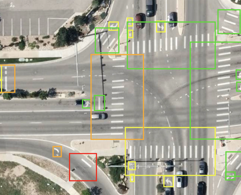 https://vexceldata.com/wp-content/uploads/2024/02/Intersection-condition-rating.png
641
1200
Angie Brewster
https://vexceldata.com/wp-content/uploads/2021/12/VEXCEL-Data-Program.png
Angie Brewster2024-02-14 16:39:102024-02-14 16:39:10Introducing Roadways: the latest AI-derived product in 3,300+ Cities
https://vexceldata.com/wp-content/uploads/2024/02/Intersection-condition-rating.png
641
1200
Angie Brewster
https://vexceldata.com/wp-content/uploads/2021/12/VEXCEL-Data-Program.png
Angie Brewster2024-02-14 16:39:102024-02-14 16:39:10Introducing Roadways: the latest AI-derived product in 3,300+ Cities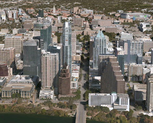 https://vexceldata.com/wp-content/uploads/2024/01/Austin-3D.jpg
550
1300
Angie Brewster
https://vexceldata.com/wp-content/uploads/2021/12/VEXCEL-Data-Program.png
Angie Brewster2024-01-09 10:01:152024-06-14 09:48:10Vexcel Announces 3D Models for Metro Areas Around the World
https://vexceldata.com/wp-content/uploads/2024/01/Austin-3D.jpg
550
1300
Angie Brewster
https://vexceldata.com/wp-content/uploads/2021/12/VEXCEL-Data-Program.png
Angie Brewster2024-01-09 10:01:152024-06-14 09:48:10Vexcel Announces 3D Models for Metro Areas Around the World https://vexceldata.com/wp-content/uploads/2023/12/EOY-Graphics_Cover.png
630
867
Angie Brewster
https://vexceldata.com/wp-content/uploads/2021/12/VEXCEL-Data-Program.png
Angie Brewster2023-12-28 10:03:242023-12-28 10:31:472023: The Year We Went BIGGER
https://vexceldata.com/wp-content/uploads/2023/12/EOY-Graphics_Cover.png
630
867
Angie Brewster
https://vexceldata.com/wp-content/uploads/2021/12/VEXCEL-Data-Program.png
Angie Brewster2023-12-28 10:03:242023-12-28 10:31:472023: The Year We Went BIGGER https://vexceldata.com/wp-content/uploads/2023/12/Clarksville-TN-Tornado_36.615674_-87.359356.jpg
1052
2048
Angie Brewster
https://vexceldata.com/wp-content/uploads/2021/12/VEXCEL-Data-Program.png
Angie Brewster2023-12-12 16:46:192023-12-12 16:48:26Capturing disaster imagery: the Tennessee tornadoes
https://vexceldata.com/wp-content/uploads/2023/12/Clarksville-TN-Tornado_36.615674_-87.359356.jpg
1052
2048
Angie Brewster
https://vexceldata.com/wp-content/uploads/2021/12/VEXCEL-Data-Program.png
Angie Brewster2023-12-12 16:46:192023-12-12 16:48:26Capturing disaster imagery: the Tennessee tornadoes https://vexceldata.com/wp-content/uploads/2023/11/MSFS_WU15_Screenshots_01-scaled-1.jpg
1440
2560
Angie Brewster
https://vexceldata.com/wp-content/uploads/2021/12/VEXCEL-Data-Program.png
Angie Brewster2023-11-14 11:53:242023-11-14 11:53:24Vexcel imagery used in latest Microsoft Flight Simulator release
https://vexceldata.com/wp-content/uploads/2023/11/MSFS_WU15_Screenshots_01-scaled-1.jpg
1440
2560
Angie Brewster
https://vexceldata.com/wp-content/uploads/2021/12/VEXCEL-Data-Program.png
Angie Brewster2023-11-14 11:53:242023-11-14 11:53:24Vexcel imagery used in latest Microsoft Flight Simulator release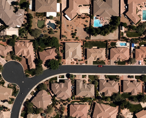 https://vexceldata.com/wp-content/uploads/2022/02/St-George_Aerial_Image_Ortho.jpg
576
1024
Angie Brewster
https://vexceldata.com/wp-content/uploads/2021/12/VEXCEL-Data-Program.png
Angie Brewster2023-11-13 16:46:312023-11-13 16:46:31Citizens Adopts Aerial Imagery Analytics–Powered by Vexcel–from Verisk
https://vexceldata.com/wp-content/uploads/2022/02/St-George_Aerial_Image_Ortho.jpg
576
1024
Angie Brewster
https://vexceldata.com/wp-content/uploads/2021/12/VEXCEL-Data-Program.png
Angie Brewster2023-11-13 16:46:312023-11-13 16:46:31Citizens Adopts Aerial Imagery Analytics–Powered by Vexcel–from Verisk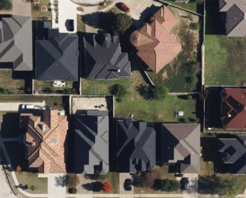 https://vexceldata.com/wp-content/uploads/2023/10/Irving-texas-us-ortho-residential-32.844341_-97.013052-copy.jpg
576
1024
Angie Brewster
https://vexceldata.com/wp-content/uploads/2021/12/VEXCEL-Data-Program.png
Angie Brewster2023-11-10 15:21:212024-06-14 09:51:19Vexcel Partnering with LexisNexis for Rooftop Solution
https://vexceldata.com/wp-content/uploads/2023/10/Irving-texas-us-ortho-residential-32.844341_-97.013052-copy.jpg
576
1024
Angie Brewster
https://vexceldata.com/wp-content/uploads/2021/12/VEXCEL-Data-Program.png
Angie Brewster2023-11-10 15:21:212024-06-14 09:51:19Vexcel Partnering with LexisNexis for Rooftop Solution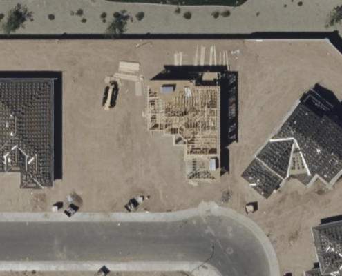 https://vexceldata.com/wp-content/uploads/2023/09/33.516010-112.247438-SecondView.png
1216
1874
Angie Brewster
https://vexceldata.com/wp-content/uploads/2021/12/VEXCEL-Data-Program.png
Angie Brewster2023-09-12 13:57:532023-09-12 13:57:53A Peek Into Our Expanded 2023 U.S. Collection
https://vexceldata.com/wp-content/uploads/2023/09/33.516010-112.247438-SecondView.png
1216
1874
Angie Brewster
https://vexceldata.com/wp-content/uploads/2021/12/VEXCEL-Data-Program.png
Angie Brewster2023-09-12 13:57:532023-09-12 13:57:53A Peek Into Our Expanded 2023 U.S. Collection