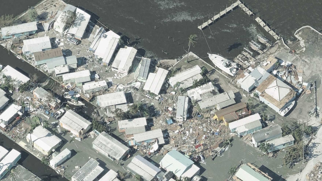
Capturing Hurricane Ian’s Destructive Path
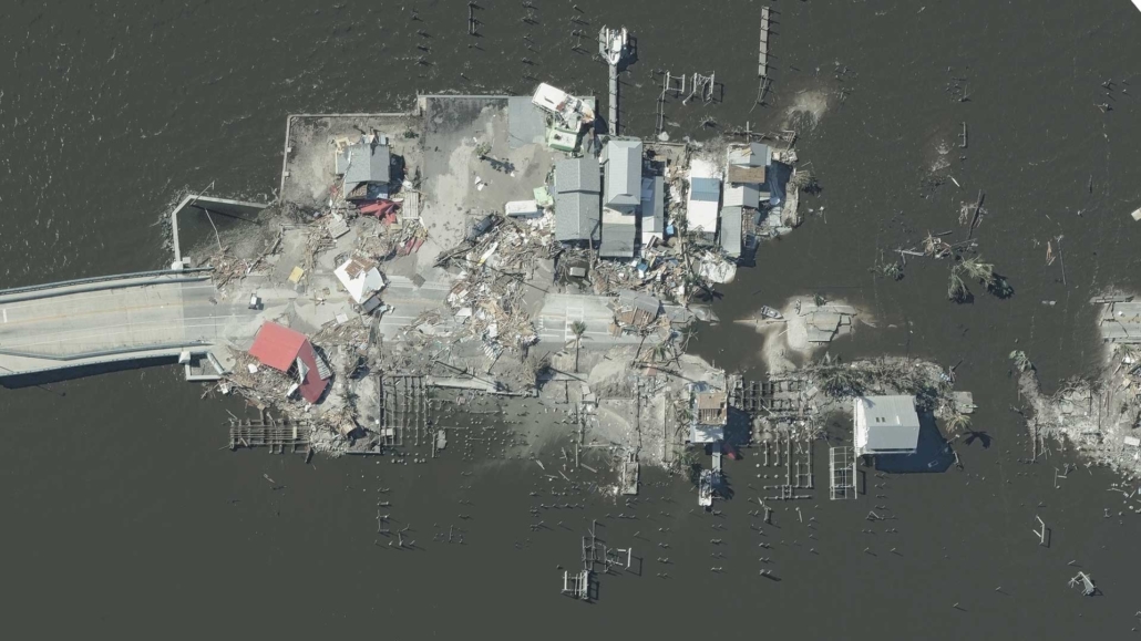
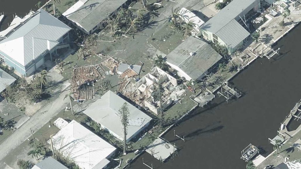
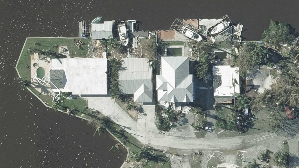
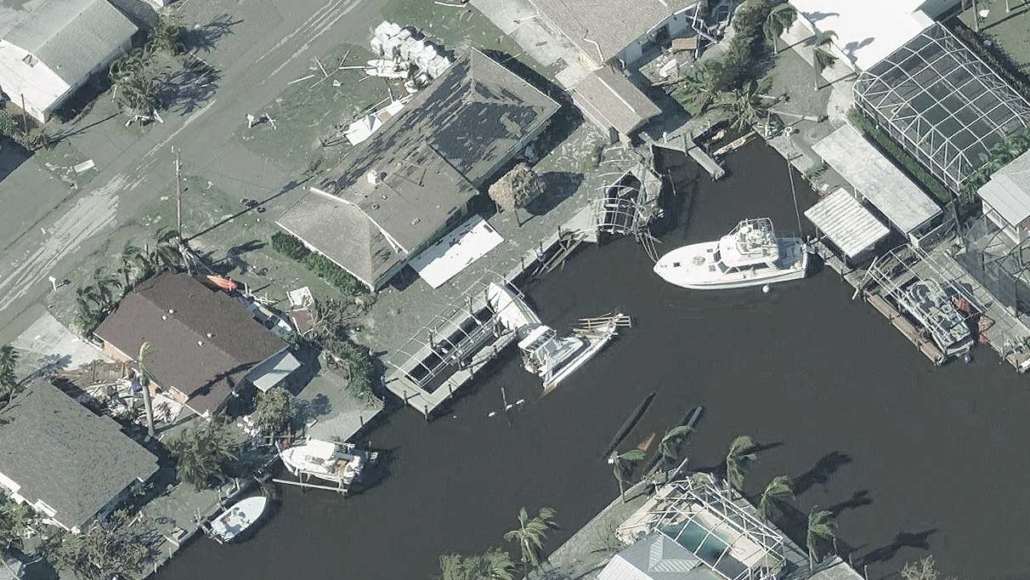
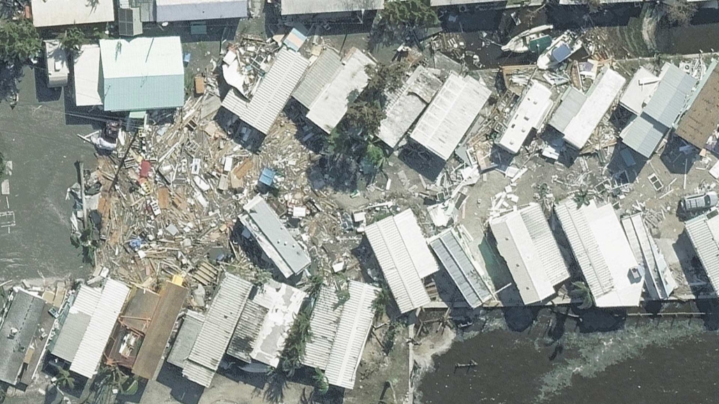
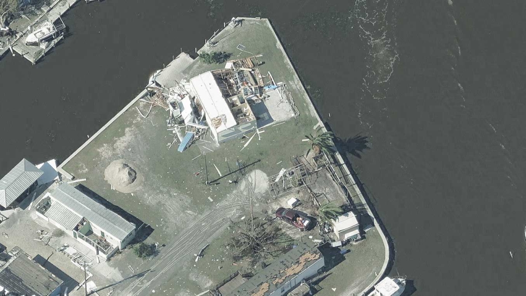
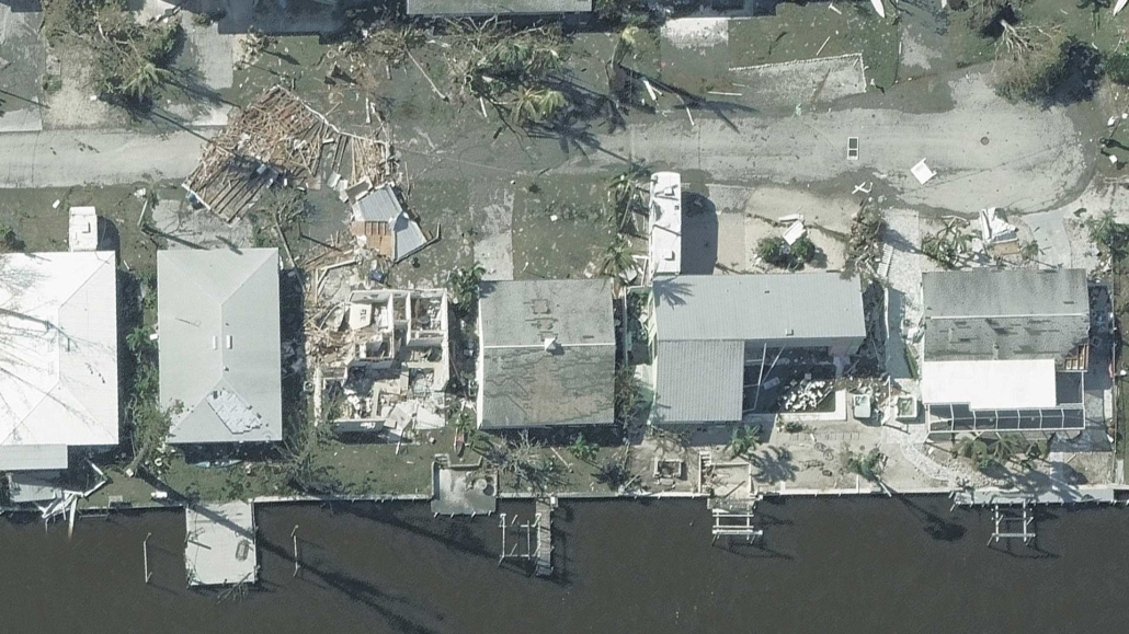
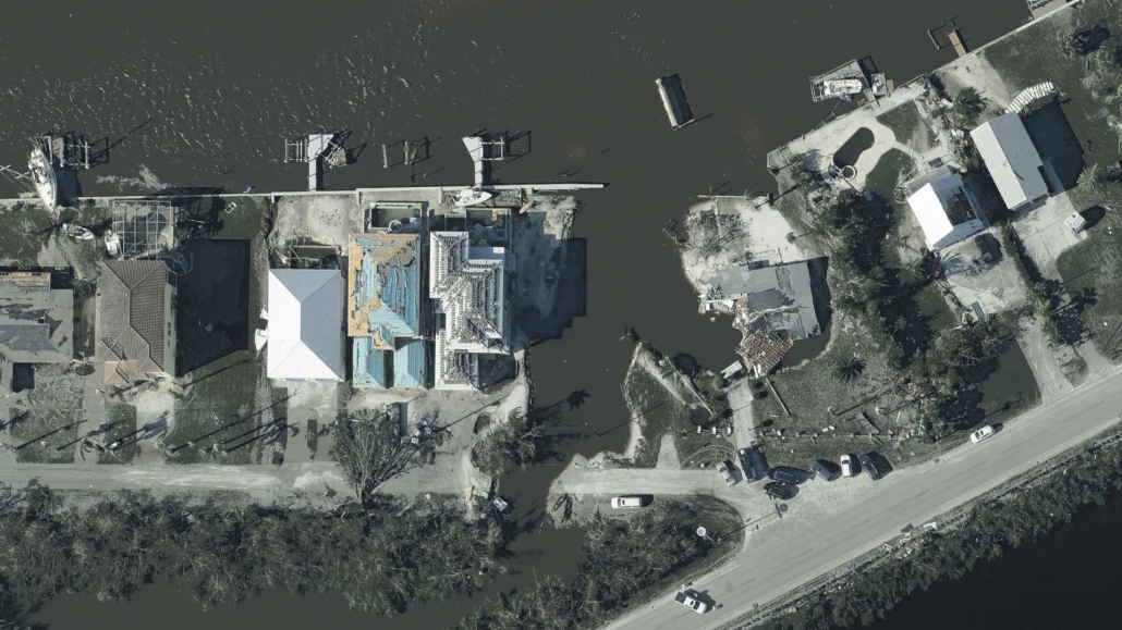
On September 28, 2022, Hurricane Ian made landfall across southwest Florida, ripping homes from foundations, flinging boats and cars asunder, and bringing an incredible storm surge that reached heights of 12 feet. The next 24 hours would see the storm slowly make its way inland battering neighborhoods with highs winds and heavy rain across its 140-mile wide path.
As the hurricane kept moving along, our planes were at the ready to get into the sky and begin capturing the aftermath as soon as it was safe to do so. Less than 24 hours after the storm began, planes were up and our disaster collection was underway.
Vexcel collects Disaster imagery to support the Geospatial Insurance Consortium (GIC), an organization dedicated solely to the insurance industry. The aerial imagery collected helps their insurer members and emergency managers know the scope and scale of damage after a storm and where the greatest damage occurred.
Ian Collection and Coverage
When the final collection of Ian’s path across Florida was complete, we had captured 25% of Florida. This collection included high-resolution Oblique imagery of the most heavily damaged areas. In addition, thanks to our new Elements: Damage Assessment product, we delivered insights on more than 3.5 million buildings centered on sustained damage on rooftops. This information has been extremely beneficial not only for insurers but for telecom and utilities companies.
You can read more an in depth account of our Hurricane Ian coverage on the GIC’s blog. Below is just a small glimpse into some of the devastation we captured as part of our response to Ian.

