The Future of Telecom Planning at Mobile World Congress
One of the largest telecom events of the year is happening in Las Vegas this week: Mobile World Congress. It’s the chance to discover what’s new in the connectivity space, the latest trends in technology, and what’s driving mobile innovation. The Vexcel team will be on hand in the Exhibition Hall, W2.1308, ready to share our latest products and help telecom companies of all shapes and sizes take advantage of our comprehensive imagery library and geospatial data.
How Vexcel is Helping Close the Digital Divide
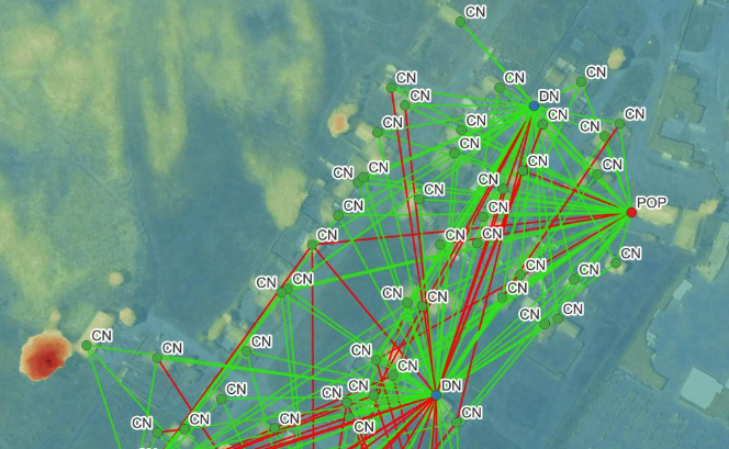
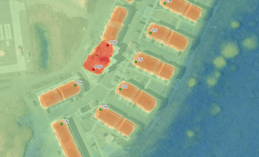
At MWC, attendees will have an opportunity to hear from Odion Edehemon, CEO of Dalet Access Labs, and how his company used Vexcel data to bring high speed connectivity to Fairhaven, CA. The project stemmed from California’s Innovation Challenge to provide a technological solution for underserved communities, keep costs low for households, and be fully deployed and implemented within a year. The winner of the challenge is yet to be named but Dalet’s proposal is one of the finalists and is poised for success. Read all about their project and how Vexcel’s data was used to model a network that now provides enviable speeds for a small community.
Five Ways Vexcel Data Improves Network Planning
Communication happens fast and the demand for faster networks is only growing year after year. Implementing a complicated network is challenging and requires trusted information, such as high-resolution aerial imagery and geospatial data, to design a system that works. So many other industries are relying on strong network signals such as smart cities, autonomous driving, energy and utilities, and agriculture to name a few. Plus, according to Statista, over 83% of the world’s population uses a smartphone so mobile connectivity is a massive driver to expand and enhance network speeds.
Below are five ways Vexcel data is helping improve network planning for telecom companies large and small.
- Pole identification – in order to support the dense network needed for 5G, more small cell base stations are needed. The location for said base stations needs to be easily found without the need to build an entire tower. Utility poles, standalone traffic signals, and street lights provide the perfect structure to place these smaller units.
- Visualization in dense areas – seeing around tall buildings is much easier when using Vexcel Oblique imagery. Take in a building or structure from all sides in urban areas to perform better network modeling.
- Remote evaluation and assessment – know before you go when it comes to sending field technicians out for network mapping. Use Vexcel’s True Ortho imagery in urban areas and Ortho imagery for more wide open, rural areas to begin mapping your network before ever setting foot on the ground.
- Comprehensive coverage – you can’t plan where you can’t see and Vexcel provides imagery collection in 25+ countries around the globe. Plus, in the U.S., 99% of the population is covered from coast-to-coast. Be better prepared with a comprehensive imagery library from Vexcel.
- Accuracy and consistency across products – Vexcel delivers imagery and data at an accuracy satellite and even drone can’t deliver. Because imagery is matched against ground control points, there is no shift or irregularities between imagery types. True Ortho matches up with Digital Surface Model data which matches with Multispectral and so on. It’s alignment you can trust when creating consistent, highly accurate network models.


