This post originally appeared on GIC.org.
Together, Vexcel and GIC have fully aligned their strengths to streamline efforts and enhance innovation, while continuing to provide the high-quality aerial imagery and coverage that insurers trust.
This post originally appeared on GIC.org.
Together, Vexcel and GIC have fully aligned their strengths to streamline efforts and enhance innovation, while continuing to provide the high-quality aerial imagery and coverage that insurers trust.
Our Gray Sky Team has been closely monitoring the severe storms and tornado activity across the United States over the past few days. On Friday, there were numerous tornado touchdowns. Fortunately, most of the damage was in rural areas.
However, by Saturday morning, we identified three populated areas in Iowa and Nebraska that suffered significant property damage and require disaster imagery for our insurance members and partners.
These areas include:
Aircraft Activated: April 27, 2024
On Saturday morning, we dispatched a pilot and aircraft from Texas. Taking advantage of clear weather between two large storm systems, the crew successfully collected high-resolution imagery at all three target locations. This imagery was processed overnight, and the first set of 10-centimeter ortho images was published early Sunday morning to the GIC platform.
Below are some samples from these collections:
The GIC library features timestamped imagery collections taken before the recent tornado damage. Our members and partners can use these images to compare the current damage of specific properties to their conditions prior to the tornado events.
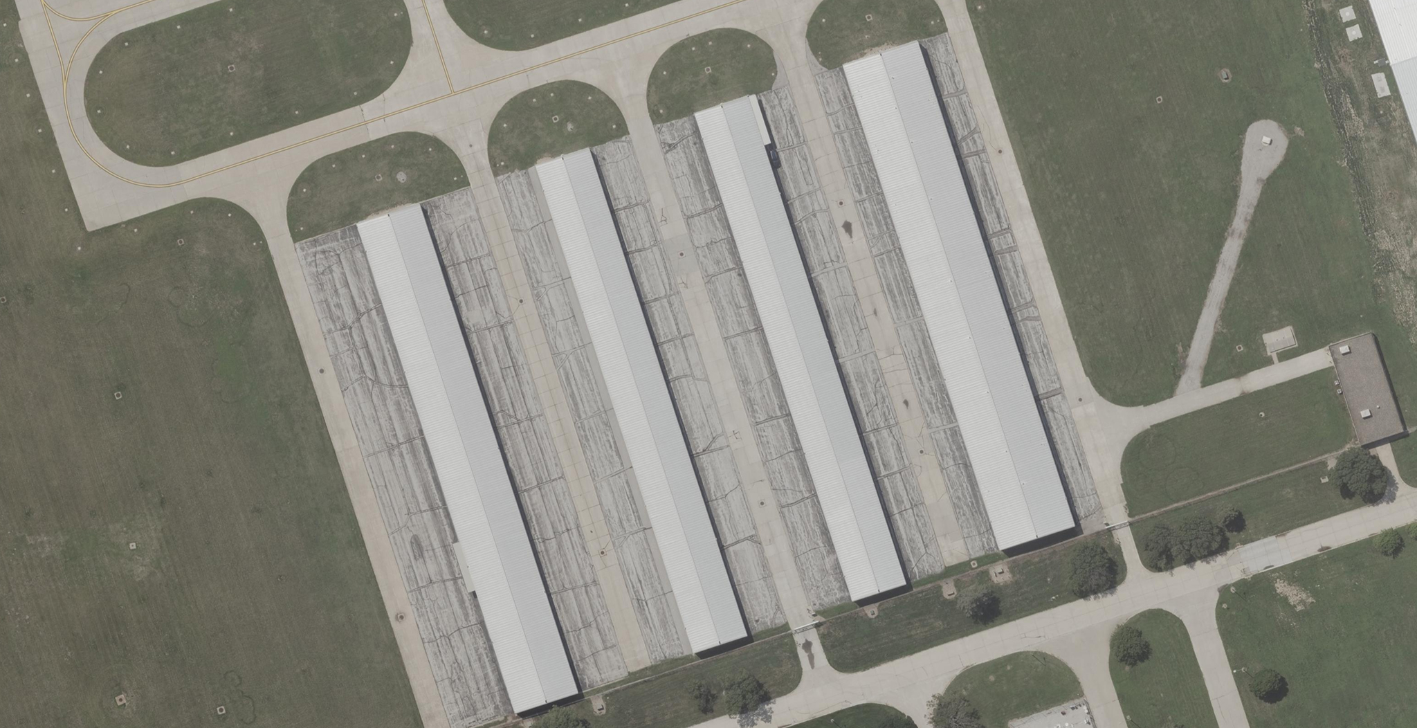
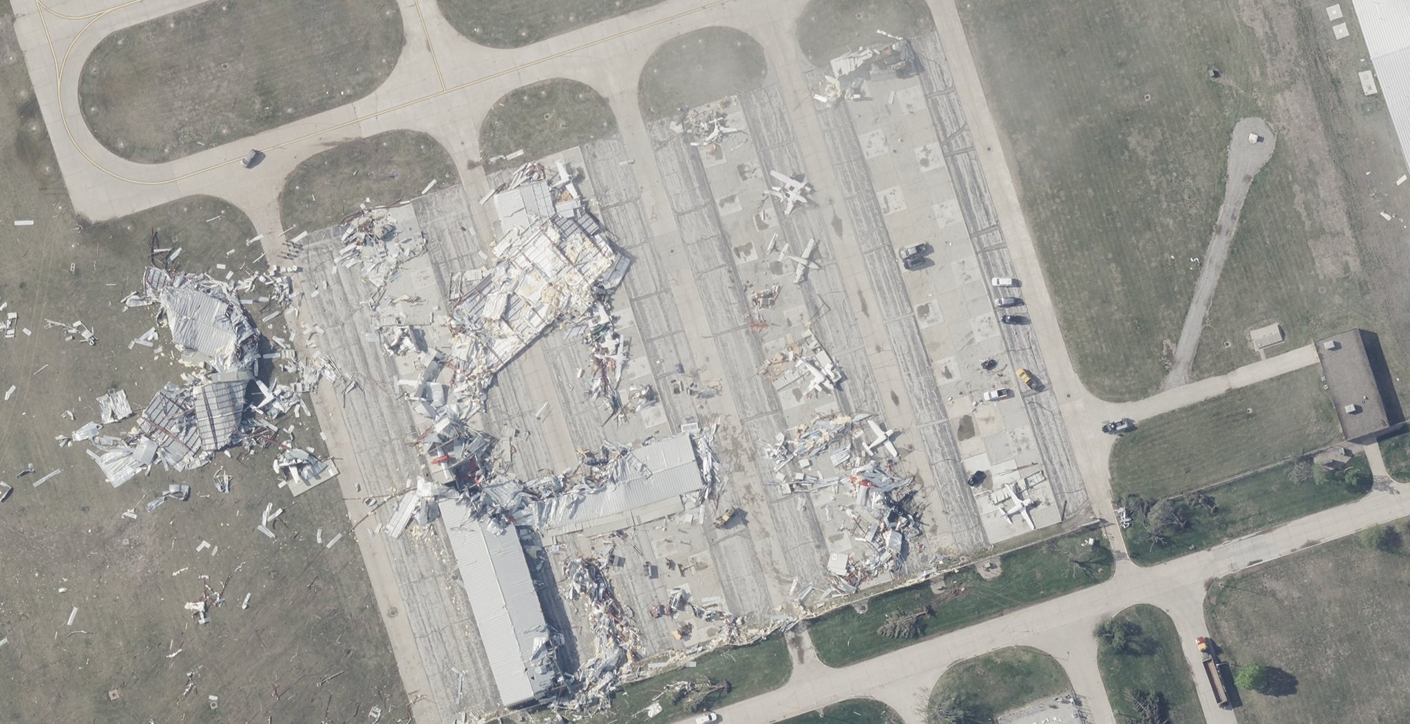
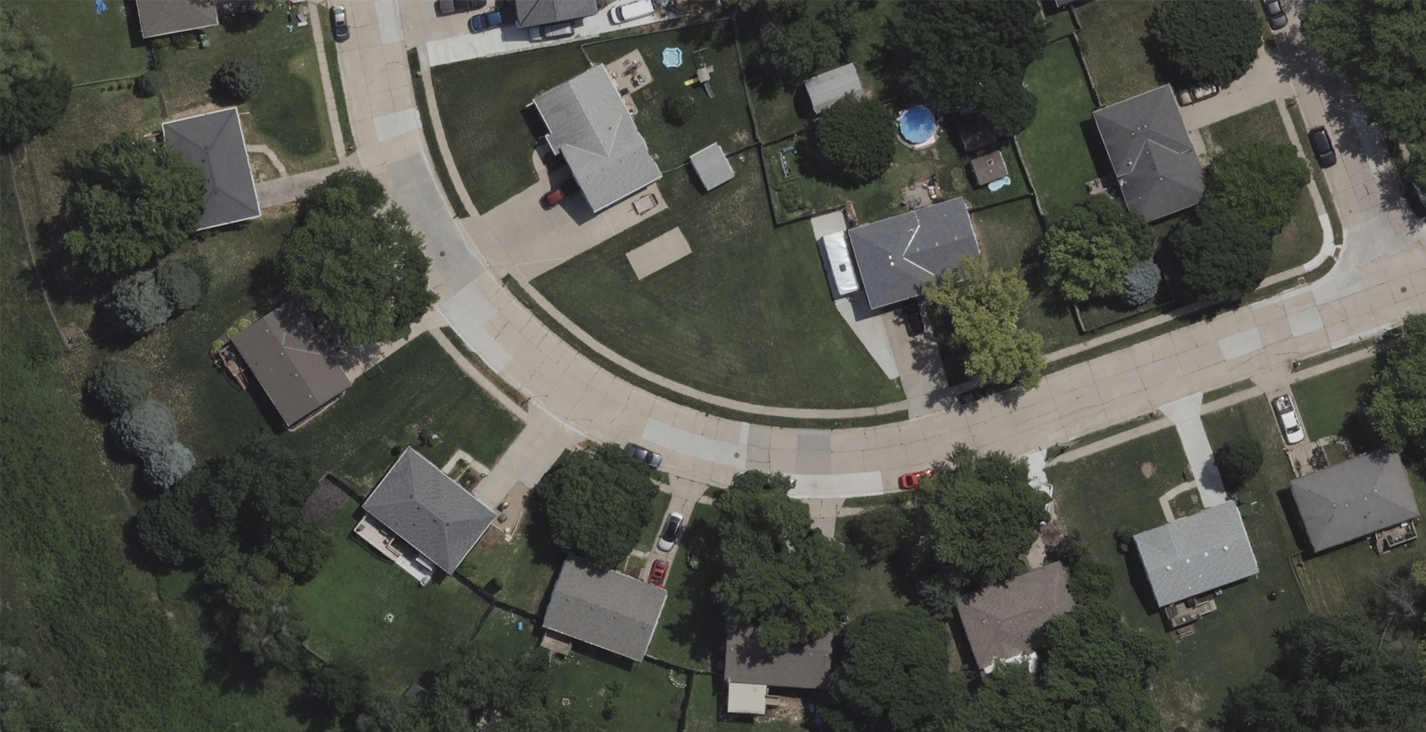
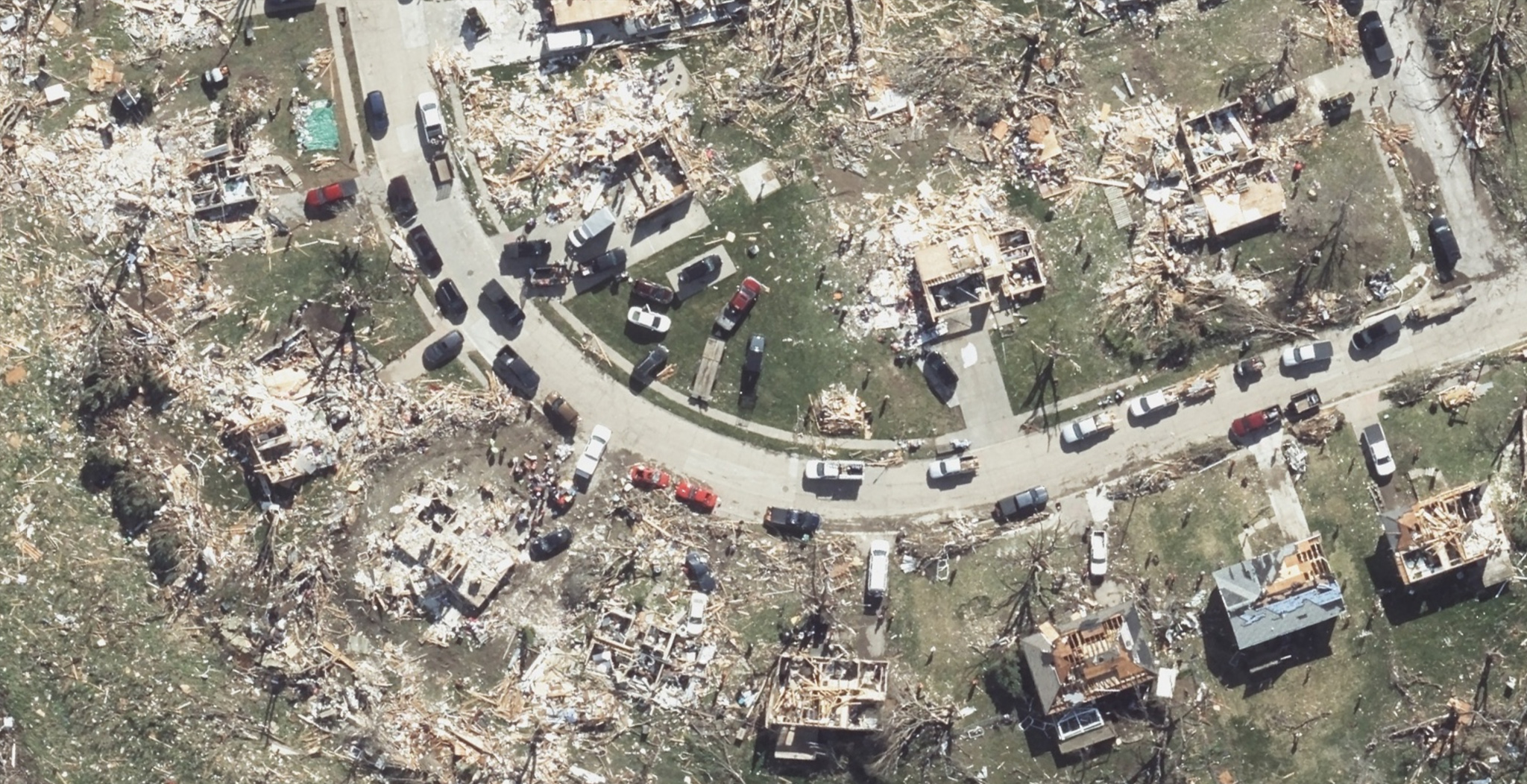
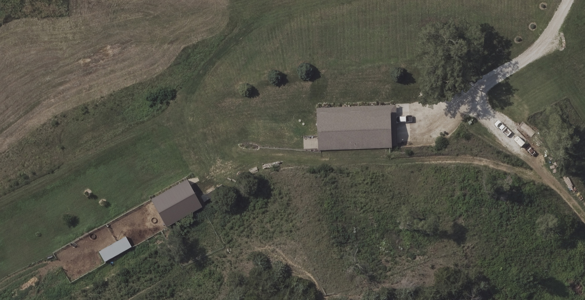
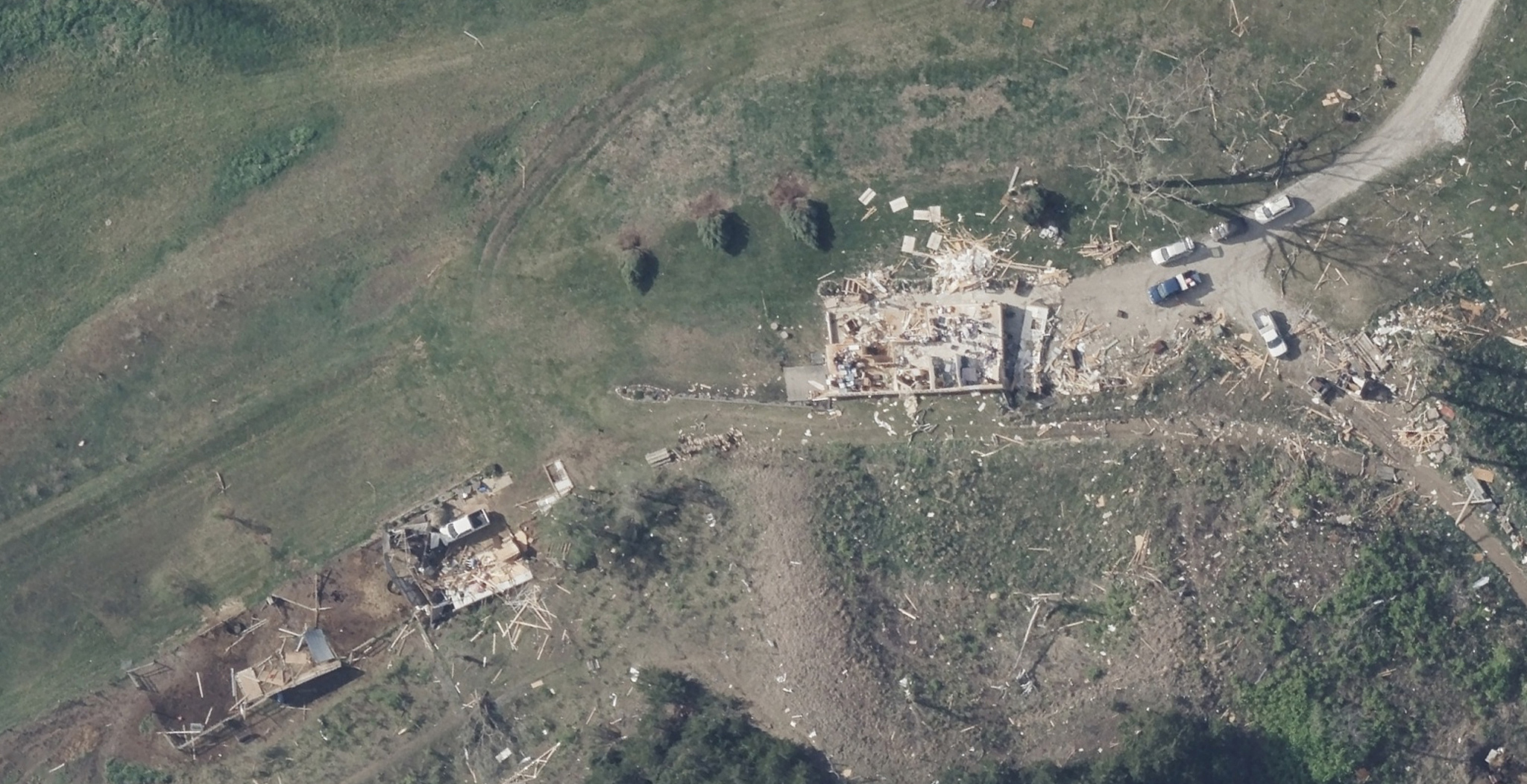
Shortly after we publish imagery, AI is run on the high-res imagery to generate damage footprints and assessments for properties in our Gray Sky collection areas.
Each building is assigned a color-coded catastrophe scroe that ranges from 0 (green, indicating no building damage) to 100 (red, indicating severe damage). This rating system allows insurers and responders to remotely gauge the extent of the damage, identify hot zones, and efficiently coordinate ground teams.
Below, you’ll find a series of damage footprints overlaid on imagery in Crescent, Iowa and Elkhorn, Nebraska. Following these is a comprehensive damage assessment report accompanied by a detailed aerial image of a building, all viewable through the GIC Viewer.
Imagery is now available via GIC Viewer, GIC APIs, Image Services for ArcGIS, and select partners. Please let us know if you need imagery for your response and recovery. You can learn more about how the GIC captures Gray Sky events here. To request access to imagery, please fill out our contact form below.

 Gray Sky Events: Oklahoma Tornadoes