- GIC launches as an initiative of the NICB
Vexcel and GIC Fully Align to Advance Aerial Imagery and AI for Insurance
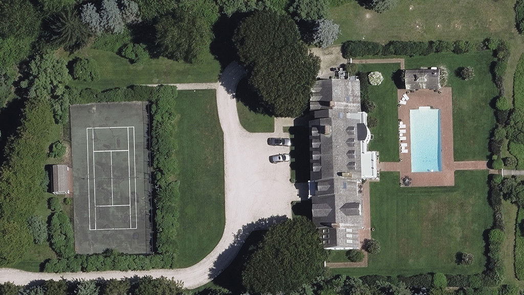
Since 2017, Vexcel has been the backbone and operations partner of the Geospatial Insurance Consortium (GIC), collecting and delivering high-resolution aerial imagery and property data to the insurance market. Our data now powers insights for more than 90% of the providers serving the property insurance market in the United States with growing demand both domestically and globally.
To better align our efforts and streamline our operations, we are unifying GIC under Vexcel. This alignment will help us:
- Scale faster
- Innovate more efficiently
- Advance our mission to serve the P&C industry
Helpful Links
Same Program, Same Mission
We will continue to offer a collective program for the insurance industry, including flexible pricing models, extensive imagery collections, rapid disaster response through our Gray Sky Program, and an ongoing partnership with the National Insurance Crime Bureau (NICB) to provide detailed imagery in the fight against fraud.
Together, we are pushing boundaries in aerial imagery, AI-derived imagery analytics, property data, and beyond.
Companies in the insurance industry who trust Vexcel data
What’s Next?
We’re proud of what we’ve accomplished as GIC and Vexcel. We brought insurers together, sparked innovation, and tackled tough challenges. By leveraging aerial imagery, AI, and technology, we’ve helped transform how the insurance industry responds after disasters and views property data everyday. But this is just the beginning. There’s much more ahead for insurers and beyond. Stay tuned.
Frequently Asked Questions
Q: How will the unified Vexcel-GIC affect my current membership and access to imagery and data?
A: There will be zero impact to your membership and how you’ve been able to access imagery and data. Since 2017, Vexcel has been the operations partner for the GIC, managing aerial collections, image processing, platform technology, the Gray Sky Program, and customer support. The services you currently receive remain unchanged and will continue as outlined in your contract. If you have any additional questions, feel free to reach out.
Q: Will the Gray Sky Program change?
A: Gray Sky is one of our cornerstone programs, launched in response to Hurricane Harvey in 2017. Since then, it has expanded to deliver post-catastrophic imagery and damage assessments for properties impacted by natural disasters. Gray Sky has equipped countless claims teams and emergency responders with timely, vital information. We have been running the Gray Sky Program and remain fully committed to its success. No changes are planned, and we will continue to provide the critical imagery, damage assessments, and support you depend on.
Q: Will this affect the quality or frequency of the imagery provided?
No, this will not affect the coverage, quality, or frequency of the imagery you receive. In fact, we’ve based our quality and frequency of collections on feedback from our insurance partners as well as other business sectors. We are fully committed to collecting and refreshing imagery across our library because we understand how important recent, accurate, and up-to-date imagery is. If you’ve been following Vexcel, you’ll know we’re collecting more imagery in the U.S., publishing more imagery daily, and adding new countries and territories. And there’s more to come!
Q: Is the NICB still involved with GIC?
A: Yes, the GIC was initiated and formed by the National Insurance Crime Bureau (NICB) in 2016 to use aerial imagery in the fight against insurance fraud. Vexcel has worked closely with them since the early days. With a heritage spanning over 110 years, the NICB remains a valuable partner, and Vexcel provides them with access to imagery at no cost.
Q: How will better alignment improve the products and services we receive?
A: Since 2017, we’ve been managing multiple efforts, platforms, and websites. By fully aligning, we’ll enhance the quality and efficiency of the products and services you receive. With less duplication of work, we can innovate more quickly and focus on delivering even better solutions that support the growing needs of insurers. We have lots of exciting updates coming on our roadmap, so stay tuned for what’s ahead! We suggest subscribing to our newsletter and following us on LinkedIn to stay informed on the latest developments.
Q: Will there be any changes in pricing or contract terms?
A: No, there won’t be any changes to your pricing or contract terms. Your current agreement remains in place, and you’ll continue to receive the same great access and services you’ve come to expect and trust.
Q: Will the GIC Viewer and other services still work for me?
A: Yes, Vexcel has always been the developer behind these services. Your login and access will continue to work in the GIC Viewer at app.gic.org. In 2025, we plan to merge all GIC Viewer accounts into the Vexcel Viewer. During the transition period, users will have access to both Viewers before the GIC Viewer is phased out. We’ll keep users updated throughout this process.
Additionally, services such as APIs, the MapControl SDK, and Image Services for ArcGIS will remain supported. Updates, support, and new features are on the way to enhance these offerings.
Q: Who should I contact for support or questions?
A: Please feel free to reach out directly to your sales or support contacts at GIC and Vexcel—we’re all here to assist you. You can also contact our Customer Advocacy Team at support@vexceldata.com for any additional help or questions.


