This post originally appeared on GIC.org.
Together, Vexcel and GIC have fully aligned their strengths to streamline efforts and enhance innovation, while continuing to provide the high-quality aerial imagery and coverage that insurers trust.
This post originally appeared on GIC.org.
Together, Vexcel and GIC have fully aligned their strengths to streamline efforts and enhance innovation, while continuing to provide the high-quality aerial imagery and coverage that insurers trust.
March 1, 2024 —
Fueled by high winds and dry conditions, wildfires in the Texas Panhandle have spread across more than 1 million acres this week. Our Gray Sky team actively monitored the fires and collected feedback from GIC members. And, on Friday morning, the team mobilized a flight crew based out of Lubbock, Texas, to capture six areas within the Windy Deuce and Smokehouse Creek Fire Zones. These areas, totaling 73 square miles (191 km²), were selected for their higher population density and member interest, including Fritch, Borger, Canadian, Miami, Stinnett, and Skellytown.
Same-Day Delivery
In collaboration with its operations partner, Vexcel, the GIC quickly processed and released orthomosaic and color-infrared aerial imagery by late Friday night. Imagery at a 10cm resolution is now accessible to GIC members and partners through the GIC Viewer, APIs, Image Services for ArcGIS, and supporting platforms.
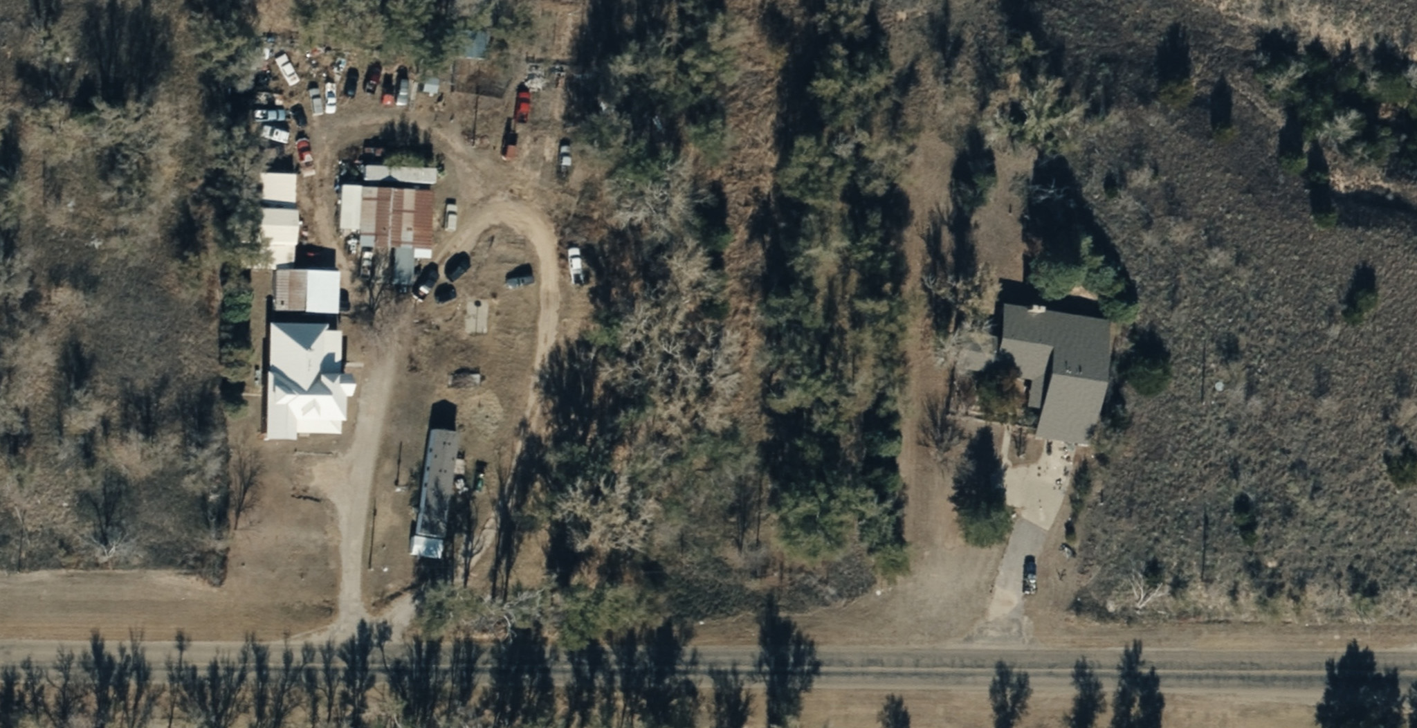
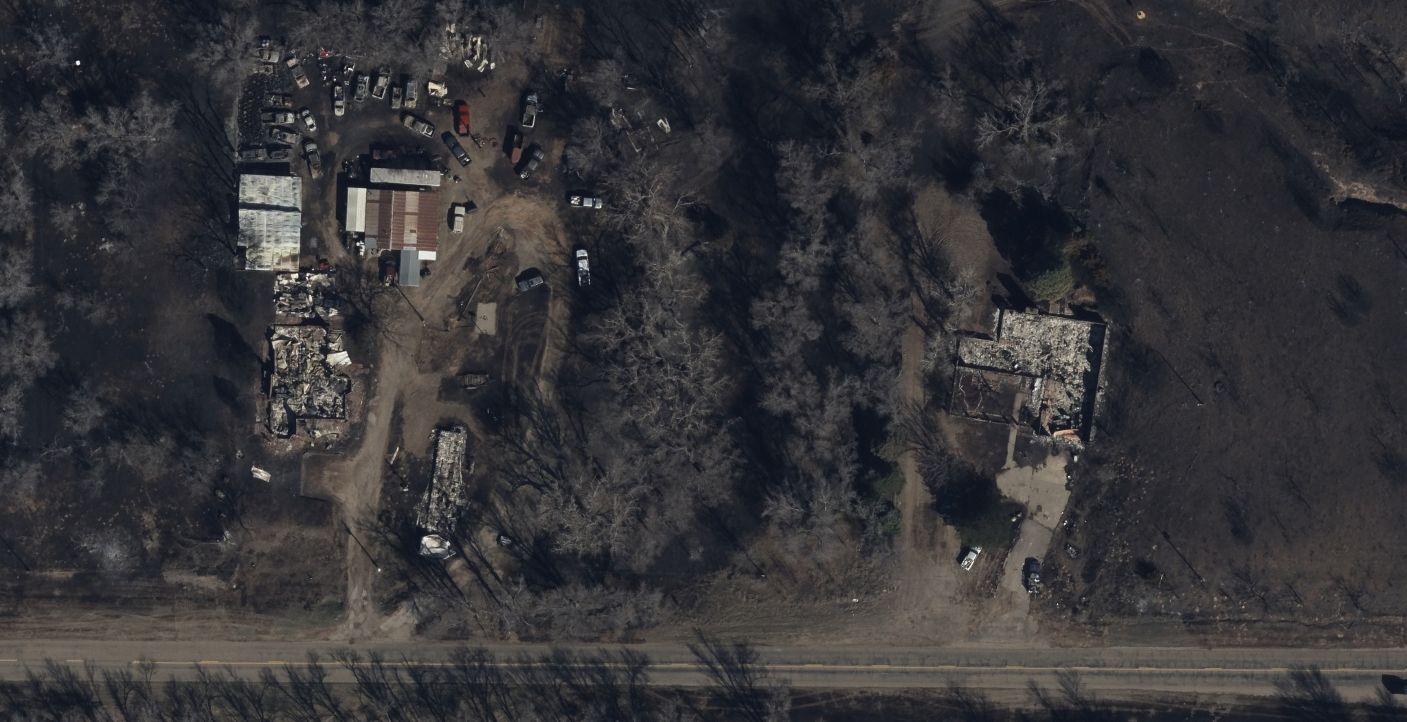
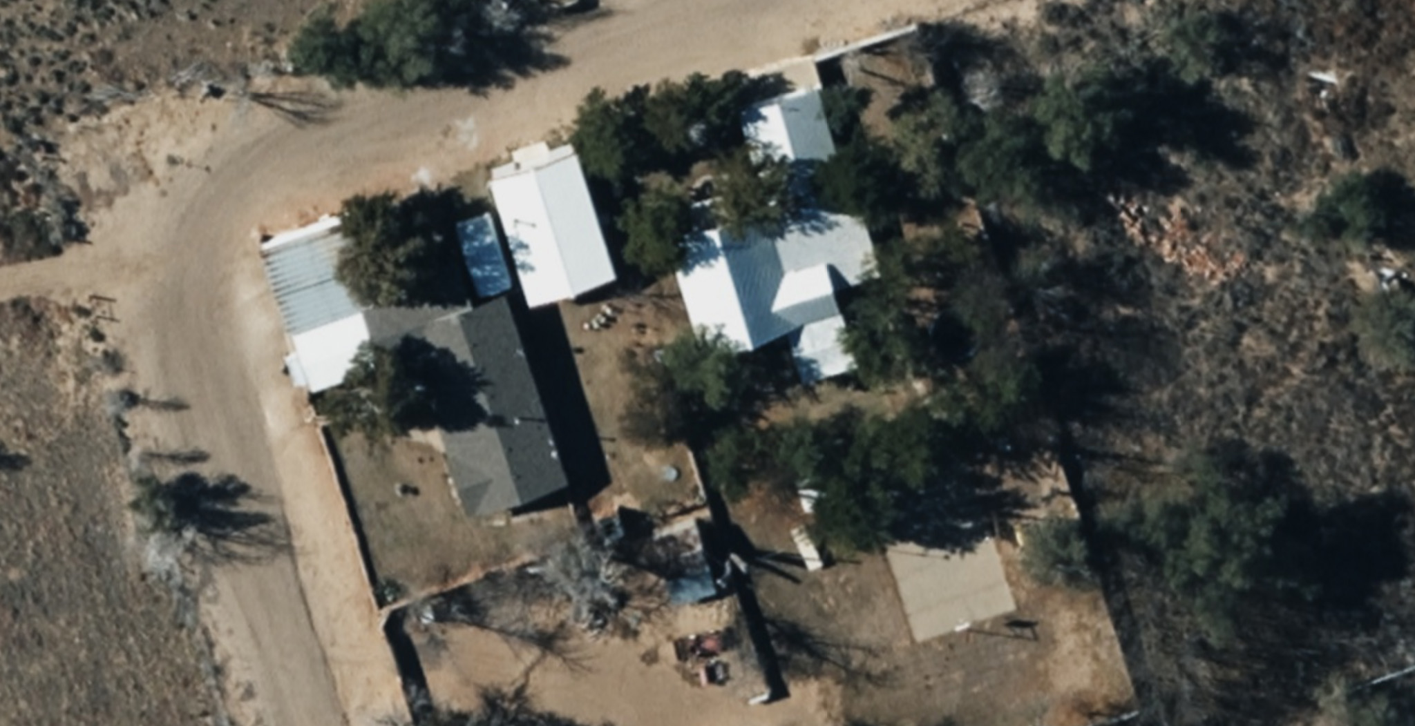
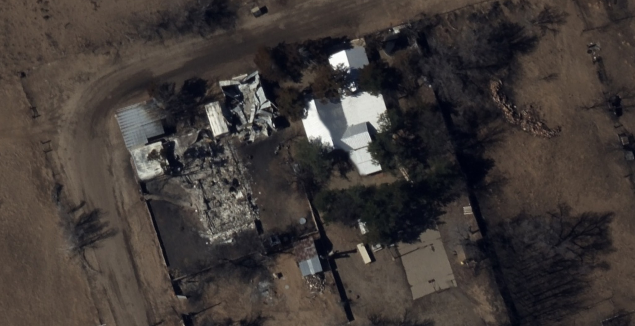
Below are select images from the collection:
Utilize Historic Imagery to Gauge Scale of Damage
We also provide access to historic imagery collected in 2022 and 2020. These images facilitate before-and-after comparisons, providing a clearer understanding of the extent of damage in the affected communities.
High-Quality Imagery for Damage Assessment
In wildfire burn zones, the landscape can appear chaotic, with burned homes standing next to untouched ones. On Saturday morning, the GIC published AI-derived Damage Assessments. This data enables emergency managers and insurers to remotely assess property damage, even in areas still inaccessible to residents and field adjusters. An overall post-CAT score is provided for each property. This information aids in directing resources where they are most needed.


Request Access
Please inform us if you require imagery for your response and recovery efforts. To request access to imagery from the Texas wildfires, please complete the contact form provided below.

 Vexcel to Expand Collection Program Across U.S. in 2024