High Resolution & Accurate
Aerial Imagery for Insurance Claims
Use high-resolution imagery and AI damage assessments to verify damage and accelerate claims response after tornadoes, hurricanes, and wildfires.

Use high-resolution imagery and AI damage assessments to verify damage and accelerate claims response after tornadoes, hurricanes, and wildfires.
Brit Insurance, a market-leading global specialty insurer, found immediate value when they began using Vexcel imagery in 2019. Discover how they’ve used the robust library to improve claims management and increase innovation across the policy life cycle.

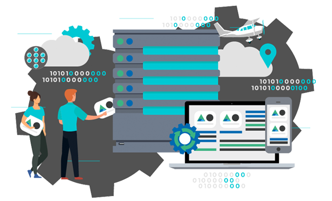
Vexcel drives innovation for insurers by helping you manage claims more efficiently with high-resolution imagery and detailed property data. Vexcel’s robust Gray Sky program also collects imagery following major hurricanes, wildfires, and tornadoes. On top of all of this, AI is applied against our imagery to deliver automated damage assessment on properties.
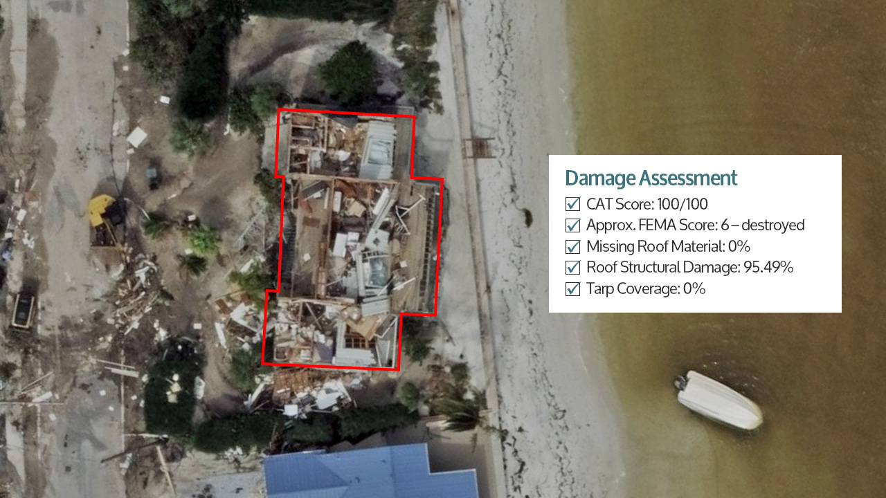
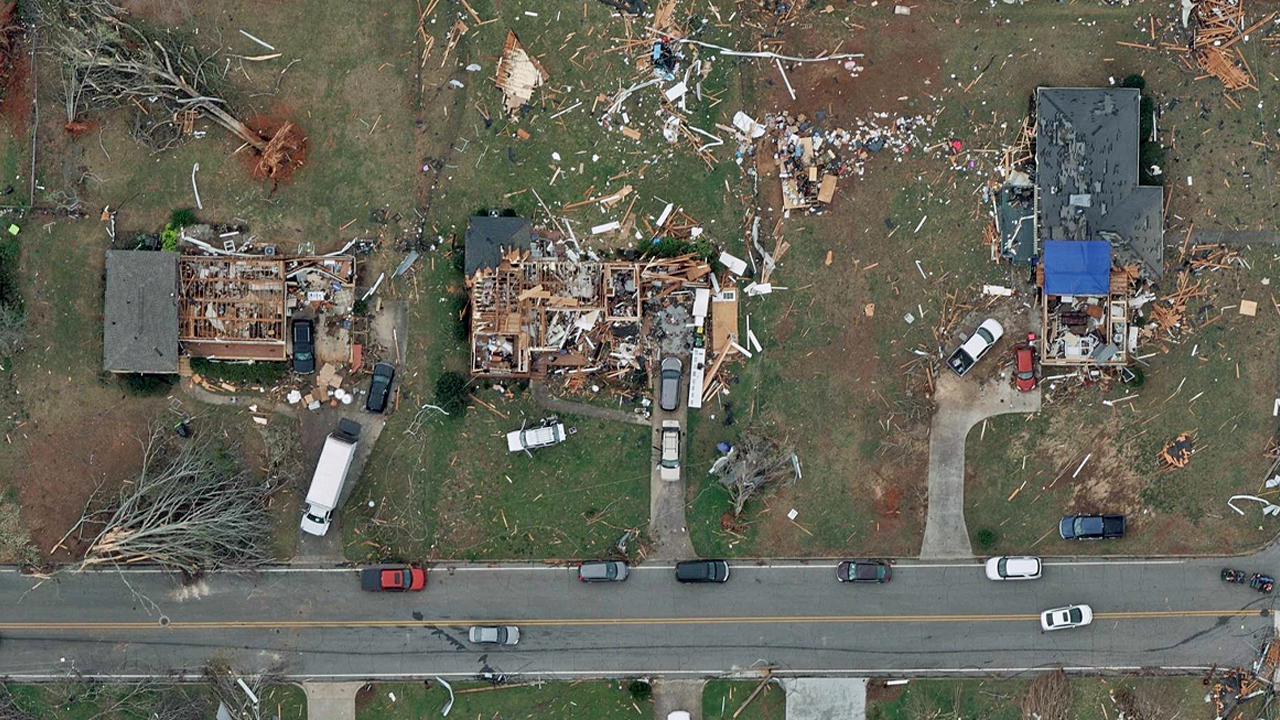
Prioritize and triage claims response teams following a catastrophic event. Reduce the number of touch points and expedite the claims process with detailed damage imagery for remote claims assessment.
Disaster and CAT response has been fundamentally changed by using AI. First, by identifying what’s been damaged with damage footprints and getting a sense of scale. Second, by honing in on the most damaged areas. And finally, by being able to compare before-and-after imagery alongside Damage Assessment details on an impacted structure.
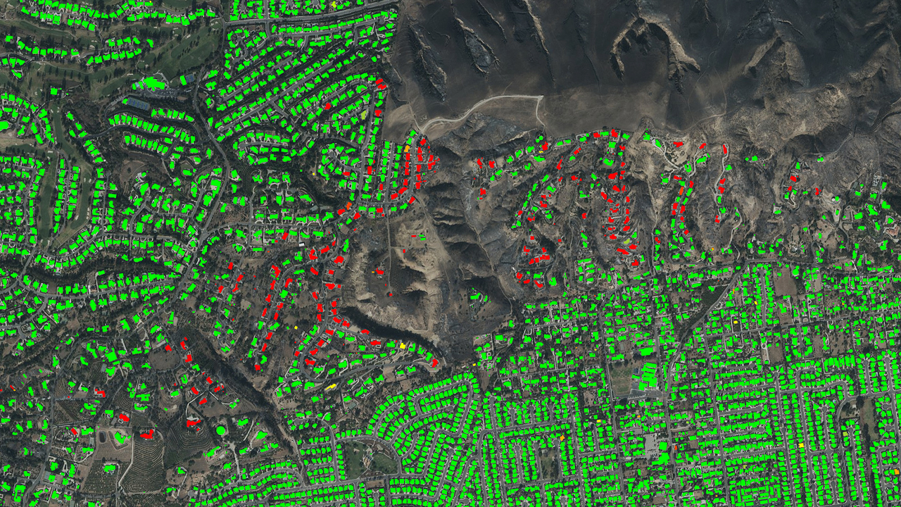
Disaster and CAT response has been fundamentally changed by using AI. First, by identifying what’s been damaged with damage footprints and getting a sense of scale. Second, by honing in on the most damaged areas. And finally, by being able to compare before-and-after imagery alongside Damage Assessment details on an impacted structure.
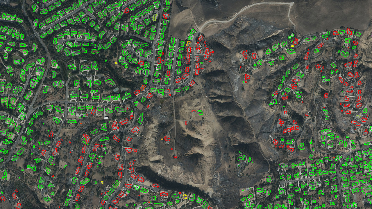
Disaster and CAT response has been fundamentally changed by using AI. First, by identifying what’s been damaged with damage footprints and getting a sense of scale. Second, by honing in on the most damaged areas. And finally, by being able to compare before-and-after imagery alongside Damage Assessment details on an impacted structure.

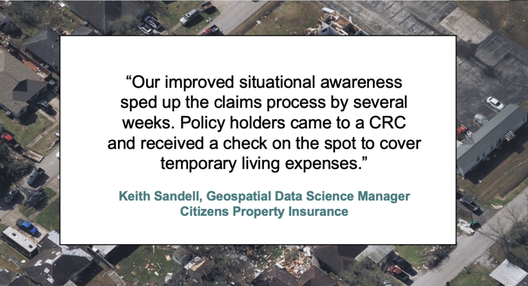
Expediting the claims process isn’t just beneficial for the insurer, it provides peace of mind for an impacted customer. By comparing before-and-after imagery, along with AI-derived insights, insurers can quickly respond to your customers’ needs, often contacting a customer before they even file a claim.
Ready to get started with Vexcel’s imagery? Bring Vexcel imagery into your apps, software, solutions, and platforms–where and when you need it.
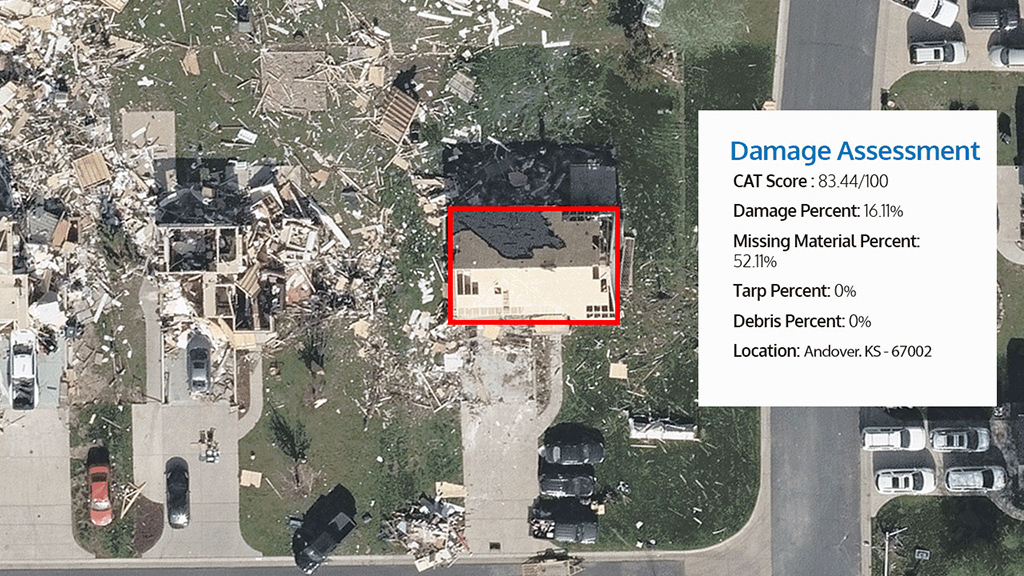
Access critical damage assessment details on properties following major disasters such as hurricanes, wildfires, and tornadoes to help triage claims faster.
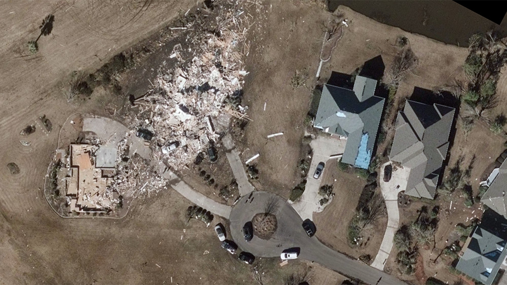
Get the full understanding of the impact of a hurricane, wildfire, or tornado with high-resolution imagery from Vexcel.
Q: How does aerial imagery help with insurance claims processing?
Vexcel aerial imagery helps insurers review property conditions before and after catastrophic events without always sending adjusters into the field. Claims teams use Vexcel imagery to assess damage, review affected areas at scale, prioritize inspections, and better understand property conditions during the claims process.
Q: What is Vexcel’s Gray Sky disaster imagery program?
Gray Sky is Vexcel’s rapid-response aerial imagery program for hurricanes, tornadoes, wildfires, and other catastrophic events. Once certain thresholds of property damage are met, the Gray Sky team deploys aircraft to collect high-resolution aerial imagery to help insurers quickly review impacted properties and support claims response and recovery operations.
Q: How does AI damage assessment work for insurance claims?
Vexcel’s Elements AI-powered damage assessments analyze aerial imagery to identify visible property damage after catastrophic events. Insurers use damage reports to quickly review affected properties, prioritize claims workflows, identify heavily impacted areas, and support large-scale catastrophe response efforts. For instance, after Hurricane Ian in Florida, Vexcel reviewed more than 3.5 million properties and provided property-level damage reports for all of them.
Q: How quickly is disaster imagery available after a post-CAT event?
Vexcel Gray Sky imagery is collected once weather and flight conditions allow. After collection, imagery is rapidly processed and published to help insurers access current aerial views of impacted areas as quickly as possible during catastrophe response. Vexcel collects Gray Sky imagery across the United States and Australia and also supports on-demand disaster response collections in other countries.
Q: Can insurers compare before-and-after imagery for claims verification?
Yes. Vexcel provides timestamped historical and post-event imagery that allows insurers to compare before-and-after conditions at the property level. These comparisons help claims teams review damage, verify loss conditions, and better understand how properties changed after a catastrophic event.


Large-format UltraCam cameras & sensors.
vexcel-imaging.com

Aerial surveys by fixed-wing aircraft.
kasurveys.com

Aerial imagery and data for government and business.
vexceldata.com