High Resolution & Accurate
Aerial Imagery for Smart Cities
Imagery and geospatial data to support infrastructure planning, sustainability initiatives, and connected networks for next-gen cities.

Imagery and geospatial data to support infrastructure planning, sustainability initiatives, and connected networks for next-gen cities.
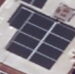
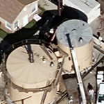
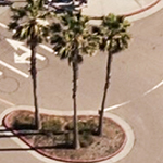
City planners need consistent, reliable data to visualize a project and evaluate the short and long-term effects of any smart city initiatives. Crystal clear aerial maps from Vexcel provide precise detail and unlock features hidden to the naked eye. Use multispectral imagery and digital surface models to classify vegetation and interpret the earth’s surface to better manage complex city environments.


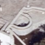
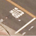
Get closer to your sites than you ever have before and expand your visualization efforts beyond everyday maps and satellite images. Understand building footprints, structure conditions, vegetation growth, and other parcel attributes from multiple angles at a sub-3” (7.5cm) resolution or better.
Interact with imagery
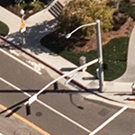
You need better data to envision the next wave of smart cities and create a more sustainable, innovative, and connected environment. Use Vexcel’s highly accurate imagery to build a robust library of geospatial data to plan smarter transportation, develop more green living space, and better energy consumption. Categorize attributes, track changes, and plan future improvements with superior location intelligence from Vexcel.
Interact with imagery


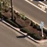


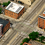
City Planners: Your vision of the future starts with ground truth. Get a bird’s-eye view of what exists today such as underutilized open space, vast housing developments, community flow and traffic patterns. Imagine what could be and set your vision in motion with confidence using Vexcel’s regularly updated aerial data.
Interact with imagery
![]()
Large-format UltraCam cameras & sensors.
vexcel-imaging.com
Aerial surveys by fixed-wing aircraft.
kasurveys.com
Aerial imagery and data for government and business.
vexceldata.com