This post originally appeared on GIC.org.
Together, Vexcel and GIC have fully aligned their strengths to streamline efforts and enhance innovation, while continuing to provide the high-quality aerial imagery and coverage that insurers trust.
This post originally appeared on GIC.org.
Together, Vexcel and GIC have fully aligned their strengths to streamline efforts and enhance innovation, while continuing to provide the high-quality aerial imagery and coverage that insurers trust.
As the second largest wildfire in California history, the Dixie Fire is challenging fire crews with unpredictability and its ability to create its own weather patterns. Currently only 21% contained and burning for over a month now, it has spread destruction across Plumas, Butte, Lassen and Tehama counties and consumed over 500,000 acres. The town of Greenville, CA was nearly destroyed with over 75% burned.
Our planes were able to get up in the area recently once smoke had cleared enough to capture crisp ortho imagery of the impacted areas. In this particular area, we also have Blue Sky imagery so members will be able to do a pre- and post-event analysis of the fire’s devastating effects.
The River Fire, while not as large in strength as Dixie, is over 60% contained but has destroyed nearly 100 structures, both residential and commercial.
By accessing pre- and post-CAT imagery of an impacted area, members quickly identify property damage, both residential and commercial to quickly assess the scope of damage caused by the wildfire.
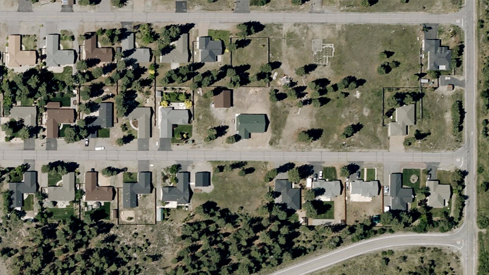
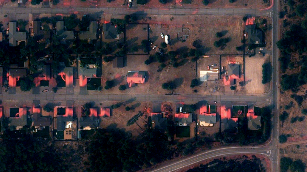
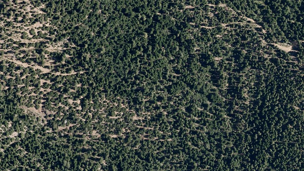
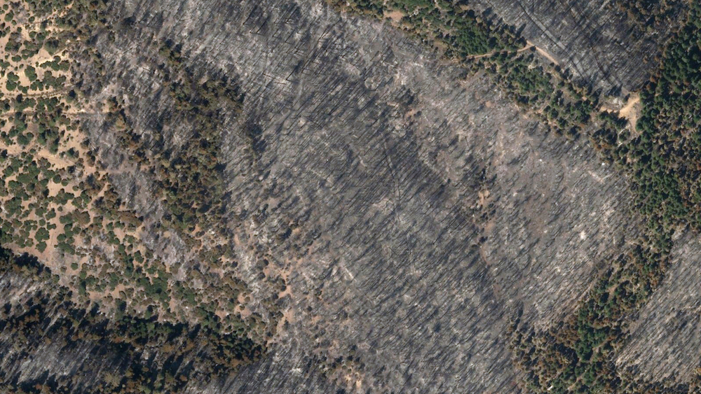
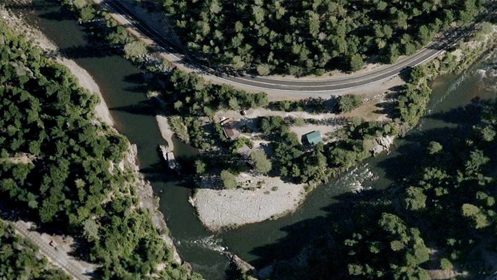
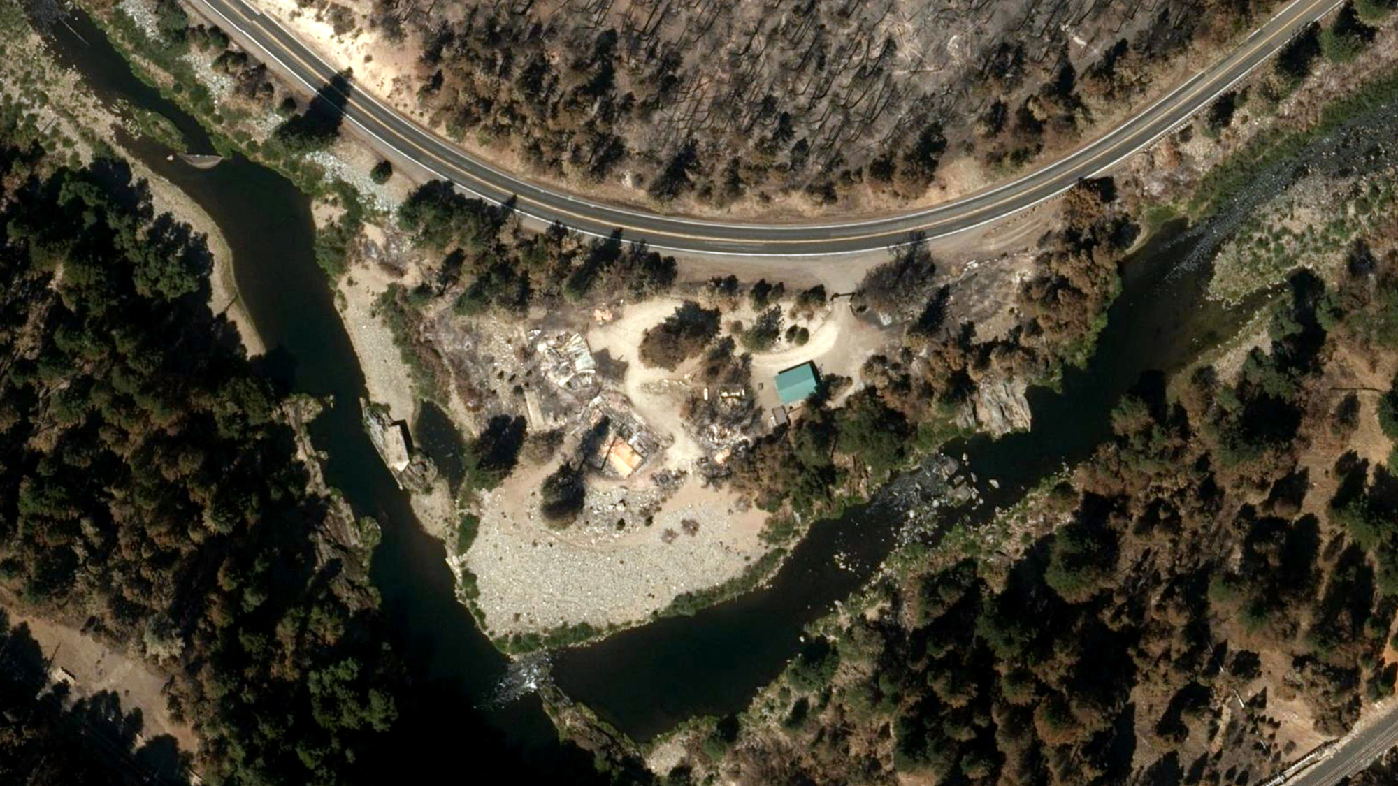
You can learn more about how the GIC captures Gray Sky events here. No one captures more disasters than the GIC. To request access to imagery from Beckwourth Complex Fire or other imagery, please fill out our contact form below.

 Gray Sky: Capturing the Caldor Fire