Collecting Disaster imagery: From Hurricanes to Wildfires and Beyond
Weather related events can create multiple problems for the communities they impact: destroyed residential and commercial structures, power outages, massive flooding, potable water needs, passable roads and damaged infrastructure. And most of these disasters–like hurricanes, tornadoes, wildfires, and massive flooding–can often come on with little to no warning.
Aerial imagery collection has become a critical pathway for capturing real truth on the ground, laying bare the aftermath of catastrophes and the devastating impact to communities. Vexcel is proud to be the Operations Partner for the Geospatial Insurance Consortium (GIC), a member-centric organization that specifically supports insurers looking to respond quickly to their customers in the event of a major disaster. Because we have hubs across the contiguous U.S., our planes are able to get up into the air rapidly following an event as soon as the airspace is safe and clear to do so. We help fulfill the GIC’s commitment to providing post-CAT imagery within 24 hours post-collection so that recovery and restoration efforts can begin as quickly as possible.
But our imagery is not just for the GIC; emergency managers from federal agencies and various government entities have requested–and needed–this valuable aerial data. And all they need to do is get access to our web-based application, Viewer, to see the capture as well as use it to compare against historical imagery we have for that area.
Hurricane Ida and Caldor Fires
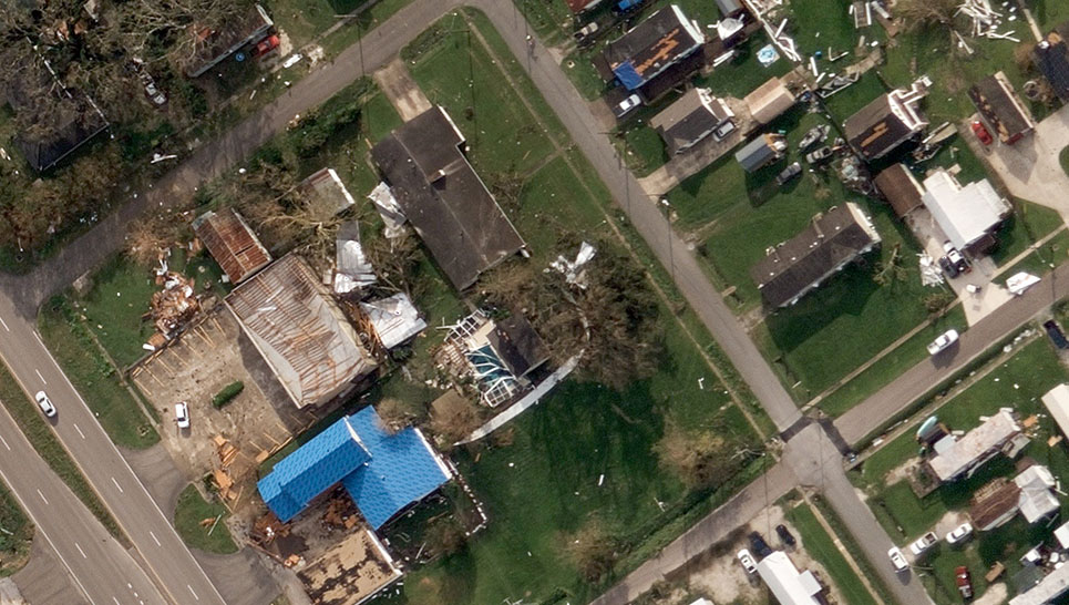
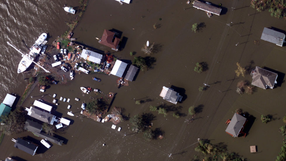
The largest events we’ve flown recently have had major impacts on hundreds of thousands of U.S. citizens. First, Hurricane Ida, which made landfall in Louisiana on August 29, 2021. This Category 4 hurricane followed a similar path to Hurricane Katrina and tied Hurricane Laura for the strongest storm to hit the Louisiana. Over a million customers are without power, residential and commercial structures are destroyed, massive flooding is spreading across New Orleans, and the tragedy of loss of life has occurred. The GIC is publishing some of this aerial data on their website so you can see what we’ve been able to collect so far. Because of the massive scale of the disaster, the capture has required multiple planes over several days.
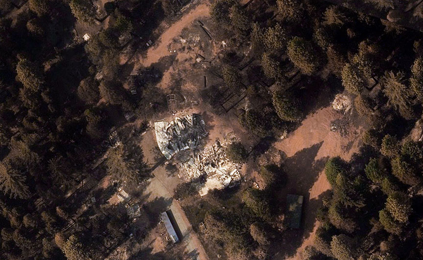
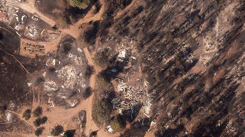
The Caldor Fire started on August 14, 2021 and has spread rapidly just over the last few days, requiring the mandatory evacuation of over 60,000 residents. As of September 1, it has destroyed over 670 structures and damaged 40 others with more than 33,600 homes and businesses still in jeopardy. It’s currently only 15% contained.
Imagery for these disasters–and many more–is available through our Viewer platform. If you need access to this imagery, please contact us and we’d be happy to help connect you to one of our customer advocacy team members.


