This post originally appeared on GIC.org.
Together, Vexcel and GIC have fully aligned their strengths to streamline efforts and enhance innovation, while continuing to provide the high-quality aerial imagery and coverage that insurers trust.
This post originally appeared on GIC.org.
Together, Vexcel and GIC have fully aligned their strengths to streamline efforts and enhance innovation, while continuing to provide the high-quality aerial imagery and coverage that insurers trust.
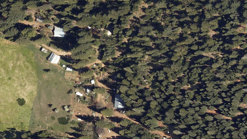
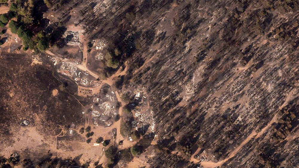
Wildfires are growing at rapid rates in California this fire season and the need for aerial imagery has never been greater. The Caldor Fire is a prime example of just how quickly fires are spreading. The fire started on August 14 and has grown swiftly, burning over 106,000 acres and only 5% contained as of August 22. So far, it has destroyed more than 400 homes with over 17,500 structures at risk.
The fire is located in northwestern California just southwest of Lake Tahoe and is one of 13 active large wildfires that have burned more than 1.5M acres (according to Cal Fire). Our flight crews were able to capture imagery to help start the recovery and restoration for those areas already impacted by the fire.
Collecting imagery for wildfires is a daunting task. The challenge of finding clear skies–while fires are still burning–is a constant battle. But the need to capture what’s happened on the ground, to help those in true need begin their recovery process, is what gets our Gray Sky pilots up in the air. Take a small glimpse into their vantage point from our pilot that flew the Caldor Fire below.


You can learn more about how the GIC captures Gray Sky events here. No one captures more disasters than the GIC. To request access to imagery from the Caldor Fire or other imagery, please fill out our contact form below.

 Capturing the Scope of Damage from Hurricane Ida