Gray Sky: Selmer, Tennessee Area Tornado


Tornado Imagery Collected and Published
Tuesday, April 8
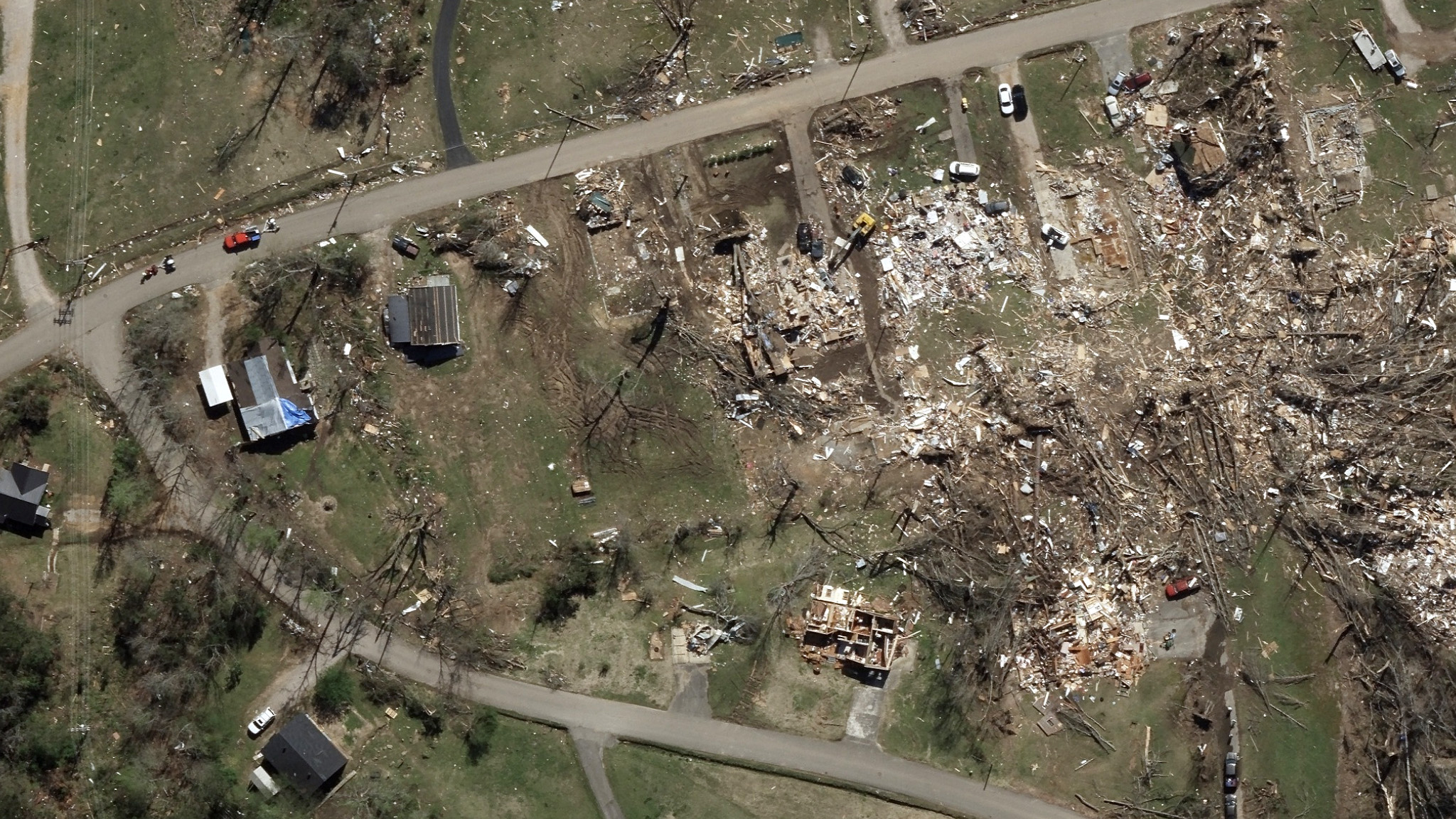
Today, our Gray Sky team collected high-resolution imagery of EF-3 tornado damage in Hardeman, McNairy, and Hardin counties in southwestern Tennessee. The collection focuses on densely populated areas with significant building damage and includes 10cm ortho and multispectral imagery. This imagery is now available to customers via the Vexcel Platform and Image Services for ArcGIS.
The coverage area spans approximately 40 miles along the tornado’s path, capturing property addresses from Pocahontas to Selmer, Adamsville, and Saltillo. Color-coded damage assessments for every property in the collection area are also available.
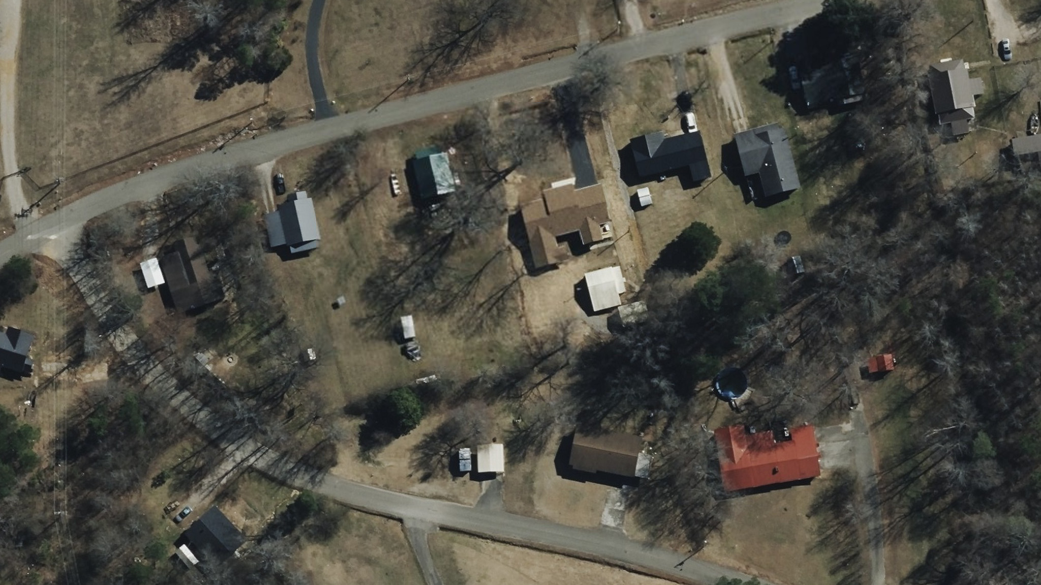
In addition, timestamped before imagery from late February 2025 is available for comparison.