Elements: Building & Property Attributes
Know What’s on the Property
Key property and building attributes — extracted, precomputed, and validated — from high-resolution aerial imagery across the U.S., Canada, Australia, and New Zealand.

Key property and building attributes — extracted, precomputed, and validated — from high-resolution aerial imagery across the U.S., Canada, Australia, and New Zealand.
Underwriters need current roof data before writing a policy. Claims teams need to verify pre-disaster property conditions before paying a loss. Assessors need to know what changed on a parcel before updating a record. Elements: Building & Property Attributes puts that data in their hands. It’s extracted from Vexcel’s high-resolution aerial imagery and precomputed across millions of properties.
A policy written without current property data is a policy priced on assumptions. A claim reviewed without verified conditions adds time, cost, and risk to every decision. A property record built on outdated information fails the people who depend on it.
Elements: Building & Property Attributes replaces assumptions with evidence. More than 40 validated attributes, tied to timestamped imagery, available across millions of residential and commercial properties.
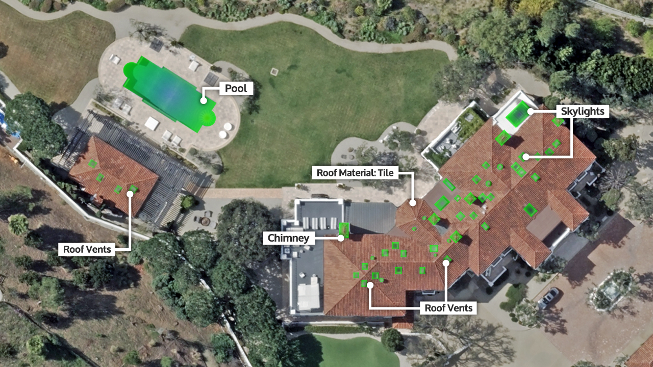
Real estate: Analyze property details across portfolios and markets
Solar: Identify, plan, and measure rooftops
Roofing: Inspect roof condition, material, and features for estimates
Insurance: Assess property risk, support underwriting, and review claims
Government: Manage property and tax records, support planning
Utilities: Understand structures for asset and growth planning
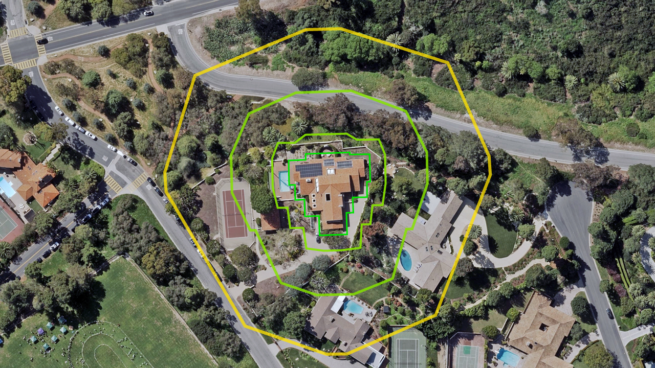
Wildfire exposure isn’t determined by the structure alone. It’s shaped by what surrounds it. Elements: Buildings & Properties maps tree and building coverage across four buffer zones (5, 30, 100, and 200 feet), giving risk teams a precise, imagery-verified view of defensible space at scale.
More than 40 validated attributes across residential and commercial properties. Each tied to timestamped imagery and location.
Building & Roof Attributes
Footprint
Ground
Building
Roof Characteristics
Roof Objects
Roof Discoloration
Roof Defects
Property Attributes
Parcel
Defensible Space
Pool & Water Features
Structures & Surfaces
Recreation
Vehicles
Precomputed property and building attributes are available in the United States, Canada, Australia, and New Zealand.
Delivery options include data files, property reports (PDF), select partner sites, and through the Vexcel Platform (Viewer, APIs, Studio, MCP).
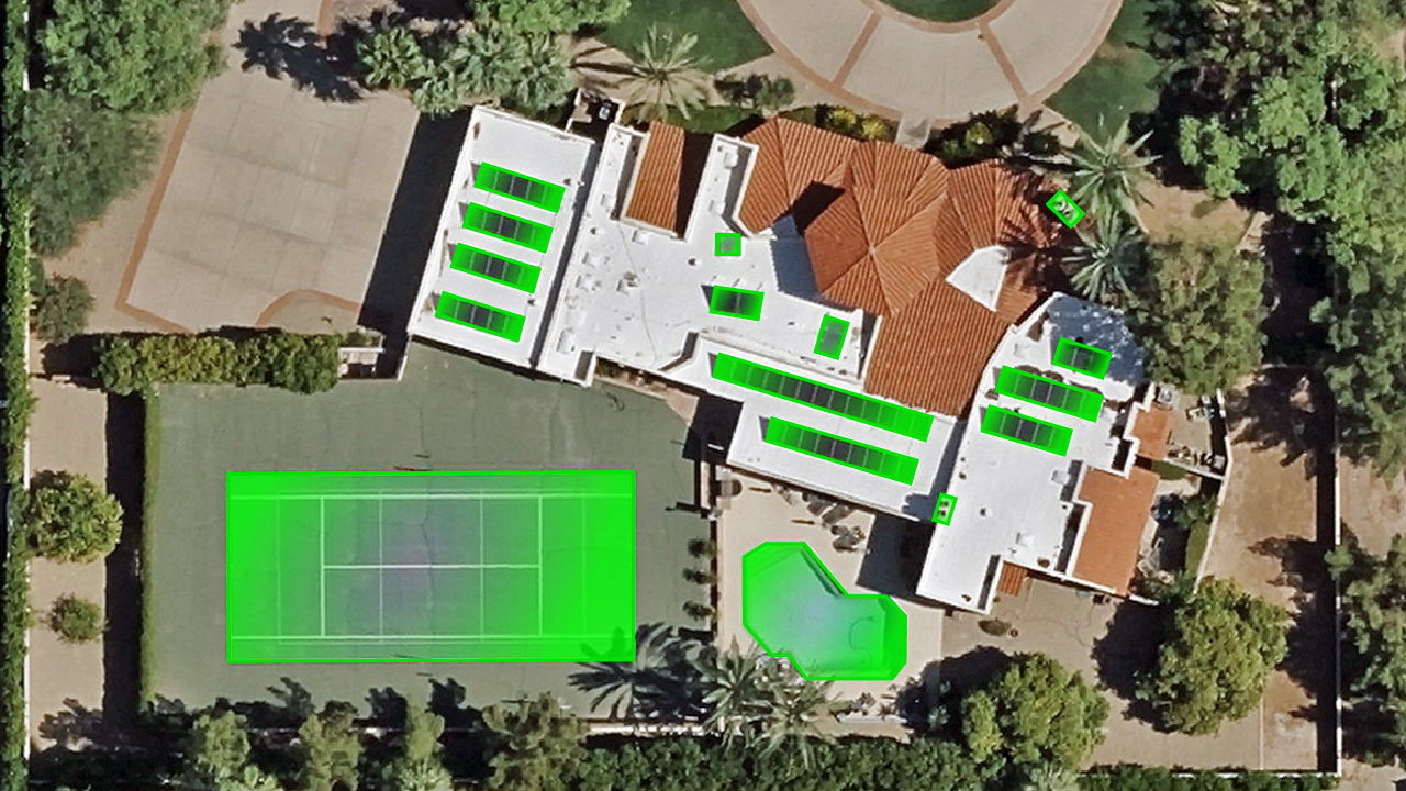
AI-powered object detection for Vexcel ortho and oblique imagery across 45+ countries and territories.
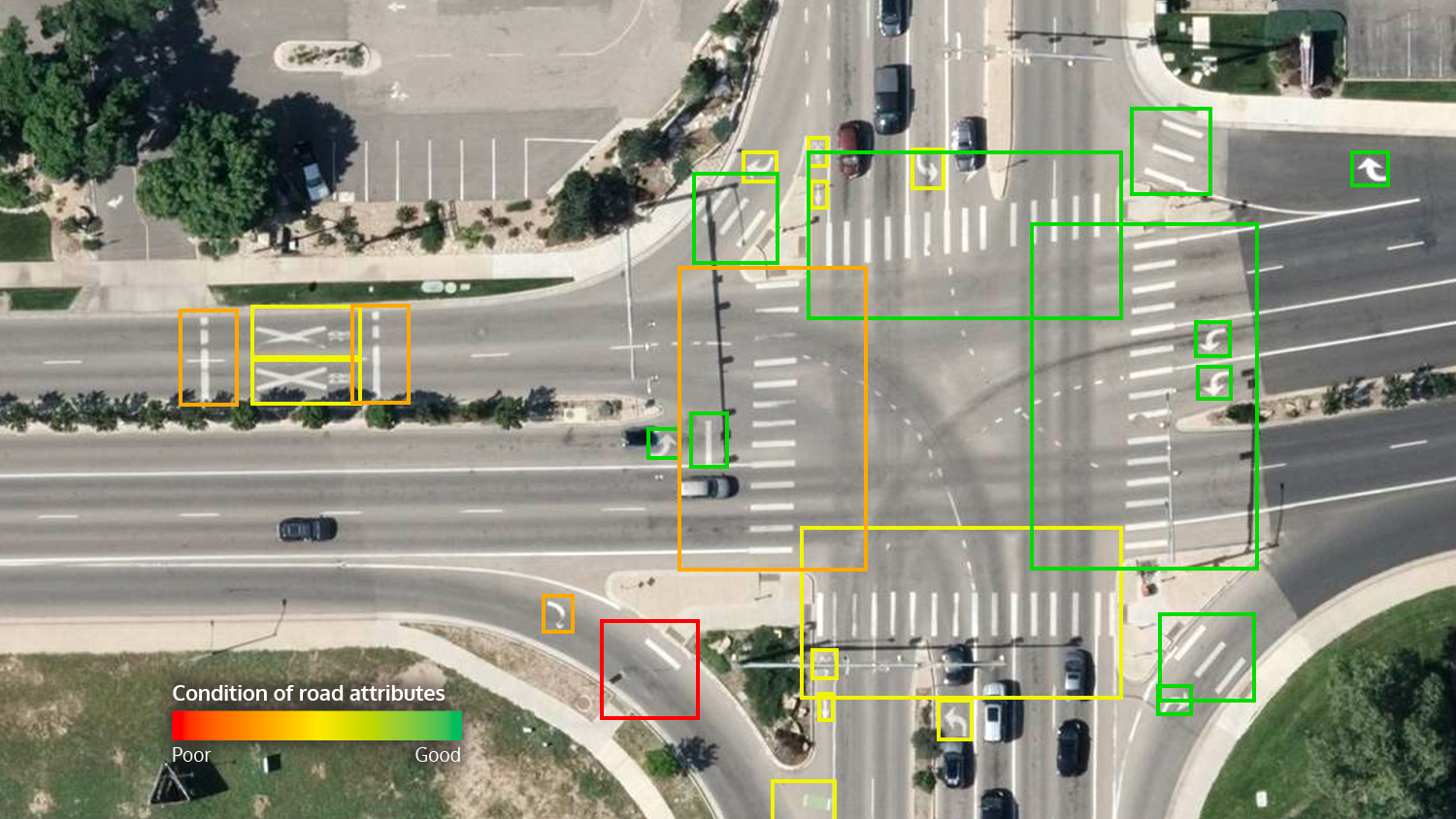
Roadway attributes from aerial imagery: bike lanes, crosswalks, curb ramps, arrows, and road text.
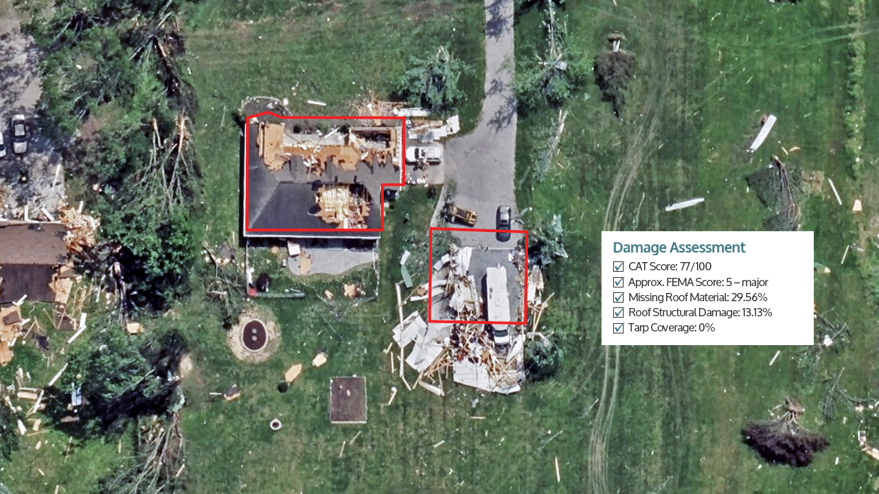
Color-coded footprints and property-level damage scores after wildfires, hurricanes, and tornadoes.
Q: How does Elements AI compare to satellite or drone data?
Vexcel Elements AI uses aerial imagery captured at 7.5–15cm resolution, providing more detail than satellite imagery. This level of detail allows Vexcel to extract property and building attributes reliably across large areas.
Vexcel aerial imagery is collected at scale with consistent coverage and production standards, scaling far beyond drone programs.
Q: Can Elements AI replace manual property inspections?
Vexcel Elements AI reduces the time and need for manual image review by providing precomputed property and building attributes derived from aerial imagery. Many workflows such as underwriting, planning, tax assessment, and portfolio analysis can be completed using this data, while field inspections may still be used for validation in specific cases.
Q: How is imagery-derived property data different from other datasets?
Vexcel Elements AI extracts property data directly from its own high-resolution aerial imagery, capturing both the presence and geometry of real-world features. Unlike aggregated or third-party datasets, Vexcel data reflects actual property conditions at a specific point in time and is tied to an exact location. The vector data can also be verified against the underlying source imagery.
Q: How do teams use Elements AI in real workflows?
Both the private and public sectors use Vexcel Elements AI to assess property risk, review claims, and analyze properties at scale. Vexcel delivers this data as data files, PDF reports, and API calls, making it easy to integrate into underwriting systems, GIS platforms, and internal workflows.
Q: How often is Elements AI data updated?
Vexcel Elements AI is updated as new aerial imagery is collected and processed. Each attribute is tied to timestamped imagery, allowing teams to understand property conditions at a specific point in time and track changes as new Vexcel imagery becomes available.
Q: How are property and building attributes pulled from aerial imagery?
Property and building attributes are features and polygons extracted from aerial imagery, such as building footprints, roof characteristics, materials, and surrounding property features. Vexcel Elements AI uses tested and verified AI and machine learning to identify these attributes and deliver structured data about real-world properties.


Large-format UltraCam cameras & sensors.
vexcel-imaging.com

Aerial surveys by fixed-wing aircraft.
kasurveys.com

Aerial imagery and data for government and business.
vexceldata.com