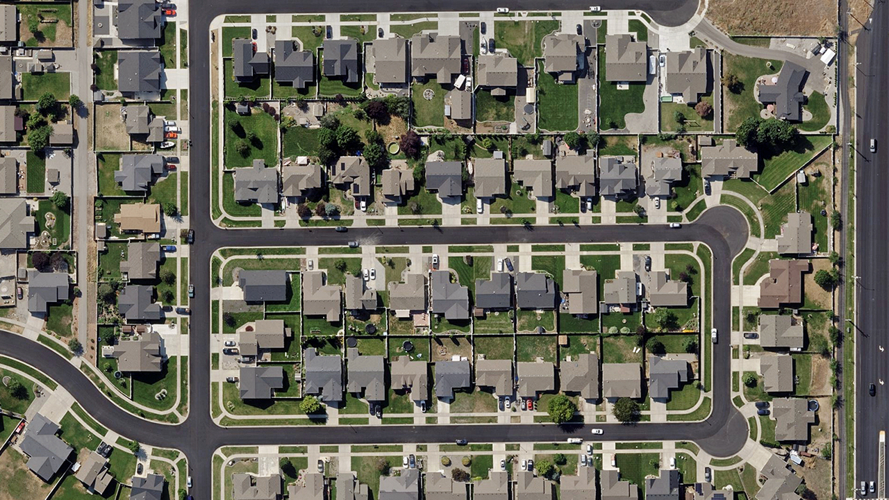
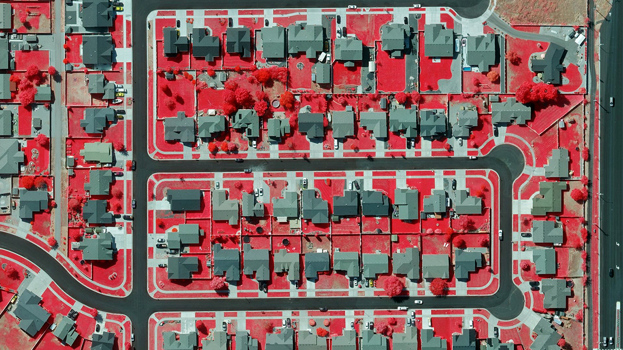
High Resolution
Multispectral Imagery
Use near-infrared (NIR) and color-infrared (CIR) imagery to analyze vegetation, evaluate wildfire risk, identify impervious surfaces, and more.
Use near-infrared (NIR) and color-infrared (CIR) imagery to analyze vegetation, evaluate wildfire risk, identify impervious surfaces, and more.
Near-infrared (NIR) is 4-band imagery, collected from several parts of the electromagnetic spectrum. With this type of data, users can extract information around a location’s vegetation and impervious surfaces. Identify plant health, soil moisture, water clarity, and wetland mapping. This data is extremely useful for monitoring environmental changes and can assist in land management and urban development.


What’s the difference between NIR (near-infrared) and CIR (color-infrared) imagery? NIR is the undetectable-by-the-human-eye fourth band directly collected from our sensors and delivered as an on-premises product. CIR is the derivative of that collection, colorized to make vegetation, water surfaces, and other impervious surfaces easier to see.
View NIR imagery in Color-Infrared (CIR) form inside of Viewer, Vexcel’s web-based application for accessing aerial content. The coloration of an image captured in near-infrared allows your eye to easily differentiate between ground surfaces in three layers and can detect vegetation, water bodies, roads and buildings.
Wildfires are an annual threat across many areas of the U.S. As part of Vexcel’s disaster response program, imagery was collected over several of the impacted communities during one wildfire in Lake Elsinore, California. Using CIR imagery, emergency managers could easily gauge the level of destruction. Live trees and grass are colored red while dead, burned areas are black and gray tones. In just seconds, they could quickly see damaged areas and start plans for rebuilding the impacted community.