Gray Sky: Hawaii Floods
Imagery now published in Vexcel Platform


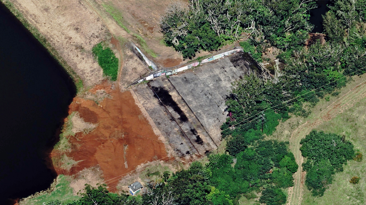
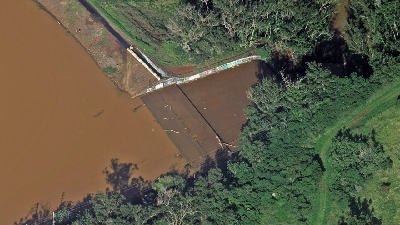
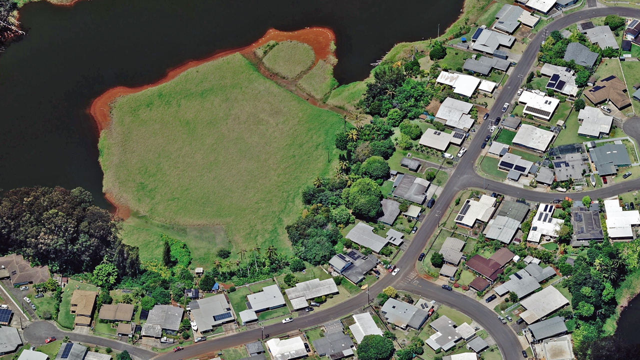
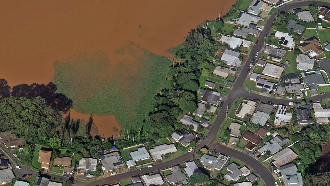
Heavy rainfall in late March caused rivers to overflow, leading to widespread flooding across parts of Hawaii and impacting homes, roads, and surrounding communities. Vexcel’s Gray Sky team monitored the event and, due to the extent of the damage, deployed a local crew and aircraft to collect high-resolution aerial imagery on March 26.
We have published 10cm ortho and oblique imagery focused on impacted properties across flooded regions in Waialua and Wahiawa on Oahu. The Gray Sky imagery shows widespread flooding across residential and commercial properties, with waterlines visible on buildings and sediment marking how far the water reached. Surrounding areas show debris piles and standing water, helping identify where properties and infrastructure have been impacted.
In addition, we have published multispectral imagery to help identify flood zones by highlighting moisture levels and water boundaries across affected areas.
This imagery collection helps insurers and government agencies quickly assess property-level damage, understand flood extent, and support recovery and rebuilding efforts.
Imagery is available in the Vexcel Platform and through select partner sites. Our thoughts go out to the communities impacted. If you need access or support, please reach out below.