
Gray Sky: Hurricane Isaias
All imagery and damage assessments now published from impacted areas in Florida, Alabama, and Mississippi.
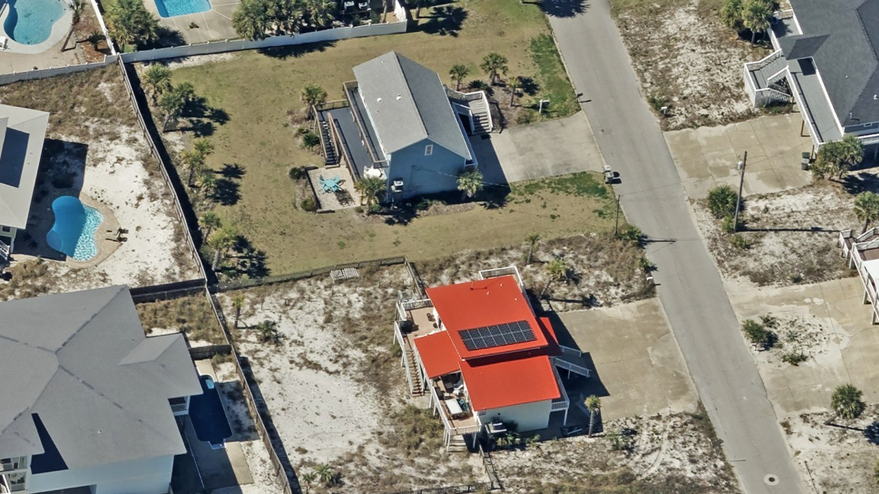
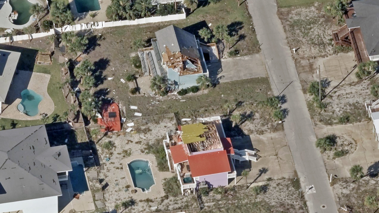
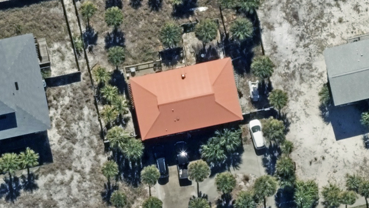
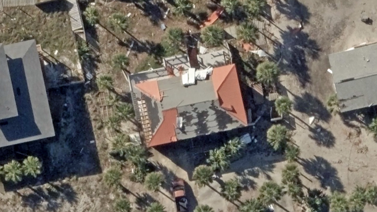
Overview
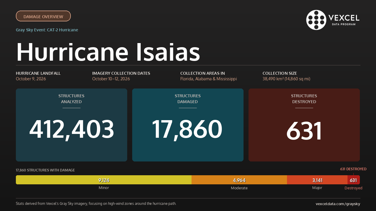
Hurricane Isaias made landfall near Destin, Florida, Friday evening as a Category 2 hurricane with sustained winds of 105 mph. The storm brought damaging winds, storm surge, and flooding to the northern Gulf Coast.
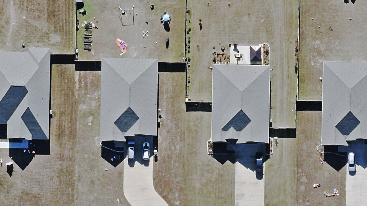
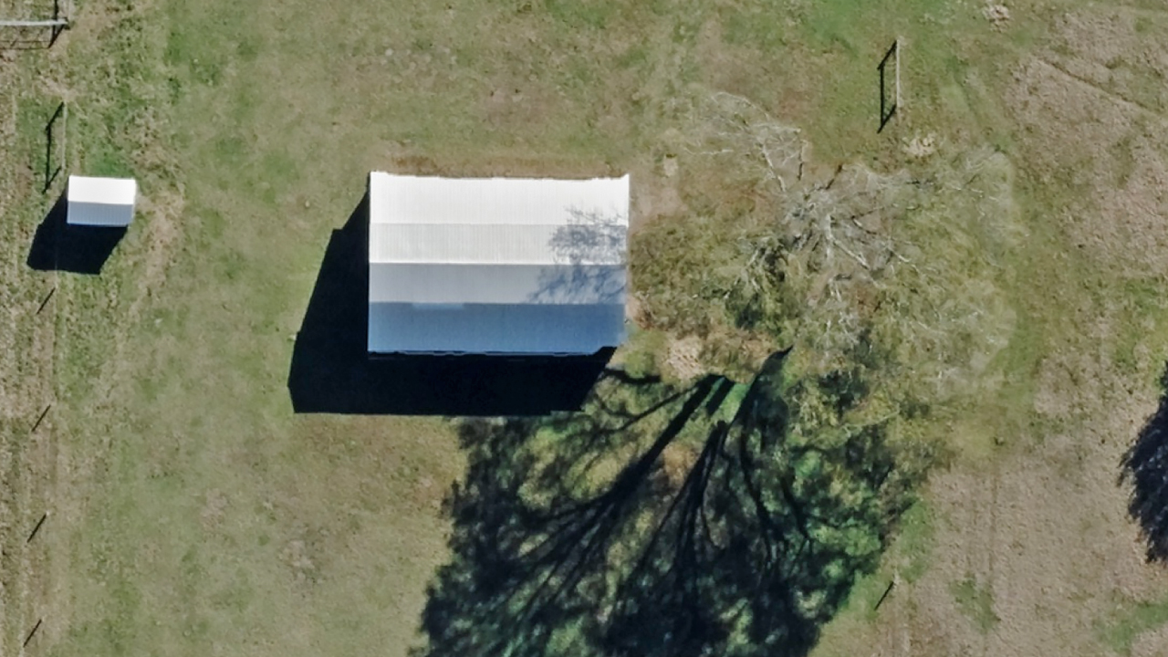
Vexcel activated seven aircraft over three days of post-hurricane aerial imagery collections. All Gray Sky imagery and property-level damage assessments are now published, covering 38,490 km² (14,860 sq mi) across Florida, Alabama, and Mississippi at 7.5cm–10cm resolution.
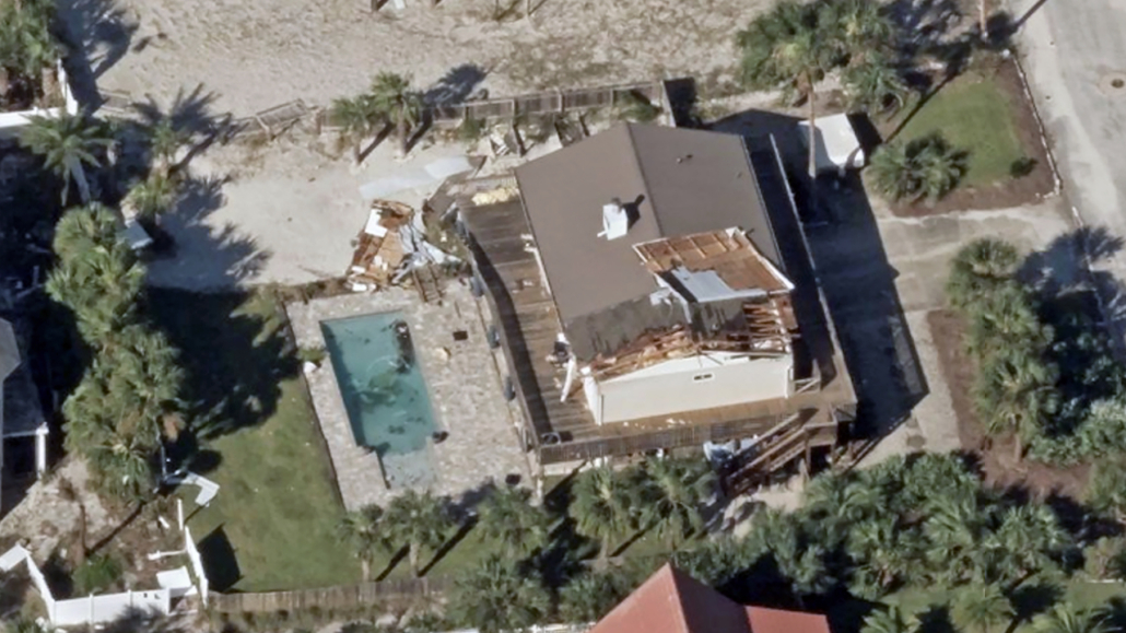
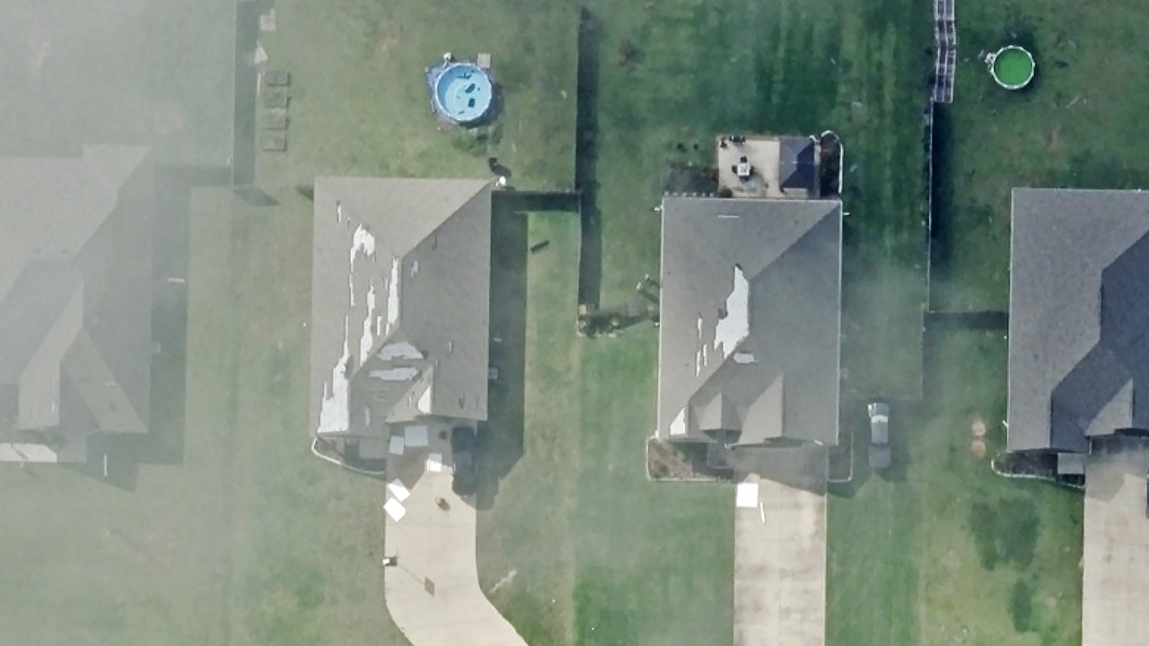
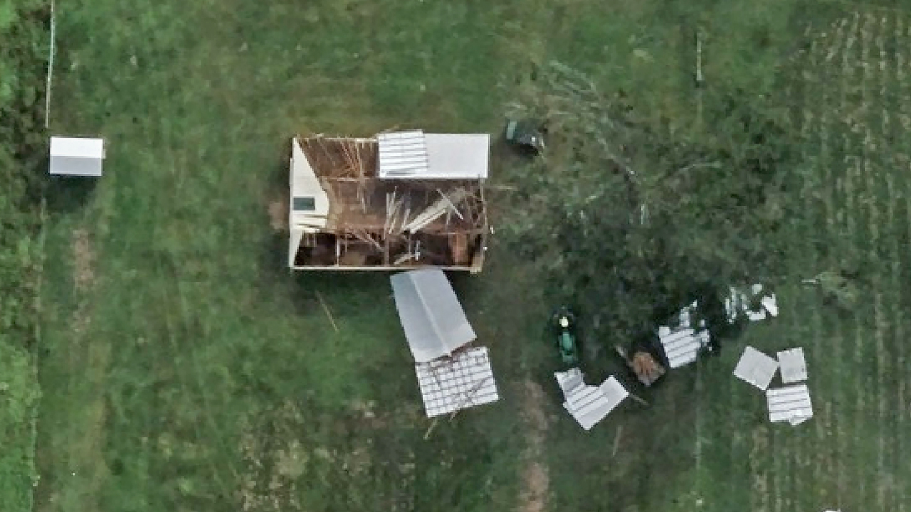
Our damage assessment analysis evaluated 412,403 buildings within the hurricane’s high-wind zones, identifying 17,860 with damage.
All imagery and damage assessments are available to support ongoing response and recovery efforts.
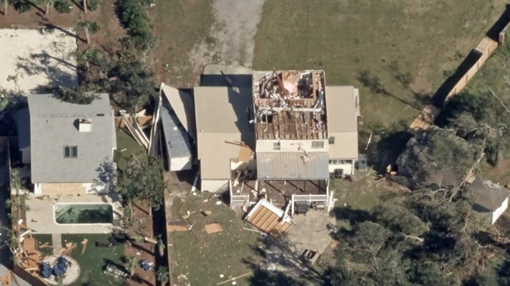
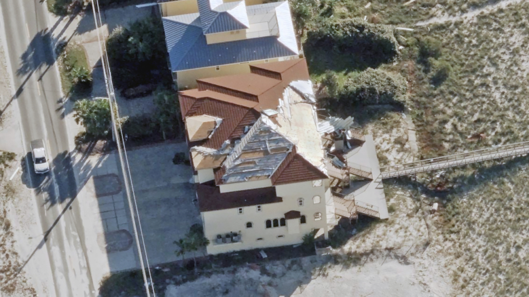
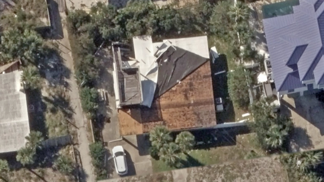
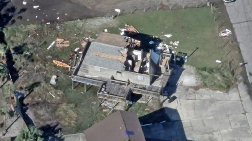
Wednesday, Oct. 14
All Imagery and Damage Assessments Published
Gray Sky operations are complete. All imagery and property-level damage assessments have been published and are available through the Vexcel Platform and select partner sites. Published Gray Sky imagery for Hurricane Isaias now totals about 38,490 km² (14,860 sq mi). Coverage runs nearly continuously along the Gulf Coast from Bay St. Louis, Mississippi, to Apalachicola, Florida, with a separate block around Tallahassee.
Cities in coverage:
Mississippi: Gulfport, Biloxi, Pascagoula, Ocean Springs, Pass Christian, Bay St. Louis
Alabama: Mobile, Daphne, Fairhope, Foley, Gulf Shores, Orange Beach, Bay Minette, Atmore
Florida: Pensacola, Fort Walton Beach, Destin, Navarre, Crestview, Niceville, Panama City, Panama City Beach, Port St. Joe, Apalachicola, Tallahassee
Tuesday, Oct. 13
More Imagery and Damage Assessments Published
We continued publishing new Gray Sky imagery (orthos and obliques) and property-level damage assessments throughout the night, adding nearly 25,000 km² (~9,600 sq mi) of coverage, including areas around Crestview, Gulf Shores, and Gulfport.
Additional imagery and damage assessments will roll out as they’re ready.
Monday, Oct. 12
More Imagery Published, Third Day of Collections
New Gray Sky imagery is available across the northern Gulf Coast, including areas around Destin, Navarre, Fort Walton Beach, Pensacola, Panama City, Tallahassee, Gulfport, and Biloxi.
Multiple aircraft continued collecting imagery Monday, focusing on remaining priority areas.
Imagery is available through the Vexcel Platform (Viewer, Studio, APIs, and Image Services) and select partner sites.
Sunday, Oct. 11
First Look Gray Sky Imagery Published
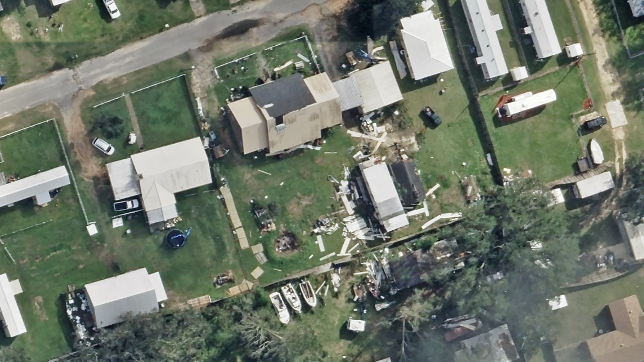
We have published the first post-hurricane aerial imagery covering areas around Pensacola, Florida; Gulfport, Mississippi; and Atmore, Alabama. The high-resolution aeriall imagery (7.5cm -10cm) provides a first look at damage to properties and infrastructure to support damage assessment and recovery efforts. Challenging weather conditions during Saturday’s collections resulted in some cloud cover.
Understanding Damage
Customers can access the imagery through the Vexcel Platform and select partner sites. Vexcel Intelligence also provides property-level damage assessments for every property within the Gray Sky collection areas. And, for the first time after a Gray Sky event, users can also use semantic search to find specific objects and conditions across Gray Sky imagery.
More Collections Today
Several aircraft are assigned to priority areas today, with additional collections planned as weather conditions allow. Our team will publish new imagery as quickly as possible following processing.
Saturday, Oct. 10
Initial Imagery Collected, More Flights Planned for Sunday
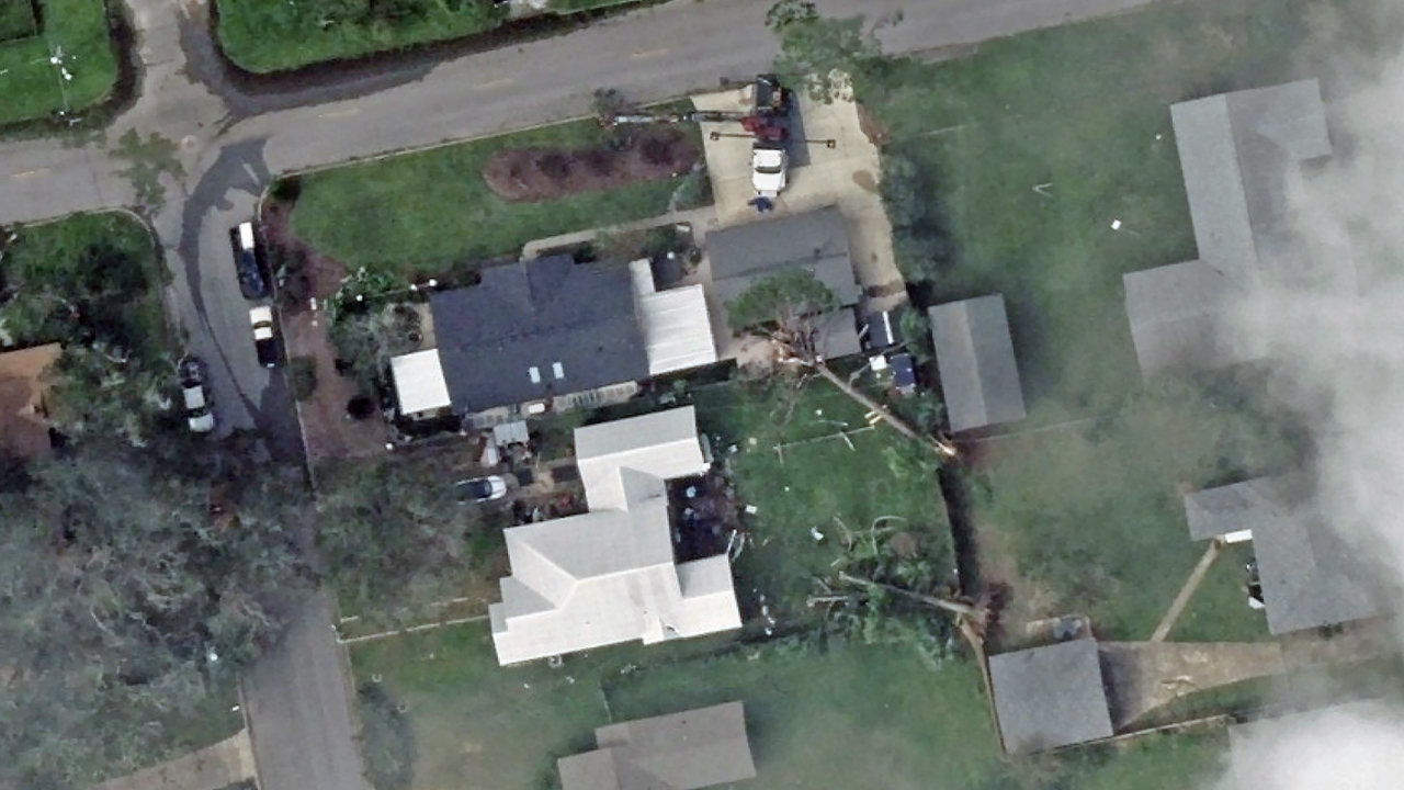
Aircraft completed initial first look collections of hurricane damage today, although afternoon cloud cover prevented some planned collections. Today’s imagery is on its way to processing.
Additional collections are planned for Sunday, with several aircraft assigned to priority areas including Pensacola and Miramar Beach, Florida, and Gulf Shores, Mobile, and Daphne, Alabama. Collection plans will continue to adjust based on weather conditions, areas of impact, and customer feedback.
Friday, Oct. 9
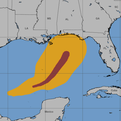
Aircraft positioned and collection areas planned
Our aircraft and crews are positioned to begin collecting high-resolution aerial imagery after Hurricane Isaias makes landfall and weather conditions allow. We’ve identified priority collection areas based on the latest storm models and will adjust plans as the storm develops and areas of impact become clearer.
Thursday, Oct. 8
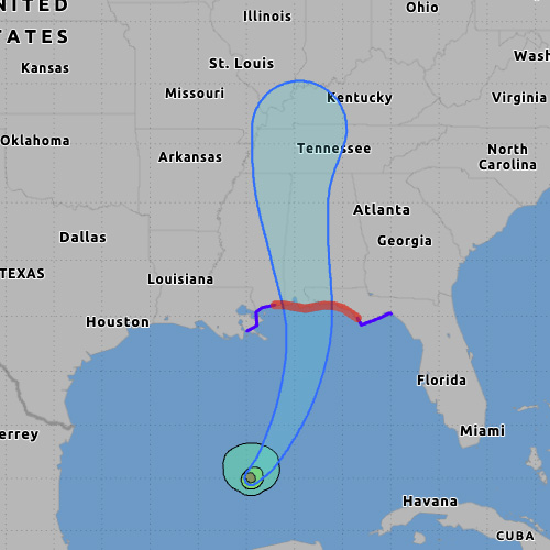
Monitoring storm path and planning activation
Our Gray Sky Team is actively monitoring Hurricane Isaias, which is forecast to make landfall along the northern Gulf Coast late Friday or early Saturday, potentially as a Category 2 hurricane.
We are activating and positioning aircraft in the region to capture high-resolution aerial imagery following the hurricane. Our team will continue to monitor the hurricane’s path and adjust collection plans based on weather conditions and areas of impact.
Request Access
Please let us know if you need imagery for your response and recovery. Fill out our contact form below.