Gray Sky: Highway 82 Fire, Georgia


Overview
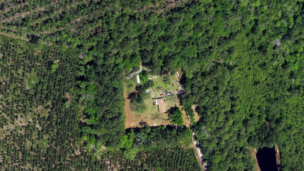
Our Gray Sky team has been monitoring the Highway 82 Fire in Brantley County, Georgia since it began on April 20, 2026. The fire spread quickly due to dry conditions, vegetation, and shifting winds, impacting areas along U.S. Highway 82 between Atkinson and Waynesville.
Our flight crew first activated to collect imagery on April 25. On April 30, the team completed a second collection, capturing areas within the fire zone for a second time to document fire growth and change. We will continue to monitor the fire. Our thoughts are with the emergency teams and communities affected.

May 1, 2026
Damage Assessments Published
We’ve rolled up the damage assessment from both Gray Sky collections of the Highway 82 Fire. The results show an increase in burned buildings since our first collection. A total of 2,556 buildings were identified in our imagery, with 140 marked as burned.
These updated stats nearly double the damage identified in the first collection (72 burned buildings). Property-level damage assessments for each property in the Gray Sky collections are also available in the Vexcel Platform.
April 30, 2026
More Imagery Collected & Published
The Highway 82 Fire expanded since our last collection, burning more buildings and properties. Our Gray Sky team activated again and completed a second imagery capture covering 131 km² (50 sq mi) across Brantley County, including areas between Atkinson and Waynesville. This high-resolution imagery (ortho, oblique, and multispectral) is now available in the Vexcel Platform and on select partner sites.
April 26, 2026
Imagery & Damage Assessments Published
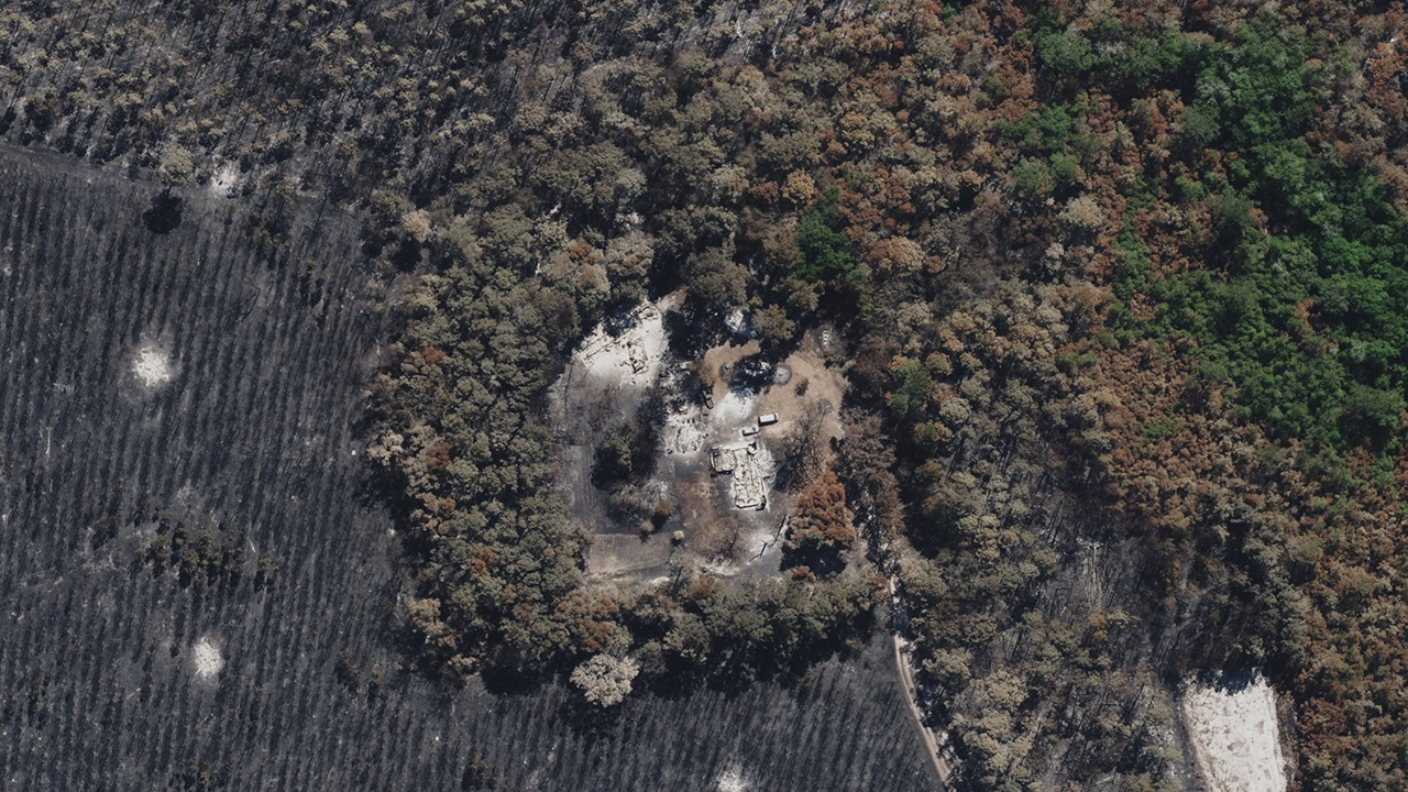
As of this morning, high-resolution ortho, oblique, and multispectral imagery at 7.5cm resolution has been published in the Vexcel Platform. The imagery shows burn damage across vegetation and structures along the Highway 82 corridor between Atkinson and Waynesville.
Multispectral imagery highlights burn patterns and affected vegetation (see above). Red tones represent healthy, living vegetation, while gray and black areas indicate burned ground and vegetation loss, helping show the extent and severity of the fire.
When paired with previous Vexcel imagery collections, this imagery supports timestamped before-and-after comparisons. In addition, a full damage overview and property-level assessment is also available.
April 25, 2026
Highway 82 Fire Imagery Collected
On Saturday, our Gray Sky team activated and collected high-resolution aerial imagery over Brantley County, Georgia. The collection focused on areas along U.S. Highway 82 between Atkinson and Waynesville, targeting locations with visible structural damage. This Gray Sky collection is focused on impacted structures and does not cover the entire firezone.