Gray Sky: Tornadoes in Illinois and Indiana

Post-Disaster Imagery Now Available
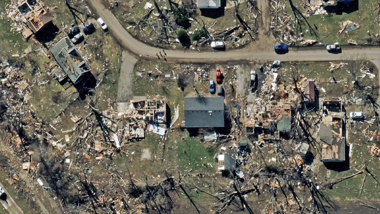
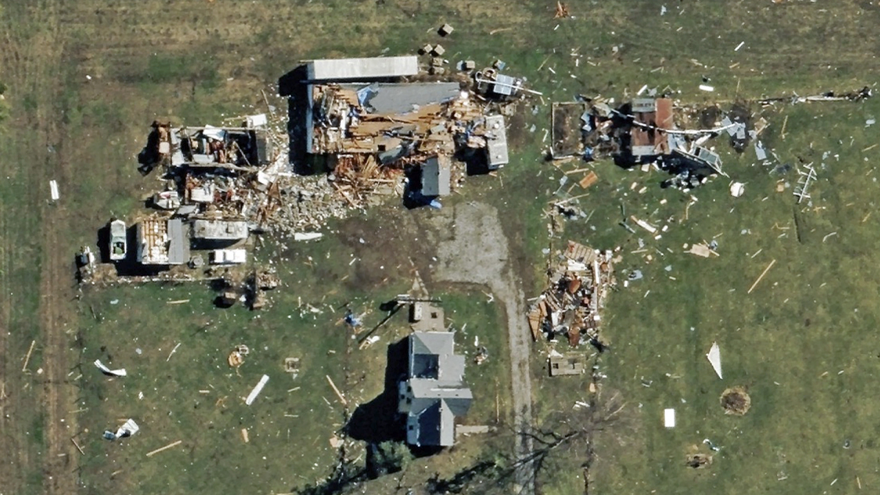
Severe storms earlier this week produced tornado activity across parts of Illinois and Indiana, damaging homes, commercial buildings, and infrastructure along the storm paths.
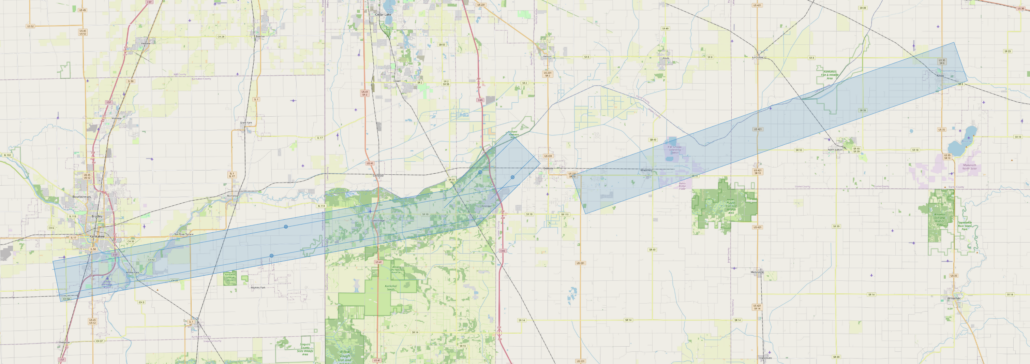
Once weather permitted, Vexcel’s Gray Sky team deployed aircraft to capture 10cm ortho and multispectral imagery across two tornado-damaged corridors: the first from Kankakee, Illinois to De Motte, Indiana, and the second from Wheatfield to Knox, Indiana.
In less than 12 hours from wheels down, the imagery was processed and is now available in the Vexcel Platform (Vexcel Viewer and Vexcel APIs) and on select partner sites.
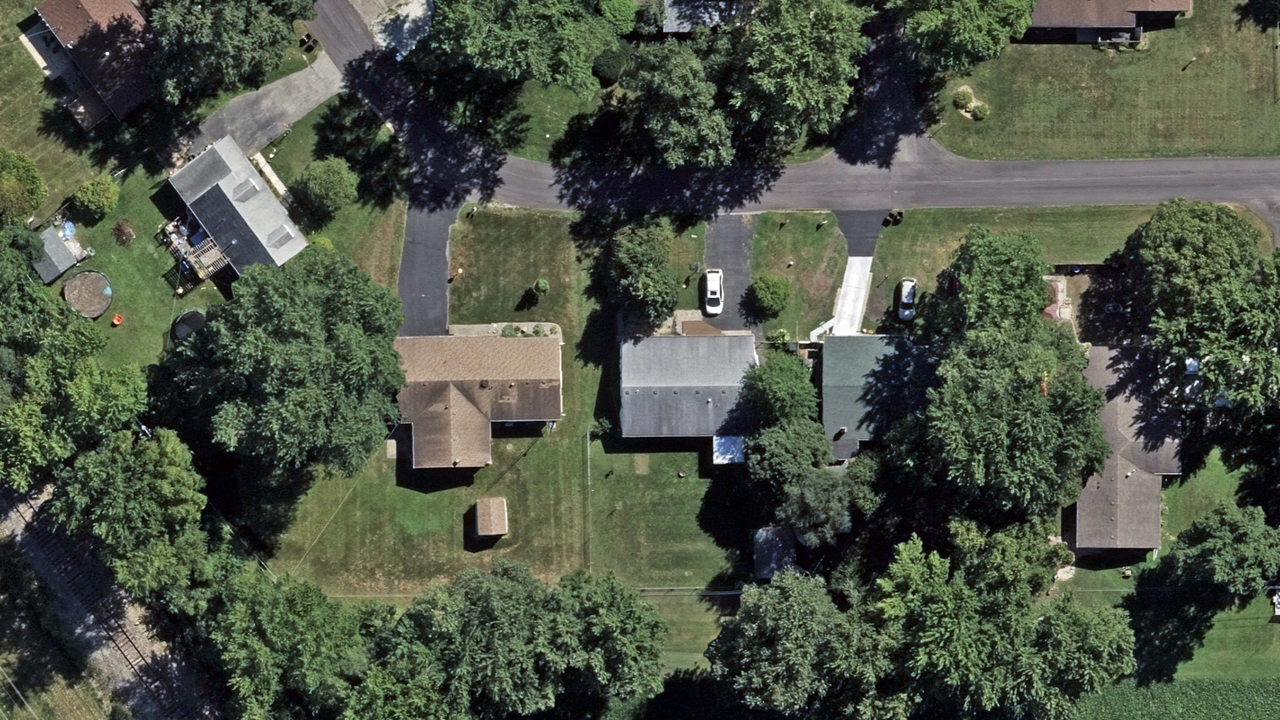
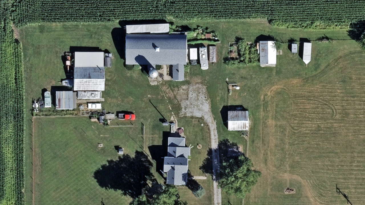
Customers can view damaged properties, compare timestamped before and after imagery, and review AI-derived damage assessments across both collection areas. This imagery helps insurers, emergency managers, and government agencies quickly understand the extent of tornado damage and prioritize recovery and re-building efforts. See a few sample images below.


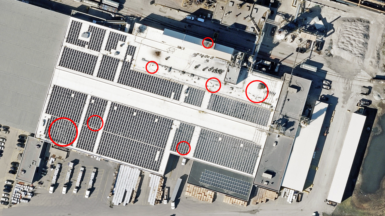
Hail Damage Also Observed
This storm system also produced large hail in the Kankakee area. In several locations, our Gray Sky imagery shows clear signs of hail impacts on rooftops and commercial buildings. For example, the image below highlights hail damage visible on a commercial building.