The Value of 3D Measurement – Tools Ready to Use
There’s a new set of 3D measurement tools now available to use in the Vexcel Viewer across our highly accurate imagery data, providing more robust ways to get further information beyond just an image. What can 3D tools do for you? How about taking your elevation and height calculations to a whole new level?
THE HOLY GRAIL OF MODERN MAP MAKING
Accurate 3D measurements are not easy to achieve from 2D images — from stereo vertical images and stereoplotters in the 1930’s to the advancement of computer vision support for dense point matching and triangulation in the early 2000’s, measuring the elevation and height of objects has been the holy grail of photography and aerial imagery since the beginning of aerial photography. Detailed elevation and height information created in digital surface models (DSM) is highly valued by end users, although it remains difficult for the average user to obtain and measure 3D points.
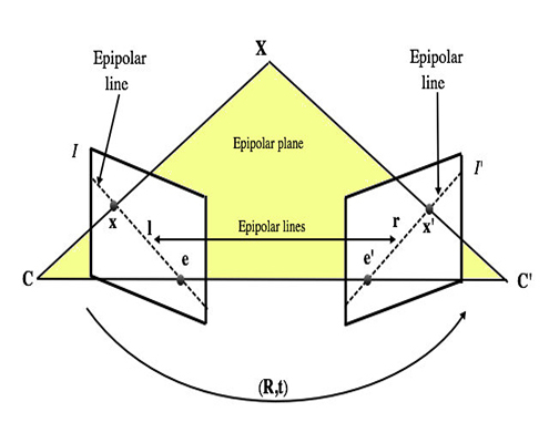
In similar fashion, oblique imagery has served up popular views since balloons and kites in the 1850’s, creating a more consumable view for the average person with its bird’s eye view. While it is easy to see the height of objects from this perspective, oblique images have been more challenging to obtain accurate measurements from, as it is difficult to obtain stereo images in the same plane and the nuances of the unique oblique image spaces. Many techniques have been developed over the years to approximate the heights objects in obliques images with the two most common being monoplotting, the use of simple right-angle triangle mathematics using a ground plane and a measuring a plumb line in the oblique image for the height which is the way that most oblique height software tools work. Another common approach is a photogrammetric triangulation calculation by selecting visible point or points in one image and positioning that point along the resulting epipolar line on the other image to triangulate these points.
Having been involved in developing and using these techniques over the past couple of decades, I have seen firsthand the frustration that users experience when these tools do not fit their conditions or the results returned are inaccurate.
THE VALUE OF ACCURATE AERIAL IMAGERY FROM VEXCEL
Accuracy drives better measurements, and in the case of frustrated users, the reason why Vexcel’s data provides such great value to an end user is by combining stereo imagery derived with easy-to-use oblique perspective imagery. Two big advantages of using Vexcel Data Program imagery in this regard? First, vertical and oblique images are collected using the award-winning UltraCam Osprey 4.1 sensor with its photogrammetric-quality optics, giving unparalleled positional accuracy. Second, UltraCam captured images are then exactly positioned using the UltraMap processing software combined with survey-grade ground control points. The end result is a precise alignment of the high-quality 3D digital surface model values to oblique imagery–effectively giving every pixel an absolute 3D value.
SHOWCASING 3D MEASUREMENTS
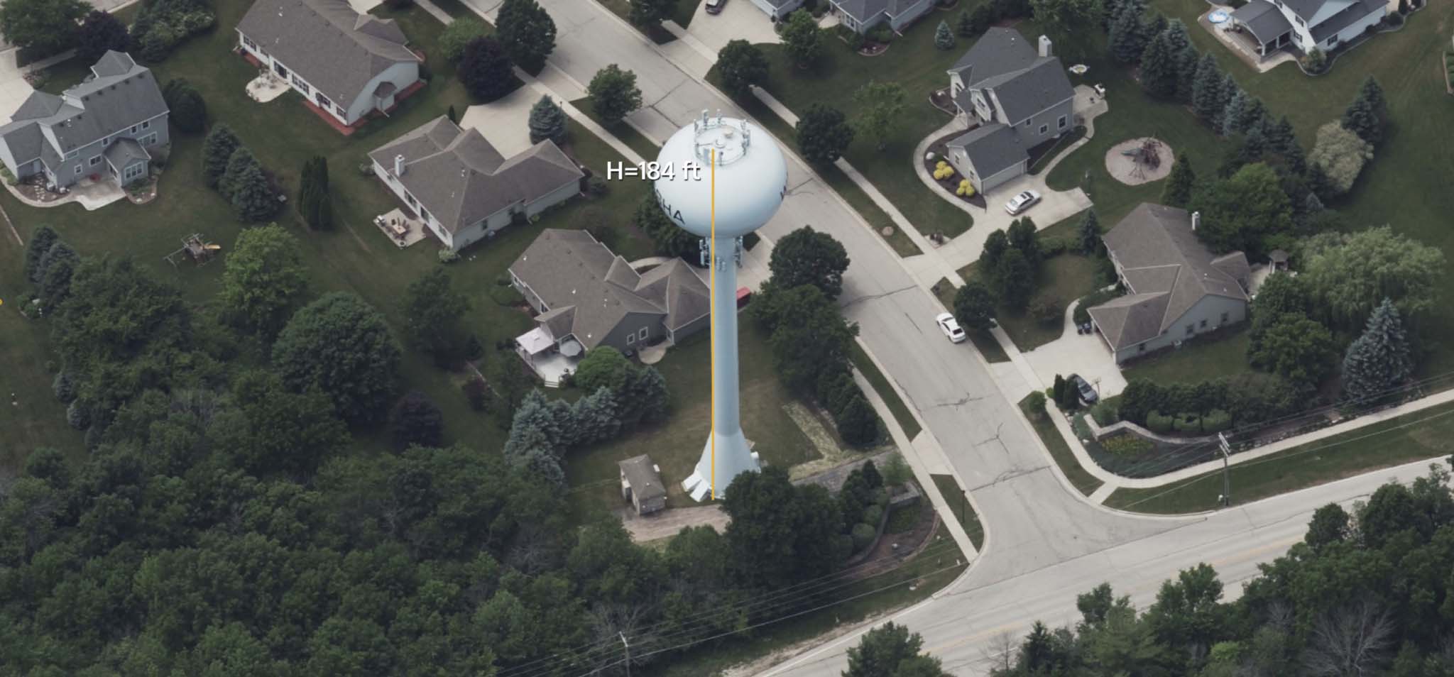
Taking advantage of this uniquely high-quality data, a new set of 3D measurement tools is now available as part of the Viewer which removes the need for plumb line to ground views of monoplotting, or the complex measurements and calculations required for epipolar triangulation. We’ve taken the complexity out and offered up simplicity and ease-of-use to help you get started right away. These tools are now included in the Viewer, enabling users to easily take real world 3D measurements of points, lines, and polygons. Some of the best benefits to our users include measuring slope and area of an embankment, lengths of ridgelines and fall-lines, and absolute heights of objects by simply selecting a few points in a single oblique image.
So let’s take this into the real world using the famously vandalized water tower on Alcatraz Island, which according to the National Park Service, is 94 feet high tall. But as seen in the first example below, it is very difficult to obtain an accurate height measurement using monoplotting due to the small overhang at the top of the tower and slight slant to the support superstructures. My result is 103 feet when using traditional monoplotting technique or a measurement error of about 14% higher than the reported height. When using Vexcel’s new hybrid 3D measurement point surface height tool, I quickly discovered that the ground under the tower has an absolute height of 95 feet and the edge of tower top is 190 feet for a relative height of 95 feet with an error of 1%. Additionally, we can measure that the tower center point is 7 feet higher than the edge which would be impossible to calculate using the monoplotting measurement methods and would require specialized photogrammetric tools and skills to perform the triangulation method.
Clearly, this is dramatically changing both the ease of use and measurement precision needed for real world applications including calculations of landscapes such as embankment slope and area; and as-built features such the height of towers or road grade.
Follow how easy it is to use the 3D line measurement tool to obtain the slope and road length of a steep section of 22nd Street in San Francisco using just two mouse clicks.
Users can also easily measure the area and perimeter of slopes such as the central lawn section at Jiffy Lube Live amphitheater in Bristow, Virginia.
GET STARTED USING 3D MEASUREMENT TOOLS TODAY
As these few examples show, there are many uses for getting started with 3D measurements today. And with Vexcel’s unique precise alignment of surface 3D values to oblique images, you can dramatically change how to perform site inspections, design field visits, and benefit from multiple applications. Whether for property review and appraisal to construction and civil engineering site visit use cases, there’s unlimited potential to apply these new features.
About The Author
Rob Carroll leads the Product Team at Vexcel, mapping the future of geospatial information through imagery content-as-a-service and new derived content. His career spans over three decades in the geospatial information industry where he has helped implement and bring new technologies to market such as web-mapping, digital oblique imagery, and multispectral analytics. Since joining Vexcel in 2018, he has had leadership roles in business development and product management for the Vexcel Data Program.


