Gray Sky: Burdoin, WA Fire
Update: Imagery Published
Friday, July 25, 2025
High-resolution aerial imagery from our Gray Sky response to the fire burning in Burdoin, WA, is now available on the Vexcel Platform and partner sites. This 10cm ortho and multispectral imagery focuses on the most severely damaged areas in Klickitat County along the Columbia River near Bingen and Lyle.
The fire started a week ago on July 18 and is currently only 13% contained with evacuations still in place. It currently has burned more than 11,000 acres, making it the largest wildfire in Washington currently. Our Gray Sky team worked around smoky conditions to capture this imagery.
Customers can now view and analyze the fire imagery to support response, recovery, and assessment efforts. We’ll continue to monitor the fire.
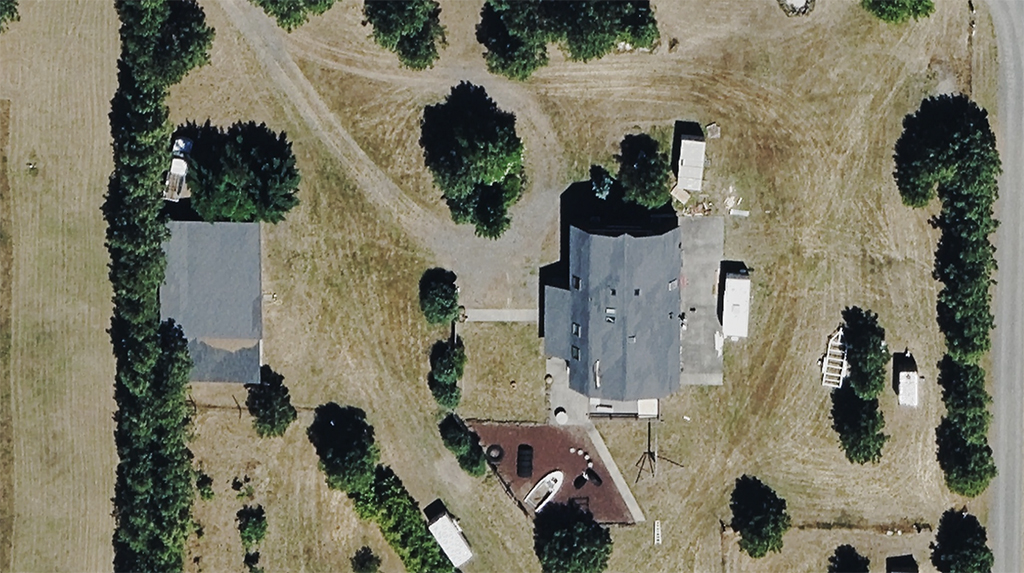
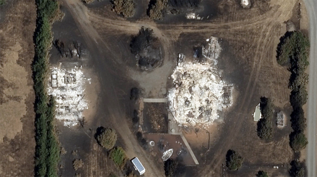
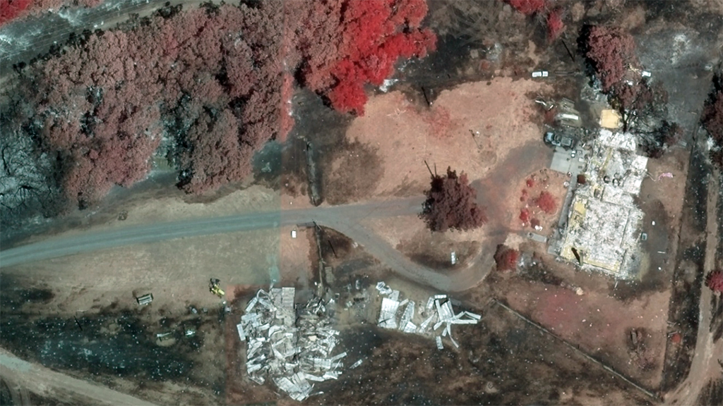
Below is a before-and-after ortho image of an impacted area. Above is a multispectral image of the same location that helps identify damaged buildings.


Imagery Collected
Thursday, July 24, 2025
Our Gray Sky Team activated today to collect high-resolution aerial imagery of damaged properties and structures in Burdoin, WA.
This collection supports damage assessment of the wildfire spreading in Klickitat County, which has impacted more than 11,000 acres and burned dozens of structures.
The fire in Burdoin is currently active and only 13% contained, driven by high winds and dry conditions. Our Gray Sky imagery focuses on the most heavily damaged buildings to support response and recovery.
This imagery is now on its way to processing and will be made available as soon as possible in the Vexcel Platform.
Stay tuned for updates and imagery from our Gray Sky response.
Request Access
Please let us know if you need imagery for your response and recovery. Please fill out our contact form below.


