This post originally appeared on GIC.org.
Together, Vexcel and GIC have fully aligned their strengths to streamline efforts and enhance innovation, while continuing to provide the high-quality aerial imagery and coverage that insurers trust.
This post originally appeared on GIC.org.
Together, Vexcel and GIC have fully aligned their strengths to streamline efforts and enhance innovation, while continuing to provide the high-quality aerial imagery and coverage that insurers trust.
Wildfires continue to rage across the western U.S. fueled by extreme heat and drought. More than 1.5 million acres have burned across 12 states, and nearly 80% of the nation’s firefighting resources are committed. The GIC is actively monitoring these wildfires and collaborating with its members and emergency agencies to see where hi-res imagery is needed and responding accordingly.
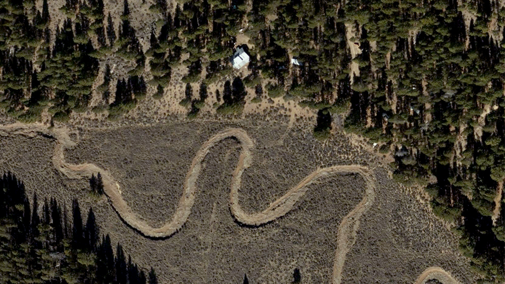
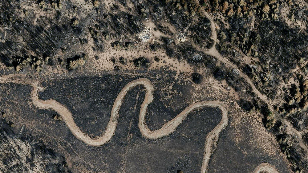
Yesterday our crew captured aerial imagery of populated areas and impacted buildings from the Bootleg Fire near Beatty, Oregon. What started as two fires—Log and Bootleg—has merged into one larger fire covering more than 413,000 acres. At least 160 homes—and hundreds of outbuildings and cars—have been burned in this disaster.
High-resolution ortho imagery from the Bootleg Fire in now published. Aerial imagery from our ongoing Blue Sky captures is also available in this area for before and after comparisons. Please let us know below if you need access to this imagery.


This wildfire imagery is now available in the GIC platforms and on partner sites. To request access to imagery from Bootleg Fire or other imagery, please fill out our contact form below.

 The GIC Collects Imagery of Tornado Damage in Pennsylvania and New Jersey