This post originally appeared on GIC.org.
Together, Vexcel and GIC have fully aligned their strengths to streamline efforts and enhance innovation, while continuing to provide the high-quality aerial imagery and coverage that insurers trust.
This post originally appeared on GIC.org.
Together, Vexcel and GIC have fully aligned their strengths to streamline efforts and enhance innovation, while continuing to provide the high-quality aerial imagery and coverage that insurers trust.
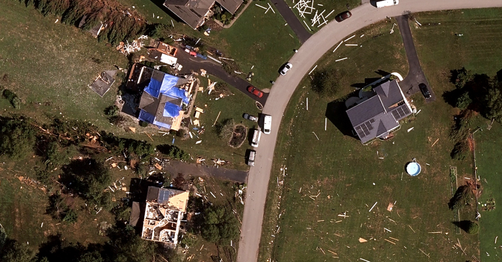
Hurricane Isaias made landfall near Ocean Isle Beach, North Carolina, at 11:10 PM EDT on August 3 as a Category 1 hurricane, and accelerated up the east coast of the United States as a strong tropical storm. Damage was reported at the area of landfall from high winds, coastal storm surge flooding, and several fires destroyed residential homes. As the storm continued up the east coast, a significant outbreak of damaging tornadoes impacted areas numerous areas.

Coordinating with our members, GIC concentrated imagery collection over the following areas:
• North Myrtle Beach, SC-Sunset Beach, NC
• Norfolk, VA
• Middletown, DE
• Suffolk, VA
• Strathmere-Marmora-Ocean City, NJ
• Hampton-Newport News, VA
• Bristol, CT
• Bridgeport, CT
• Hamden, CT
• Hartford-East Hartford, CT
• Milford, CT
• New Haven, CT
Following clearing of weather for conditions safe for the operation of aircraft, imagery was collected on 05-Aug-2020 and 06-Aug-2020 and made available to GIC members within 24 hours of collection. Images were collected with Eagle and Condor cameras with 5-15cm resolution.
 Geospatial Insurance Consortium
 Geospatial Insurance ConsortiumGIC Collects Wildfire Imagery Across The Western U.S.