This post originally appeared on GIC.org.
Together, Vexcel and GIC have fully aligned their strengths to streamline efforts and enhance innovation, while continuing to provide the high-quality aerial imagery and coverage that insurers trust.
This post originally appeared on GIC.org.
Together, Vexcel and GIC have fully aligned their strengths to streamline efforts and enhance innovation, while continuing to provide the high-quality aerial imagery and coverage that insurers trust.
Our multi-day, wide-scale aerial imagery collection will cover nearly 20% of Florida in the aftermath of Hurricane Milton and corresponding tornadoes. The collection includes high-resolution ortho and multispectral imagery in all areas, with oblique imagery available in select locations.
Every property in our Milton Gray Sky collection will feature a full damage assessment, along with before imagery for comparison to assess the storm’s widespread impact.
If you need access to imagery for your recovery and rebuilding efforts, please contact us.
Sunday, October 13
Lots of high-resolution aerial imagery and damage assessments continue to roll out on the Vexcel Platform and select partner sites. Our Gray Sky team remains dedicated to supporting customers, partners, and state and emergency agencies.
Sunday’s Aerial Collections
Aircraft crews were up early Sunday and had a few hours of aerial collection before weather conditions impacted flight operations. We will extend our multi-day, wide-scale collection following the aftermath of Hurricane Milton.
Saturday, October 12
As we continue our multi-day collection across areas of Florida hit by Hurricane Milton, we’re rolling out more published imagery day-by-day. The latest areas published to our Viewer platform and available via select partners include: St. Petersburg, Largo, Tampa, Siesta Key, Longboat Key, Anna Maria Island, Sarasota, Clearwater, and Homosassa Springs. Many of these areas include high-resolution oblique images as well. View additional imagery in the gallery below.
Friday, October 11
More high-resolution aerial imagery is now available in select areas impacted by Hurricane Milton. You can compare before and after images and soon see full property damage reports. Here are some before-after images from St. Petersburg and Palmetto, Florida.
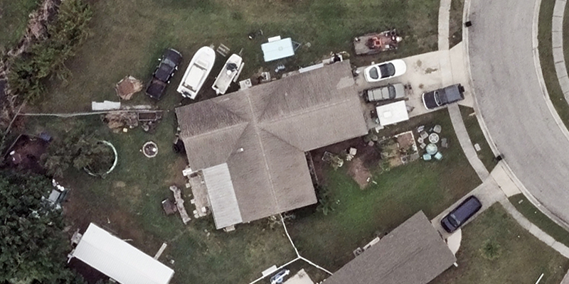
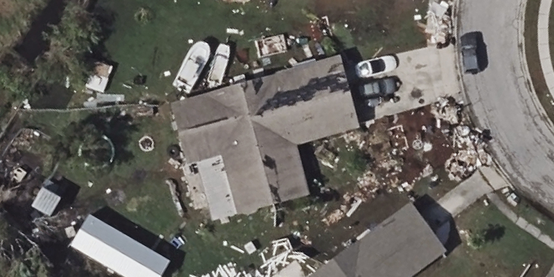
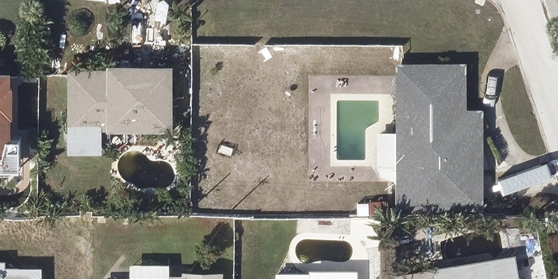
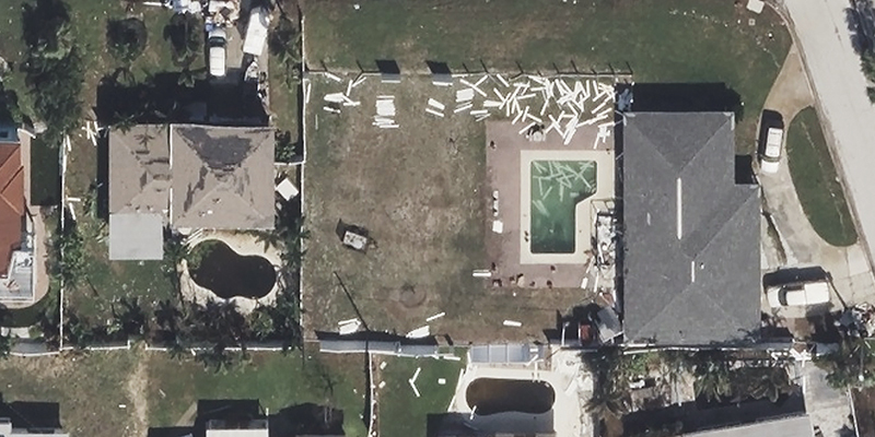
Friday, October 11
Imagery is now rolling out from our Day 1 collections for Sarasota, Spring Hill, Fort Myers, St. Pete, Bradenton, and Naples. This 10 cm ortho and multispectral imagery is available in the Vexcel Platform and on select partner sites. We’ll post sample imagery on this page. We also have before and after comparisons.
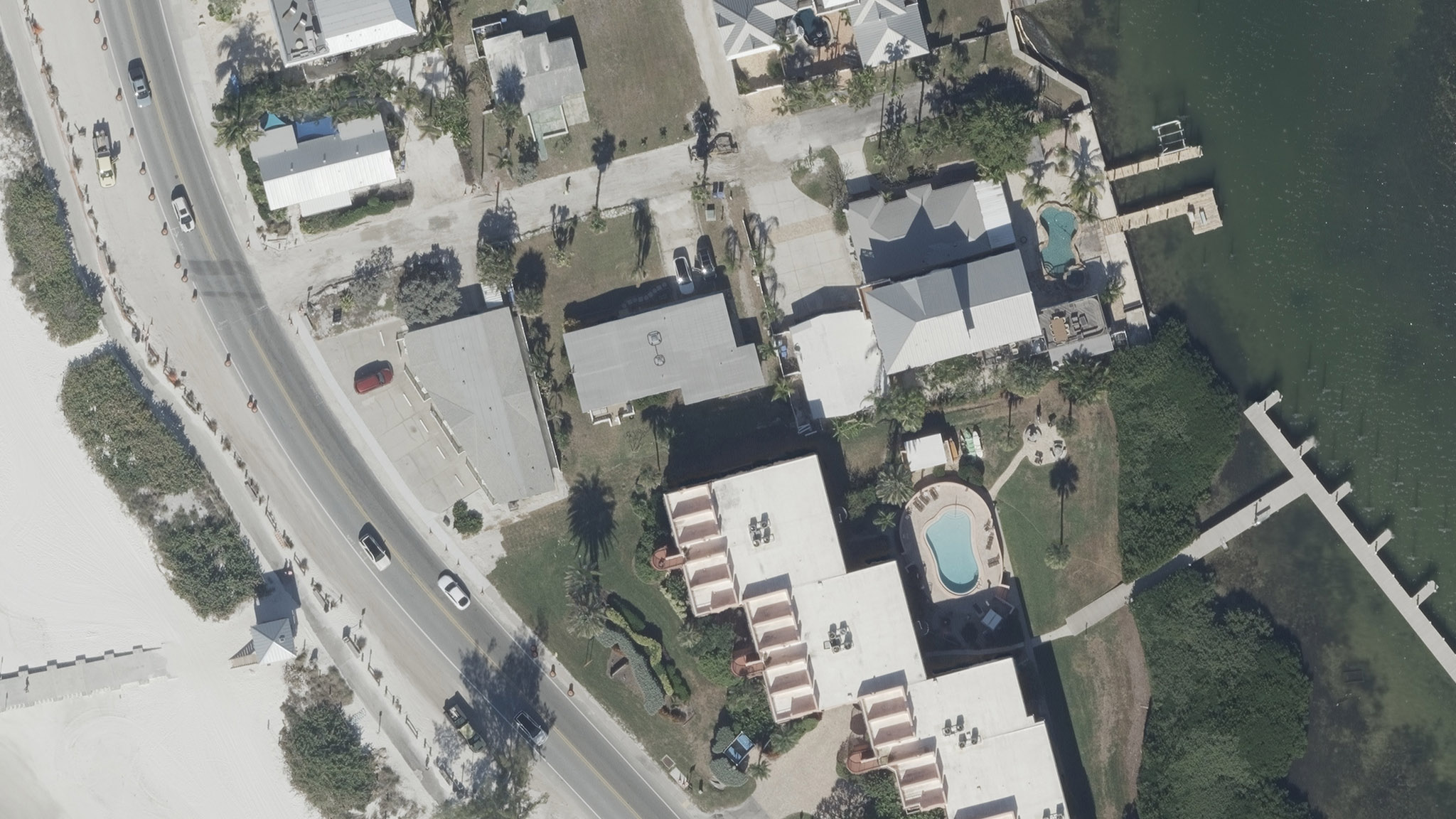
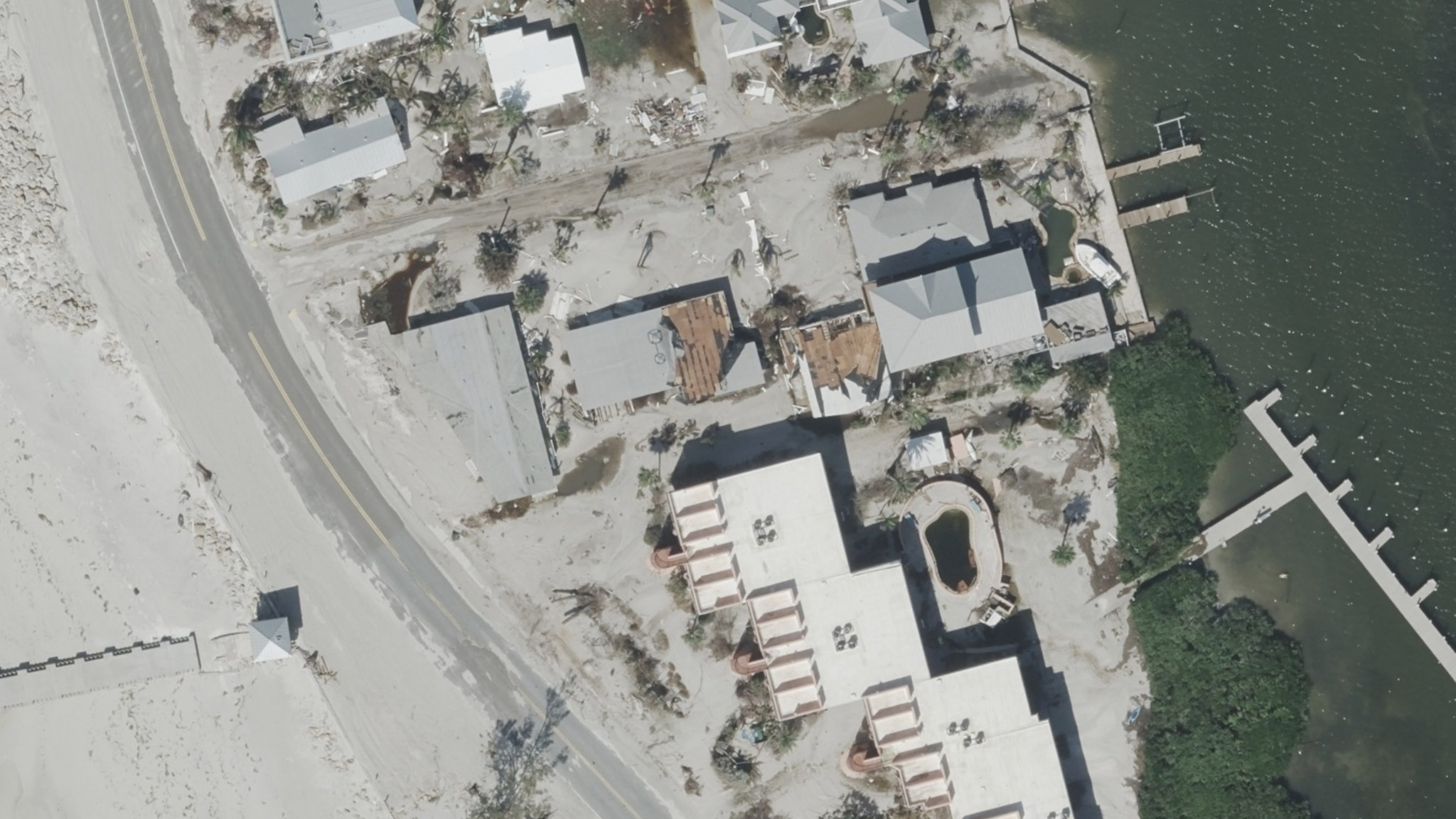
More Areas Coming: Friday’s Collection
Our wide-scale collection with several aircraft continues, and imagery has already been collected throughout the morning in Florida. Weather remains a challenge, and our team is adjusting or switching to other collection areas as needed based on clouds and winds. We are capturing ortho and multispectral imagery in all areas, with oblique imagery in select locations. Again, this will be a multi-day collection. And we continue to work closely with customer and partners as well as state and emergency agencies to support recovery efforts.
Thursday, October 10
Hurricane Milton has moved through Florida, and earlier today our Gray Sky team refined its lists of collection areas based on the storm’s path as well as related tornado activity. Much of the state has been under high winds and cloudy weather bands today, making it difficult to fly and attempt to collect imagery.
FIRST LOOKS
However, during a few weather windows, we successfully deployed aircraft to attempt to collect First Looks in areas around Sarasota, Bradenton, and St. Pete. The imagery will be transported to our processing center and published as soon as possible.
BIGGER COLLECTION PLANNED FOR FRiDAY
Weather looks better for imagery collection tomorrow. We will deploy multiple aircraft for our wide-scale collection across the western coast and central Florida. Flight crews will move into locations as weather allows, collecting ortho and multispectral imagery in all areas and oblique imagery in select areas. We are collaborating with state and emergency agencies on our collection efforts. The damage area is massive, and this will be a multi-day collection.
Wednesday, October 9
Our Gray Sky team is fully activated and closely monitoring Hurricane Milton as it moves toward the western coast of Florida. Our aircraft are positioned and ready to collect imagery.
Based on feedback from members, partners, emergency managers, as well as the latest spaghetti models, we have created an initial list of collection areas. However, this list may change as the storm progresses. This will be a wide-scale collection with several aircraft on assignment. We will focus on populated areas with property damage from hurricane winds. Our thoughts go out to all the communities and responders in the path of this storm. Let us know how we can support and stay tuned on updates.
Monday, October 7
Our Gray Sky team is in full activation, closely monitoring Hurricane Milton as it approaches central Florida. We are positioning several aircraft in preparation for collecting imagery and continue to track the storm’s path to adjust our collection plans as needed. Based on current models and the storm’s Category 5 rating, we expect this to be another large-scale collection effort.
We will continue to provide updates as Hurricane Milton moves closer to Florida.
Please let us know if you need imagery for your response and recovery. You can learn more about how the GIC and Vexcel Data Program captures Gray Sky events here. Please fill out our contact form below.

 Insurance Trailblazer Orion180 Enhances Underwriting and Claims Operations with...