This post originally appeared on GIC.org.
Together, Vexcel and GIC have fully aligned their strengths to streamline efforts and enhance innovation, while continuing to provide the high-quality aerial imagery and coverage that insurers trust.
This post originally appeared on GIC.org.
Together, Vexcel and GIC have fully aligned their strengths to streamline efforts and enhance innovation, while continuing to provide the high-quality aerial imagery and coverage that insurers trust.
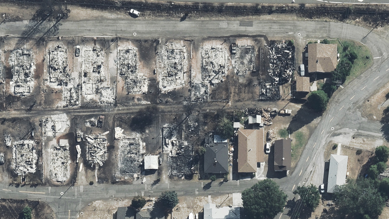
Our Gray Sky team has been monitoring the growth and spread of several wildfires across the Western United States. This week we collected both the Mill & McKinney Fires in California. Our planes were able to safely get into the air and capture high-resolution ortho and multispectral imagery of the property damage from above.
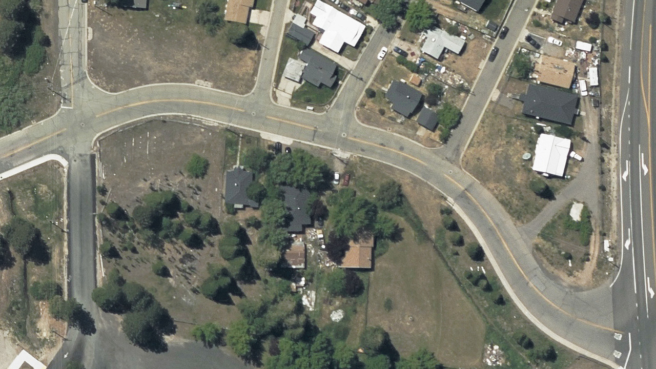
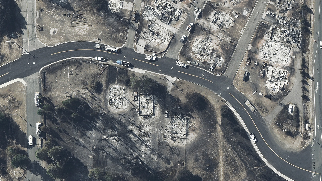
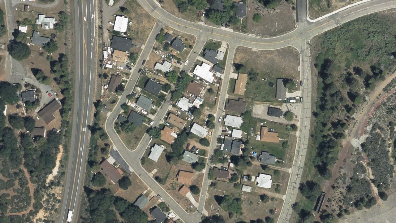
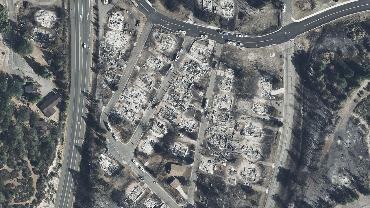
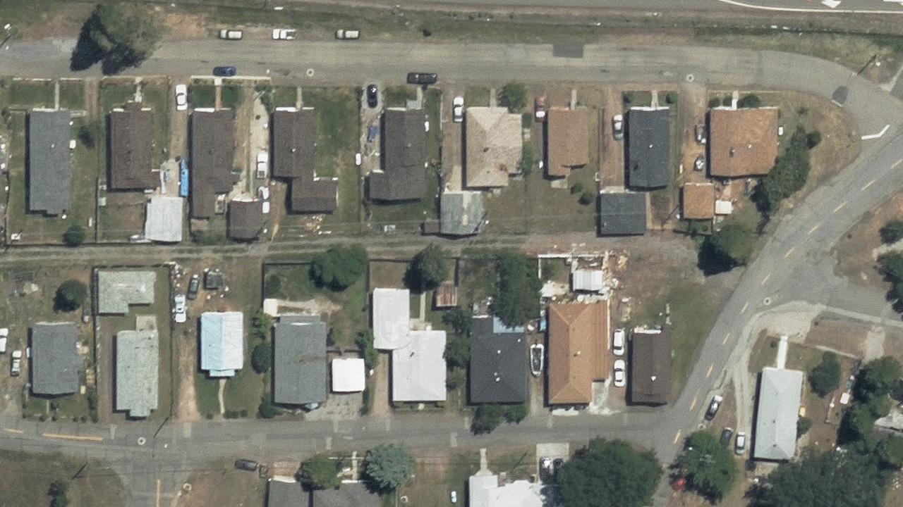
The Mill Fire started burning on September 2, 2022, in Weed, California. The fast moving flames destroyed entire neighborhoods and warehouses, leaving a gutted landscape pockmarked with empty foundations. The wildfire grew so intensely that residents living in the Lincoln Heights area had little time to react.
In the imagery gallery below, you can see several before/after comparisons of what once stood in these communities, including additional imagery of the fire’s destruction. Having our Blue Sky imagery to compare against helps our insurance members do a pre- and post-event analysis of the fire’s devastating effects.
To request full access to all the aerial imagery from the Mill or McKinney Fires, please fill out our contact form below.

 GIC’s Operations Partner, Vexcel, Announces New Partnership with Artu...