This post originally appeared on GIC.org.
Together, Vexcel and GIC have fully aligned their strengths to streamline efforts and enhance innovation, while continuing to provide the high-quality aerial imagery and coverage that insurers trust.
This post originally appeared on GIC.org.
Together, Vexcel and GIC have fully aligned their strengths to streamline efforts and enhance innovation, while continuing to provide the high-quality aerial imagery and coverage that insurers trust.
New Mexico wildfire season has ignited intensely with more acres burned this year than in the past eight years alone. Drought conditions and high winds are fueling the flames as they race across the landscape. Across the San Miguel and Mora Counties in New Mexico, firefighters have been battling raging wildfires that have destroyed at least 150 homes and damaged close to 300 residential and outbuildings.
With precipitation being at a near all-time low for the month of April, little relief from the skies is in sight. The Hermits Peak fire in the Calf Canyon area is over 60K acres, making it one of the top 15 largest fires on record for New Mexico. And wind conditions are expected to worsen before these fires are fully contained. Local residents are hopeful the monsoon season begins early to help combat the extremely volatile drought conditions.
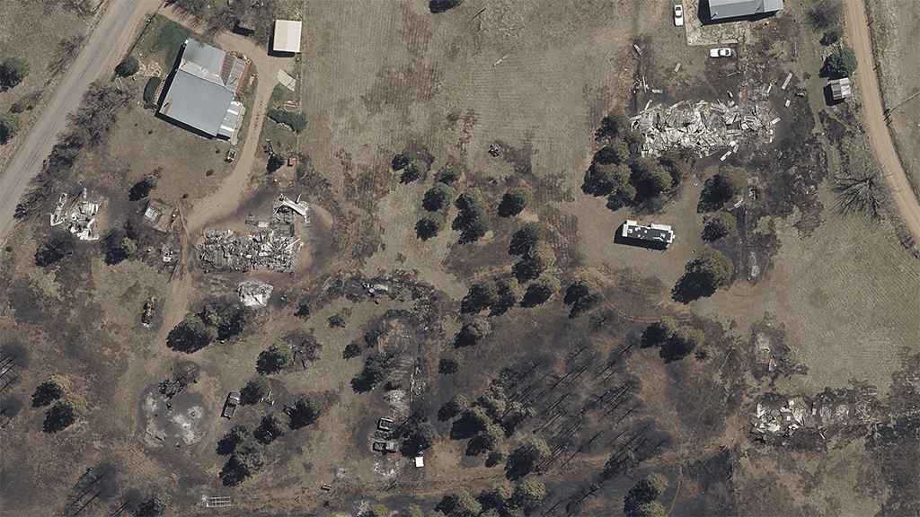
Our Gray Sky team was able to activate on Thursday, April 28, to begin collecting the initial damage and destruction from these wildfires. Imagery is now available for GIC members to begin proactively reaching out to impacted customers.
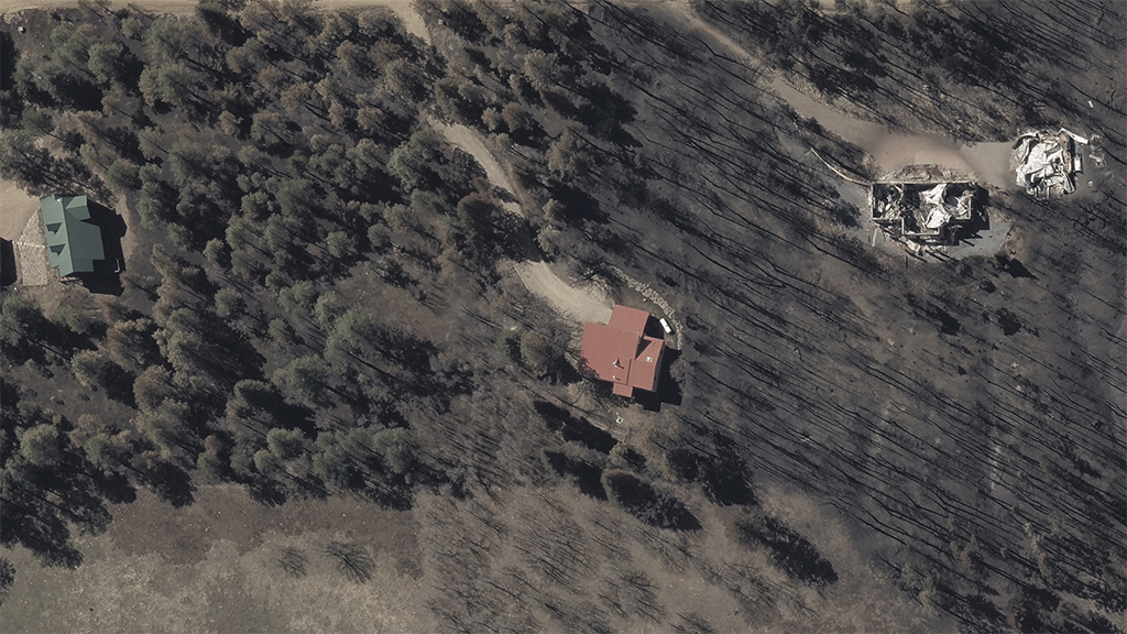
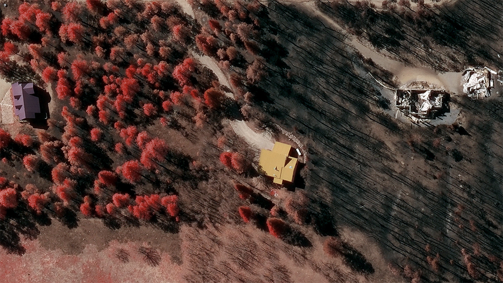
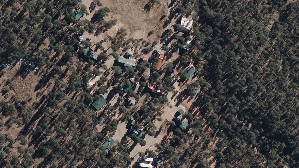
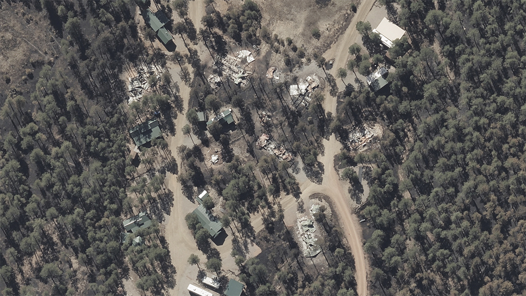
In the gallery collection below, you’ll see some before/after comparisons, multiple homes affected, and an example of why our Multispectral imagery helps insurers understand a whole new level of the fire’s impact.
Take a look at the Gray Sky image on the left, showcasing what a member can see when pulling up the location for an impacted customer. Now look at that same location with the color-infrared (CIR) layer turned on in Viewer. You can clearly distinguish between healthy vegetation (darker red) and where the fire line is on the properties. It’s another level of visualization, helping our members make more informed decisions in pressure filled situations.

You can learn more about how the GIC captures Gray Sky events here. No one captures more disasters than the GIC. To request access to imagery from New Mexico Wildfires or other imagery, please fill out our contact form below.

 Gray Sky Event: Tornado Damage in Andover, Kansas