This post originally appeared on GIC.org.
Together, Vexcel and GIC have fully aligned their strengths to streamline efforts and enhance innovation, while continuing to provide the high-quality aerial imagery and coverage that insurers trust.
This post originally appeared on GIC.org.
Together, Vexcel and GIC have fully aligned their strengths to streamline efforts and enhance innovation, while continuing to provide the high-quality aerial imagery and coverage that insurers trust.
Dry weather and furious winds are creating the perfect storm for potential wildfires. A wildfire ignited Tuesday, April 12, in New Mexico and spread to over 5,000 acres rapidly with winds of 50 to 60 miles per hour and wind gusts of 70 mph. Hundreds of homes were evacuated as fire crews worked diligently to contain the spread. Besides residential structures, garages, sheds and outbuildings were also at risk.
Current containment for the McBride fire is at 0% with over 150 structures lost and mandatory evacuations for an estimated 4,000 people. Our Gray Sky team was able to collect the initial damage from this fire to help our members begin supporting their impacted customers. Wildfires are notoriously difficult to collect with smokey air challenges and rapidly changing fire patterns. The imagery below is just a small peek into what we’ve been able to capture, process, and deliver to our customers within 24 hours of collection.
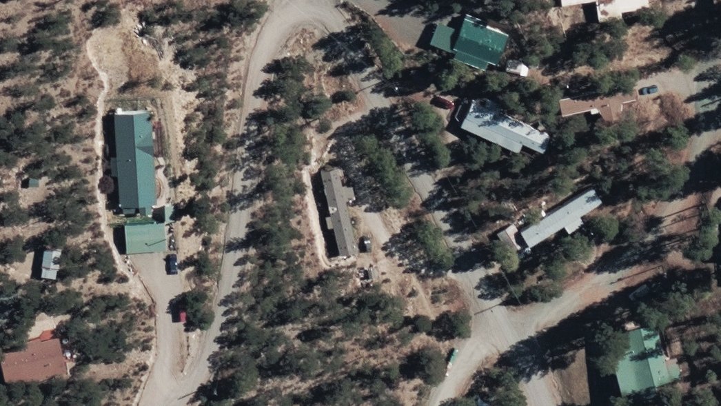
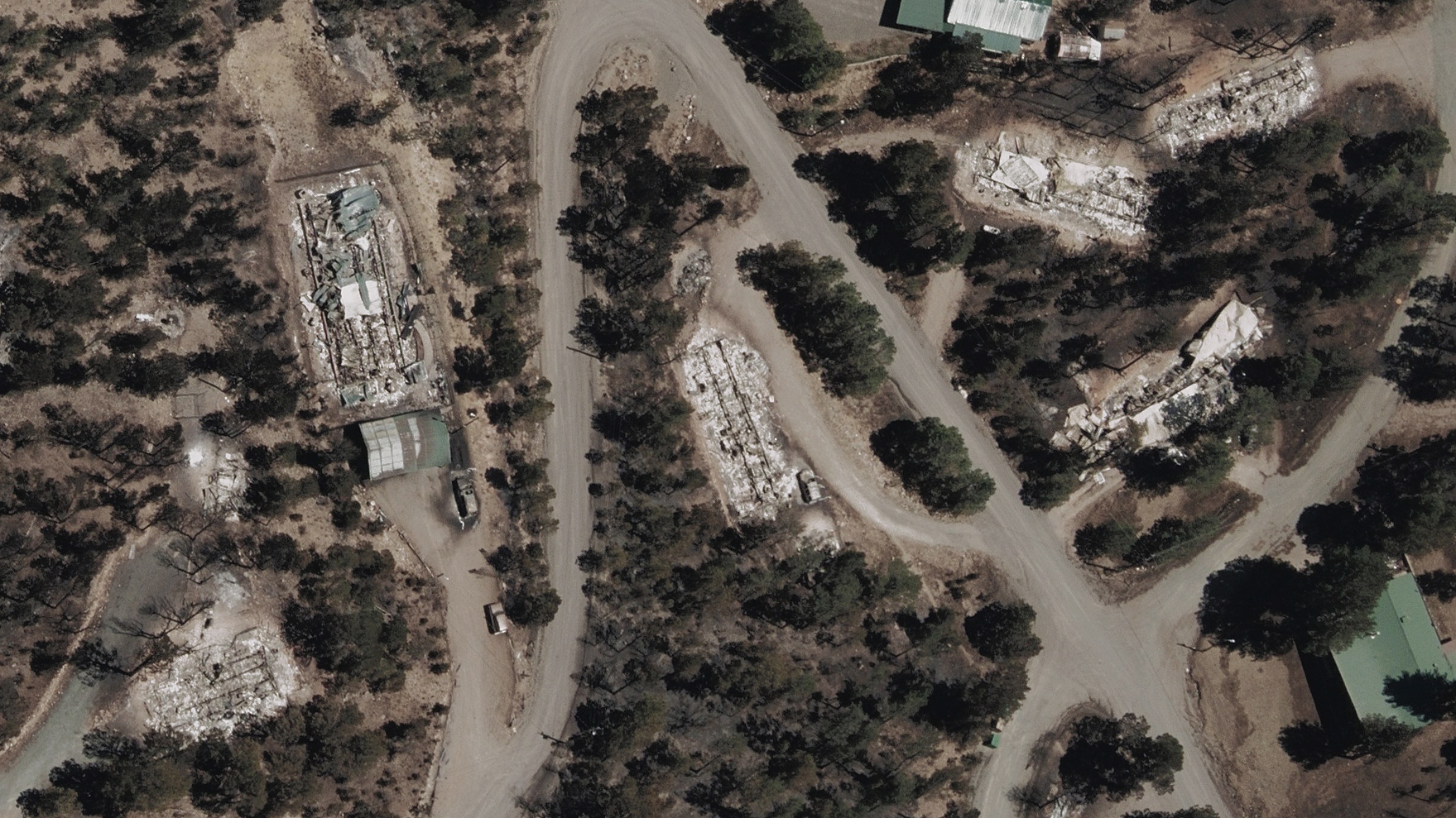
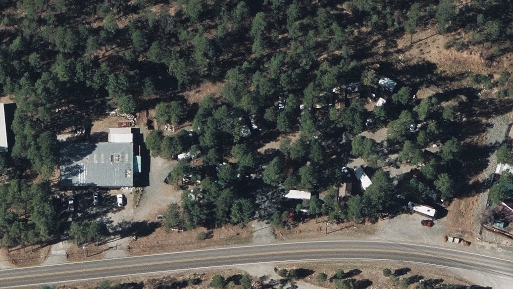
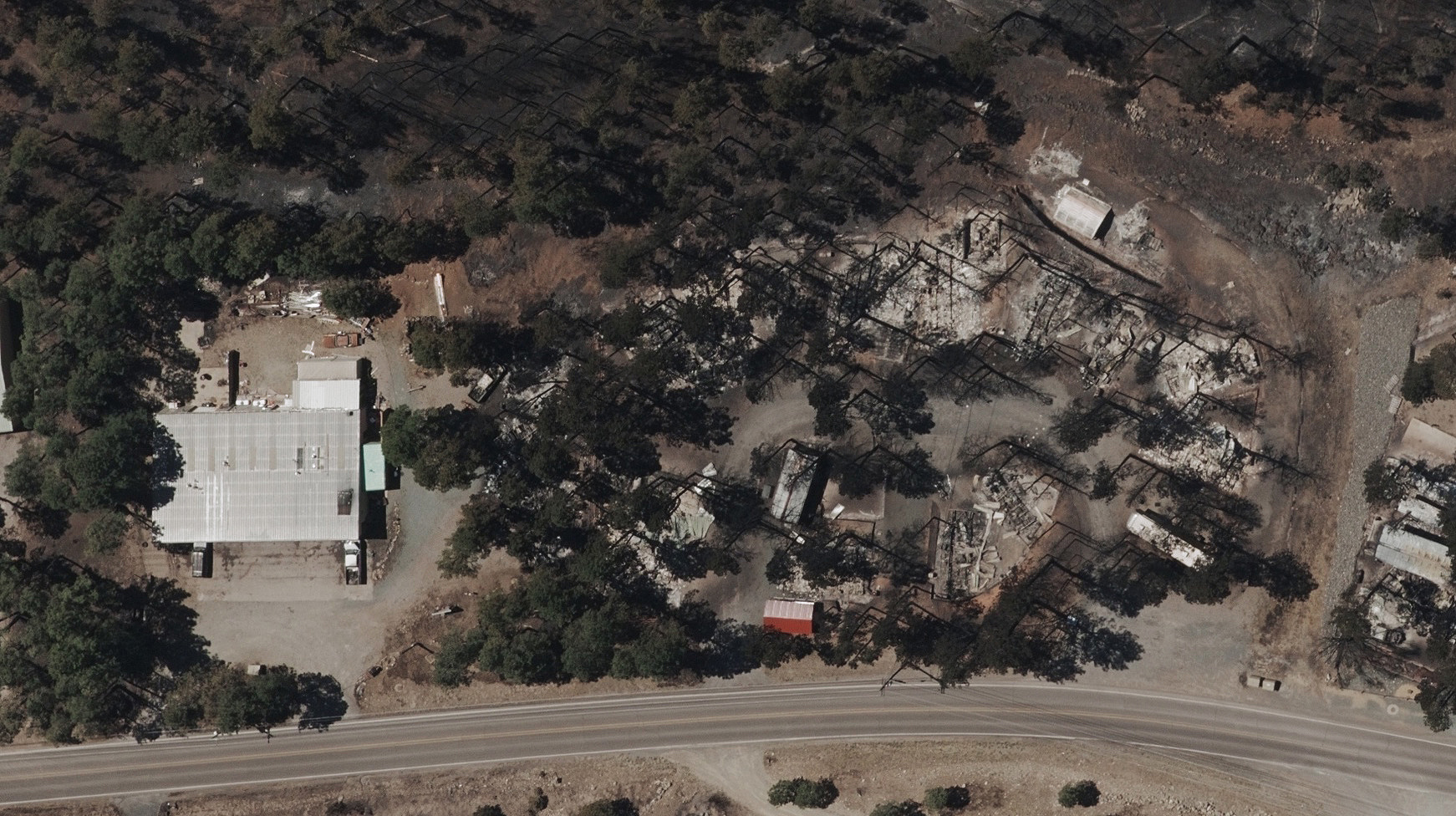
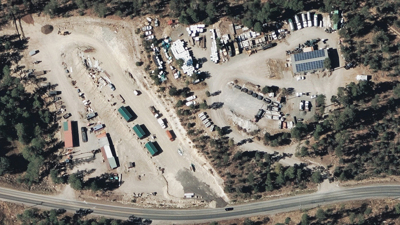
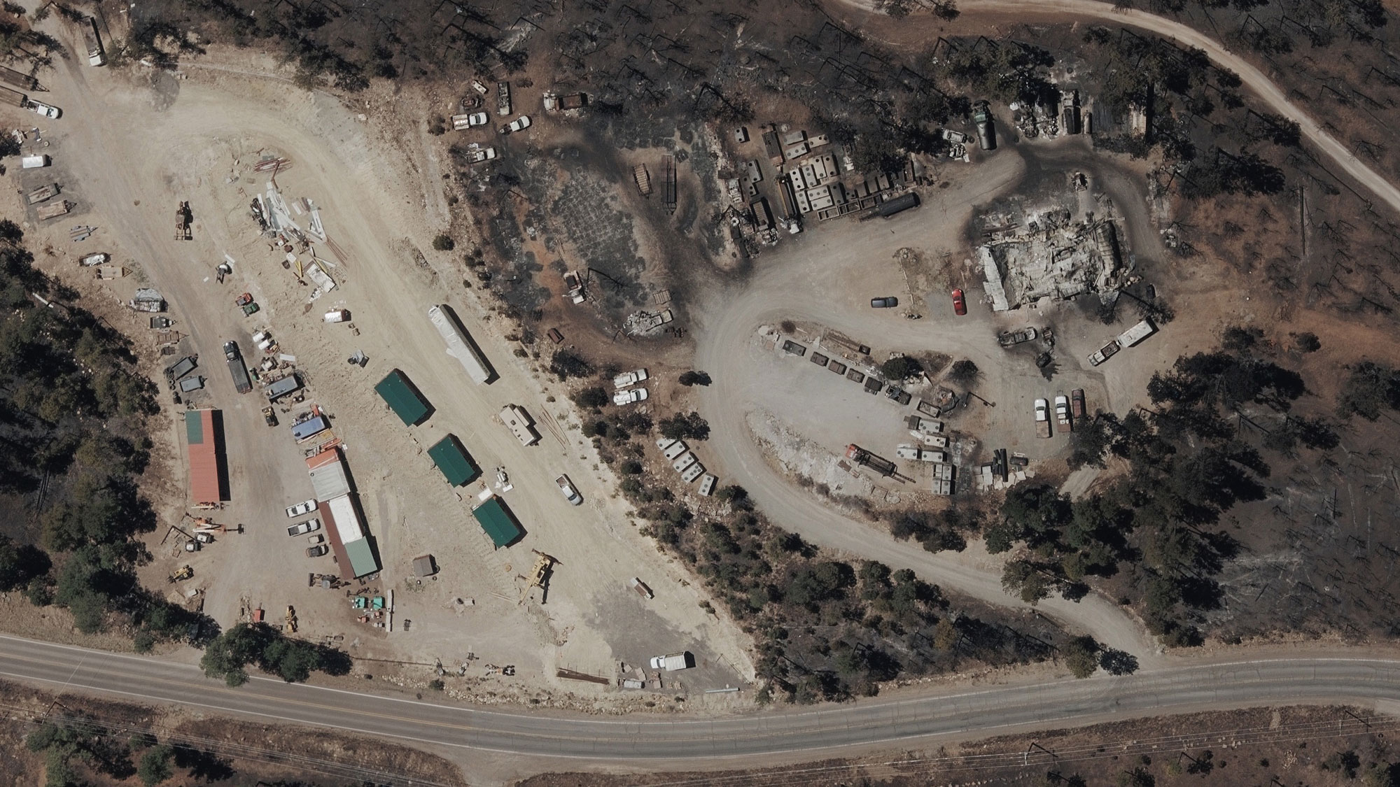
You can learn more about how the GIC captures Gray Sky events here. No one captures more disasters than the GIC. To request access to imagery from McBride Fire or other imagery, please fill out our contact form below.

 Maximize Your Property Reviews with Detailed Property and Building Attribut...