Gray Sky: Oklahoma Fires


33 Road Fire Collected and Published
Tuesday, March 25
Yesterday, our flight team activated to collect high-resolution imagery of the 33 Road Fire, located northeast of Oklahoma City. We captured 10cm ortho and multispectral imagery across the burned area, with a focus on property damage.
Imagery is now live in the Vexcel Platform, along with color-coded building footprints and damage assessments extracted directly from the imagery.
This fire has burned more than 31,000 acres and is one of the largest in the state this year. It marks the third wildfire we’ve collected in Oklahoma this March.
See more below, and please contact us if you need access to imagery.

Wildfire Imagery & Damage Assessments Now Available
Tuesday, March 18
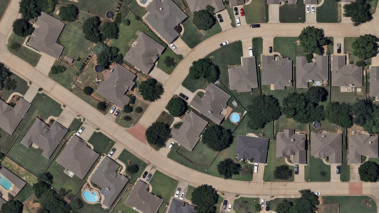
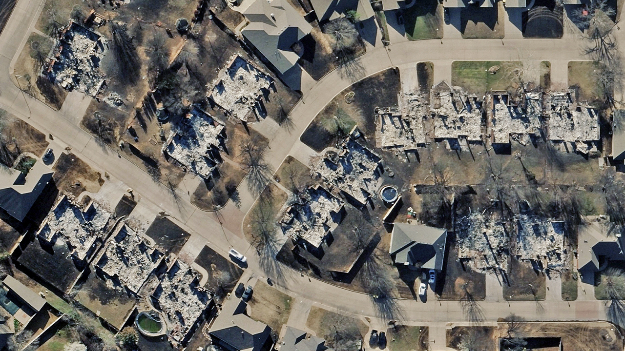
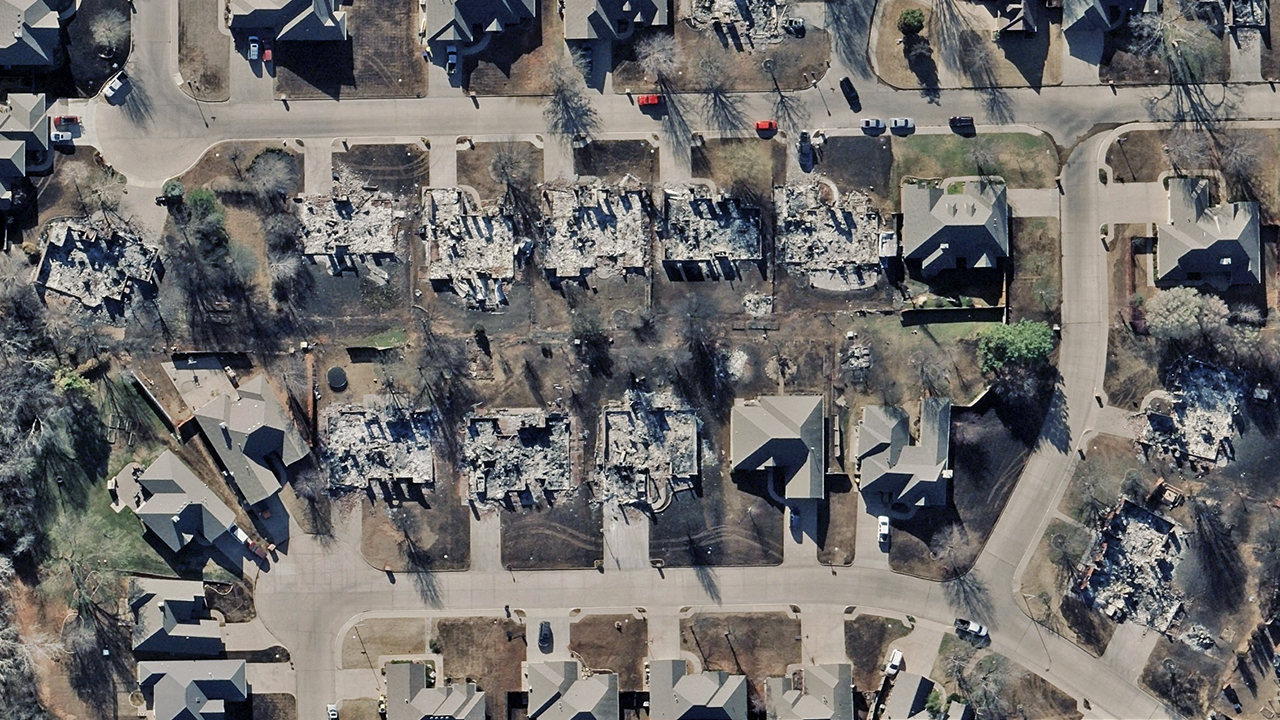
Extreme winds fueled destructive wildfires across in Oklahoma, leaving behind significant damage. Our thoughts are with the communities affected.
Vexcel’s Gray Sky team has been closely monitoring these fires since late last week and, once conditions allowed, activated a flight team to capture aerial imagery. On Monday, we collected high-resolution imagery of impacted properties for the Stillwater Fire and Little Salt Creek Fire.
This imagery, along with color-coded property-level damage assessments, is now available in the Vexcel Platform and select partner sites. These resources are here to help insurers, government agencies, emergency responders, utilities, and others working to assess damage and support recovery efforts.
Below is just a handful of images from the collections. Please reach out if this imagery can help.