This post originally appeared on GIC.org.
Together, Vexcel and GIC have fully aligned their strengths to streamline efforts and enhance innovation, while continuing to provide the high-quality aerial imagery and coverage that insurers trust.
This post originally appeared on GIC.org.
Together, Vexcel and GIC have fully aligned their strengths to streamline efforts and enhance innovation, while continuing to provide the high-quality aerial imagery and coverage that insurers trust.
On Wednesday evening, September 11, 2024, Hurricane Francine made landfall in Terrebonne Parrish, Louisiana as a Category 2 Hurricane. The 100 mph winds send heavy bands of rain into parts of Louisiana with major flooding washing over parishes and leaving tens of thousands of people without electricity. Although the winds lost power quickly, the after effects of a hurricane were on the minds of many with flood watches stretching far and wide.
Our Gray Sky team was on alert and stationed near the impact zone before Francine made landfall with plans to begin collecting as soon as the skies were clear. The first collection was able to occur mid-day Thursday with plans to complete additional collections as we connected with our GIC members on areas of interest and concern.
Below is some first look aerial imagery of the impact of Hurricane Francine. This blog will continue to be updated with additional imagery as it becomes available.
The GIC also has historical imagery of these areas, helping identify what existed previously before the hurricane hit. These help with before and after comparisons, showcasing the level of damage suffered by residents in these communities. In addition, Damage Assessment will be available to help GIC members remotely review property damage so they can triage and proactively begin the claims process to help those in greatest need.
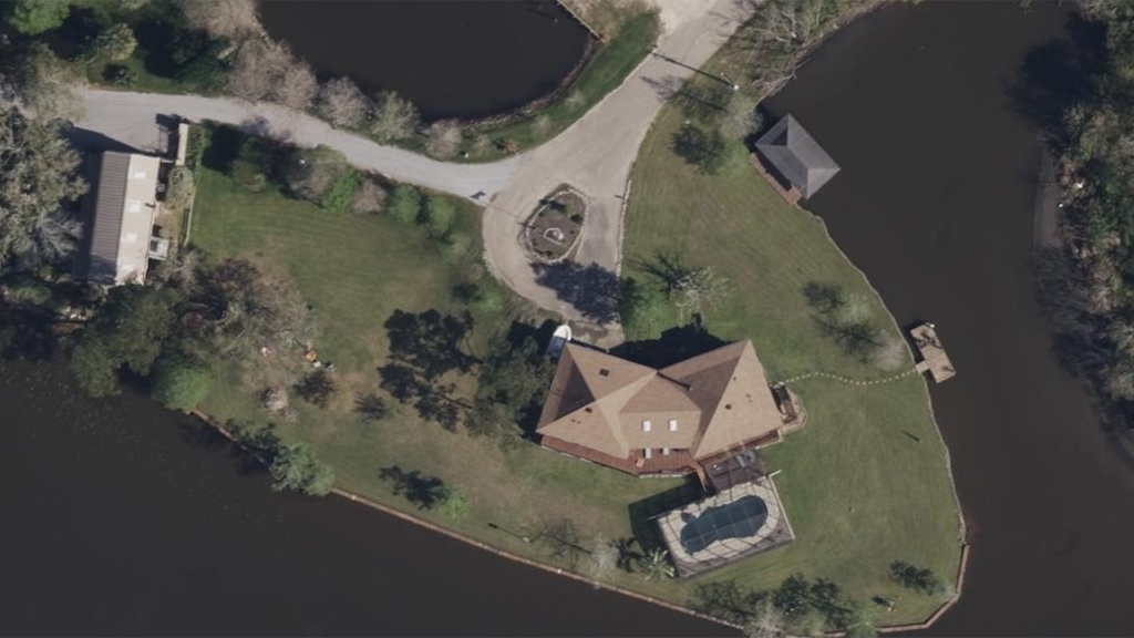
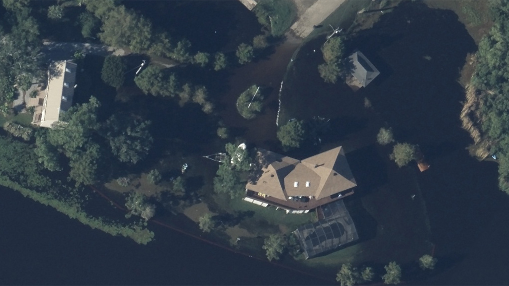
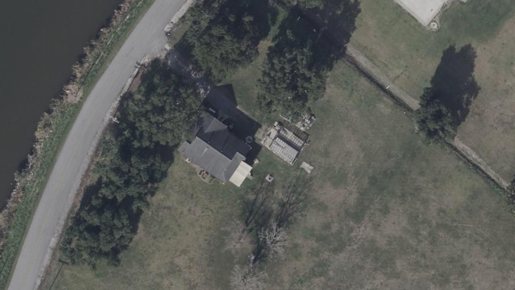
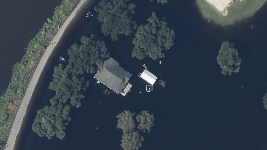
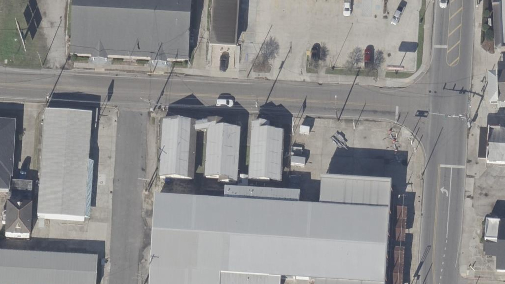
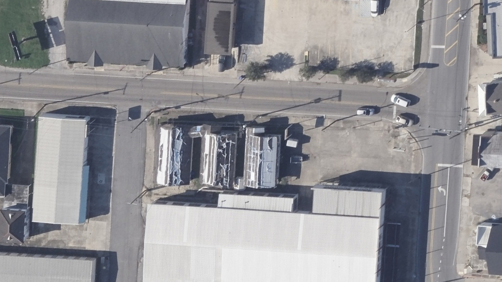
With significant flooding being the major contributor to damage, using Multispectral imagery to look at and review areas is also greatly valuable. Below is an example of a parish neighborhood showing the before and after with both Ortho and Multispectral imagery. Water bodies are delineated quite darkly so you can quickly see the reach of the water as it has moved throughout this area.
Request Access
Please let us know if you need imagery for your response and recovery. You can learn more about how the GIC captures Gray Sky events here. To request access to imagery from Hurricane Francine, please fill out our contact form below.

 Urban Planning Using Powerful 3D Models