
Gray Sky: Aspen Acres Fire, Colorado
Imagery and damage assessments now available
Overview
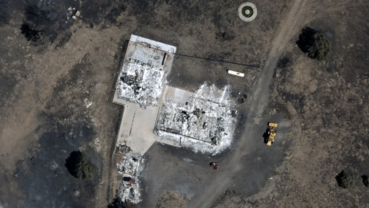
Our Gray Sky team has been monitoring the Aspen Acres Fire in south-central Colorado, west of Pueblo, since it began over the Fourth of July holiday weekend. The fire has since grown to become one of the largest wildfires in Colorado history, impacting communities across Pueblo and Custer counties, including Beulah, Rye, Colorado City, San Isabel, and Wetmore.
Our flight crew first activated to collect imagery on July 5. On July 14, the team completed a second collection, capturing areas within and around the fire zone to document its progression. We will continue to monitor the fire and publish additional imagery and assessments as needed.
Our thoughts are with the residents of Colorado, as well as the firefighters, law enforcement, and state officials working to protect their communities during this challenging time.
Second Collection
July 15, 2026
Second Collection Imagery & Damage Assessment Published
High-resolution ortho and multispectral imagery (10cm resolution) from our July 14 collection is now published and available in the Vexcel Platform and select partner platforms.
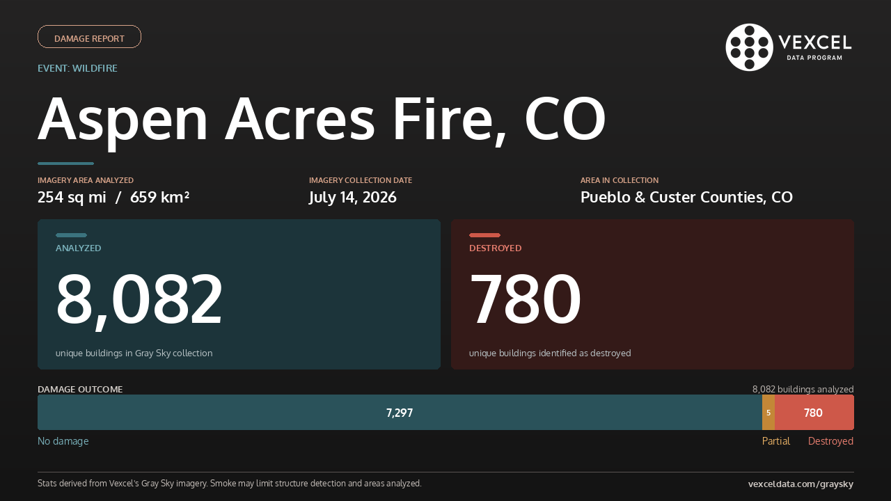
This second Gray Sky collection covers 659 km² (254 sq mi) across Pueblo and Custer counties, including the communities of Beulah, Rye, Colorado City, San Isabel, and Wetmore, giving an updated view of the fire’s progression since our initial response.
Using Vexcel Intelligence, structures were analyzed across the two Gray Sky collections. The second collection identified 253 additional structures. Some had been obscured by smoke in the first collection, while others were included after flight lines were expanded in the second collection to account for the fire’s growth.
Across the two Gray Sky collections, the damage assessment identified 780 uniquely destroyed structures and five with partial damage. Although the second collection captured additional burned areas, most of the newly mapped damage was forest rather than buildings. Therefore, the overall damage picture remained largely consistent between the two collections.
First Collection
July 6, 2026
Imagery & Damage Assessment Published
High-resolution ortho and multispectral imagery (10cm resolution) from our July 5 collection has been published in the Vexcel Platform and select partner platforms. The collection covers approximately 1,341 km² (518 sq mi) across portions of Pueblo and Custer counties.
Property-level damage assessments are also available for this collection, except in a few areas where smoke obscured imagery and prevented building analysis and before-and-after comparisons. Our damage intelligence analyzed 7,829 buildings and identified 780 as burned.
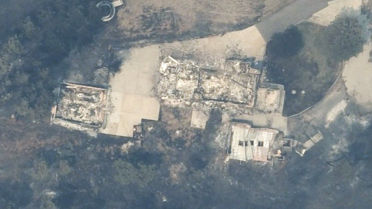
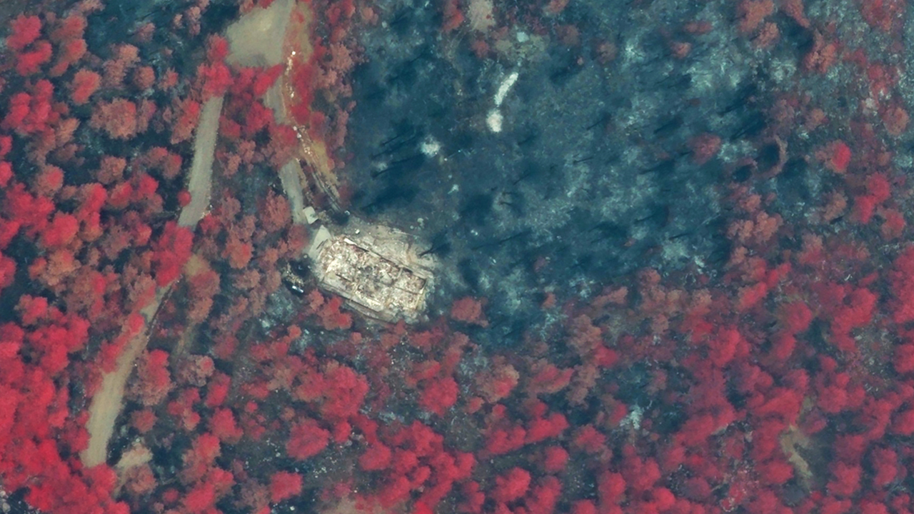
Before and After Imagery
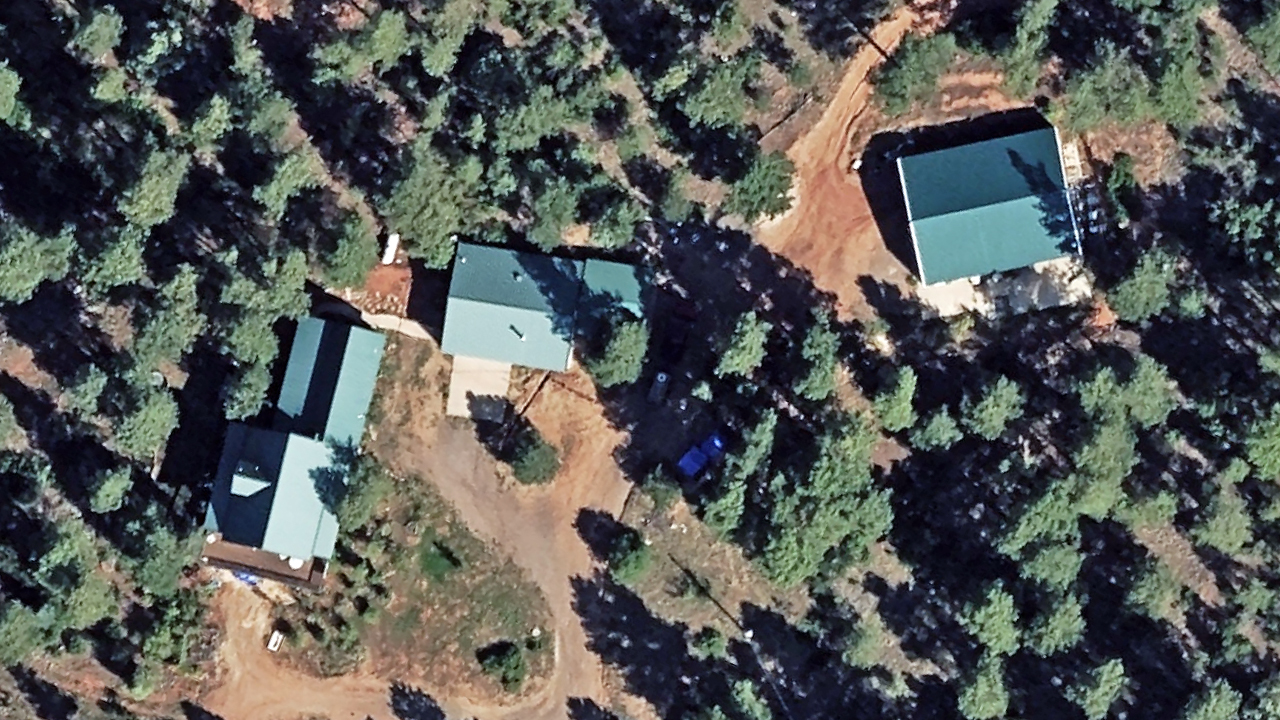
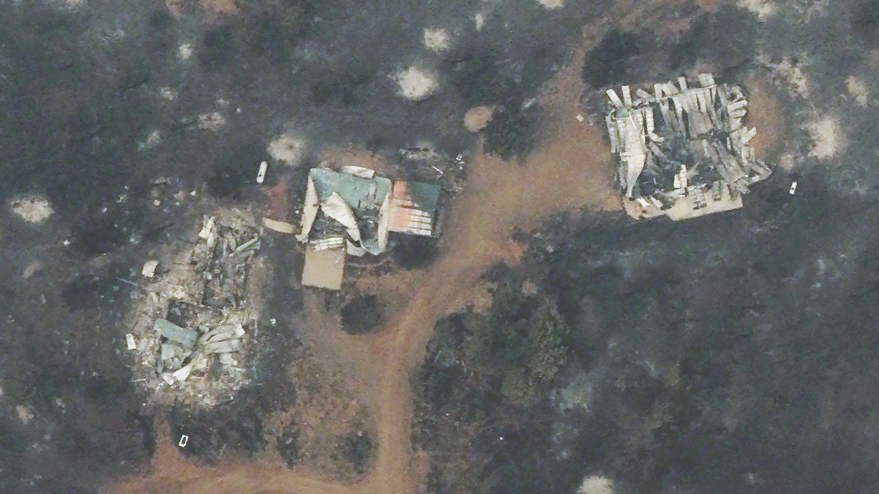
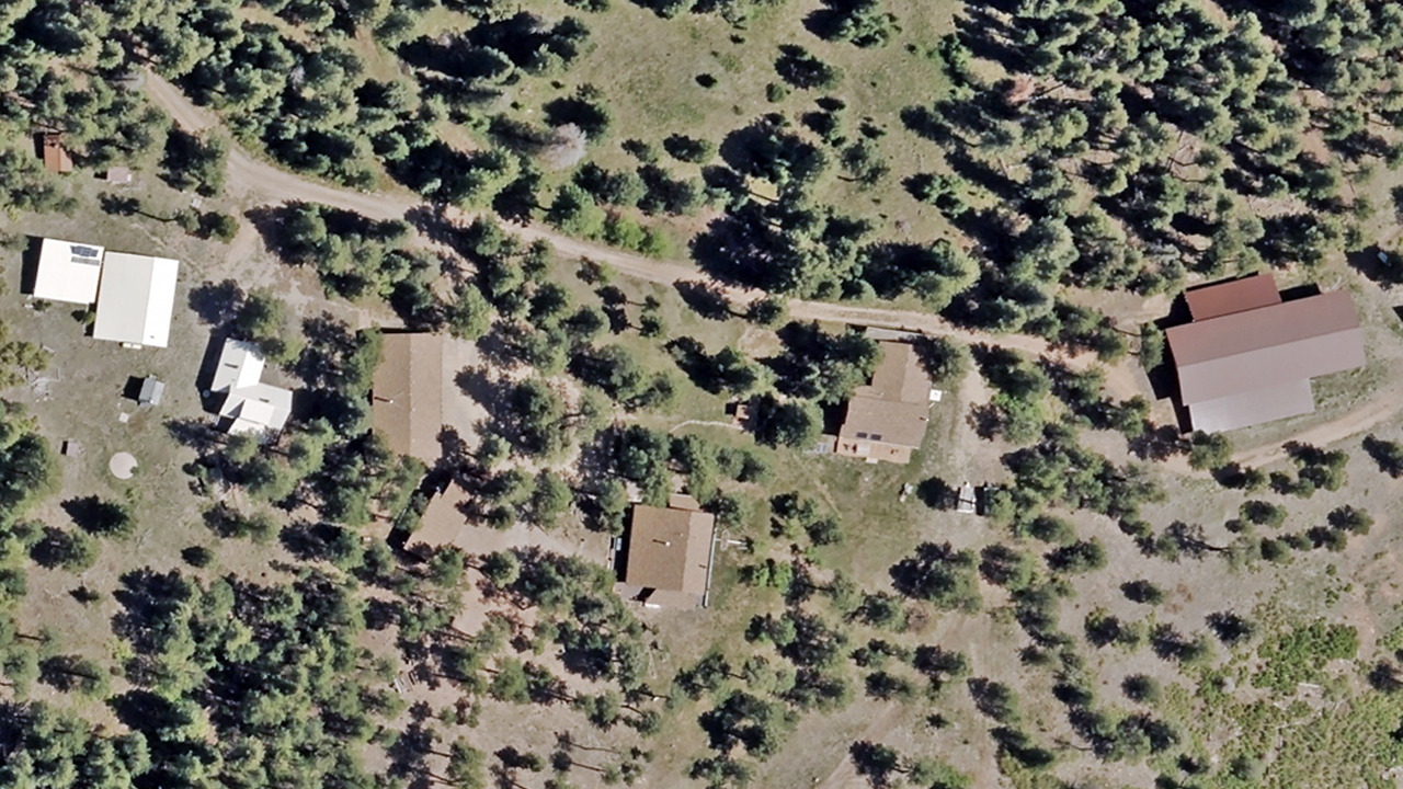
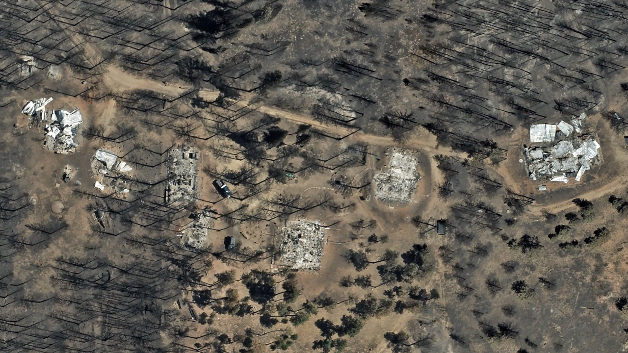
Request Access
Please let us know if you need Aspen Acres wildfire imagery for your response and recovery. Please fill out our contact form below.





