Gray Sky: Midwest Tornadoes
Post-CAT aerial imagery collections in Illinois and Wisconsin


Overview
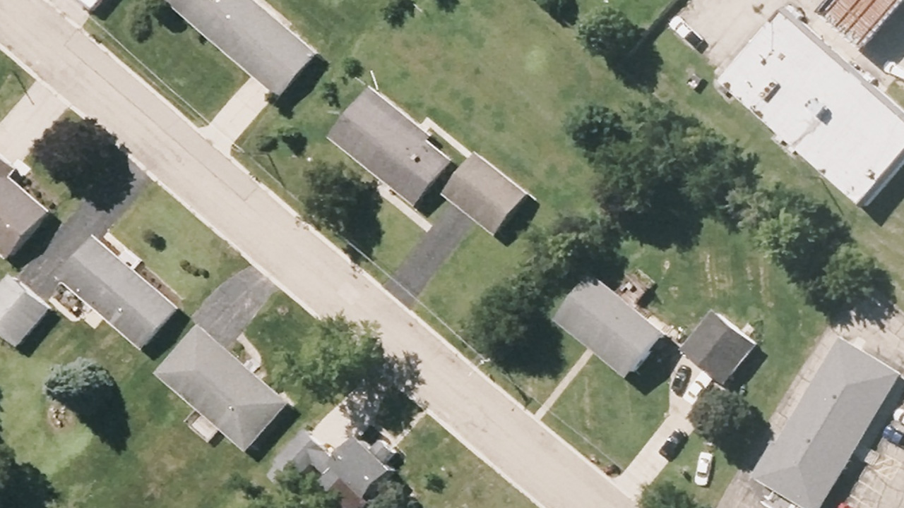
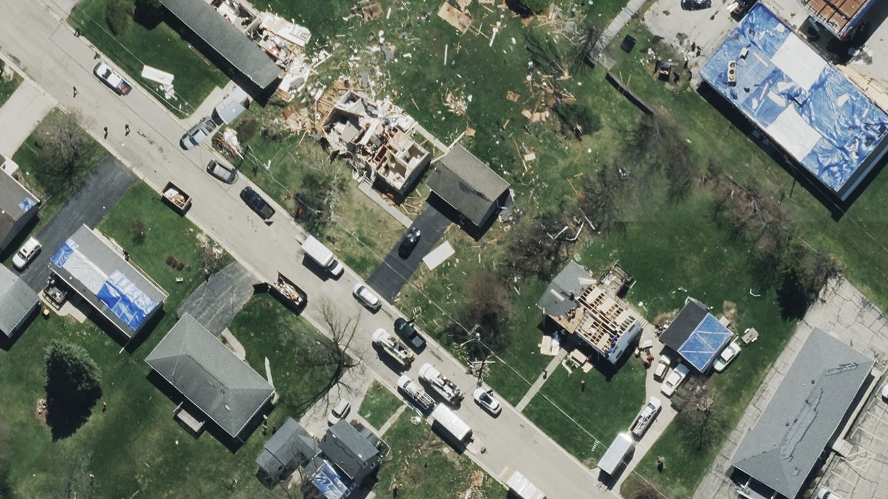
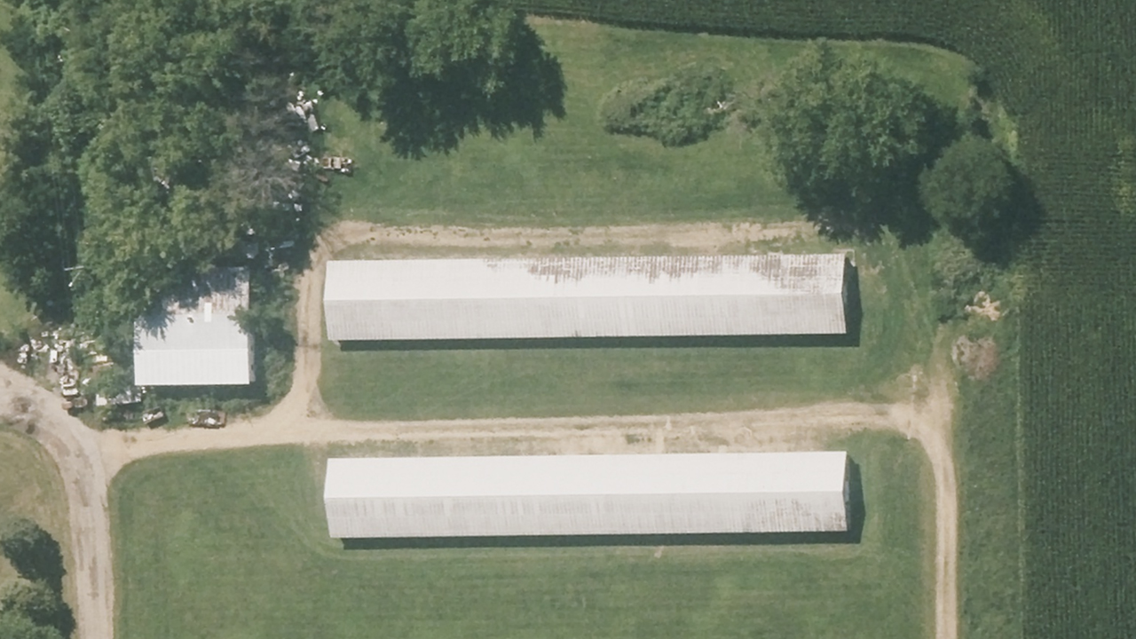
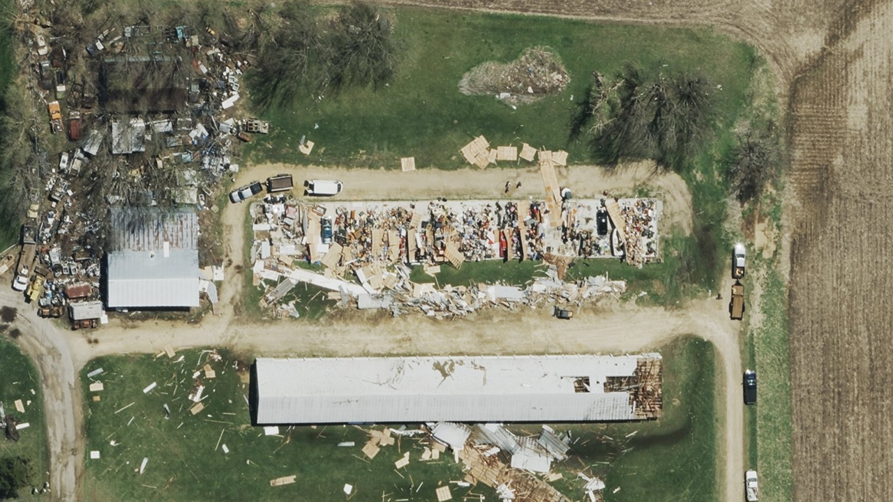
Tornadoes struck multiple communities across the Midwest, causing damage across parts of northern Illinois and Wisconsin. Our Gray Sky team mobilized to capture high-resolution aerial imagery to support response, assessment, and recovery efforts.
The imagery shows impacted areas in detail and, when paired with previous Vexcel collections, enables before-and-after comparisons to understand the full extent of tornado damage. Our thoughts go out to the communities impacted by these severe storms.
If you need access to imagery, please reach out below.
Tuesday, April 21
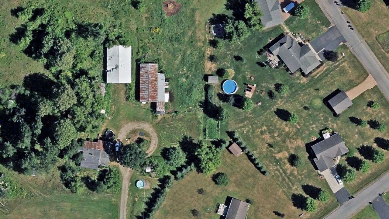
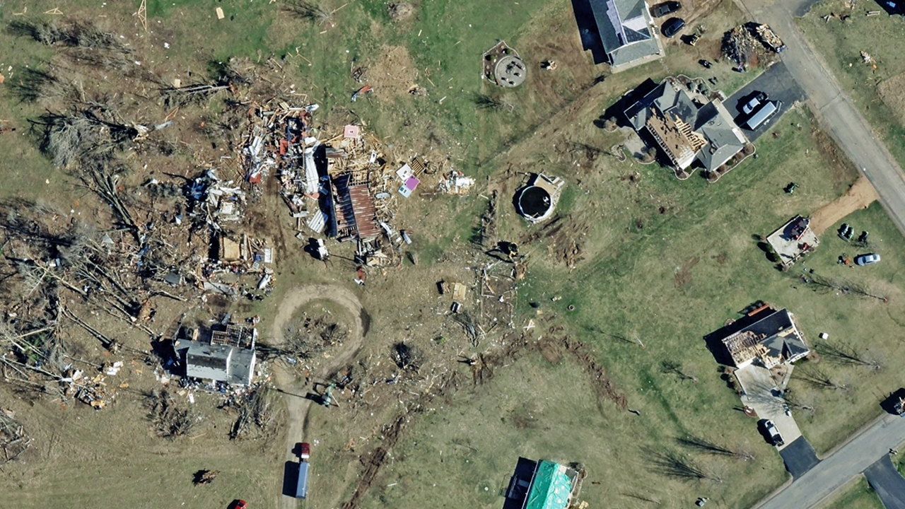
Early this morning, we published high-resolution imagery of tornado-damaged properties in Marathon County, WI in the Vexcel Platform. The coverage includes Ringle, Weston, and Kronenwetter, just southeast of Wausau. Damage assessments are now live. We analyzed more than 12,000 buildings in the collection area, with detailed damage reports available for every property.

Monday, April 20
Update: We collected in Marathon County, WI today. Imagery is en route to processing.
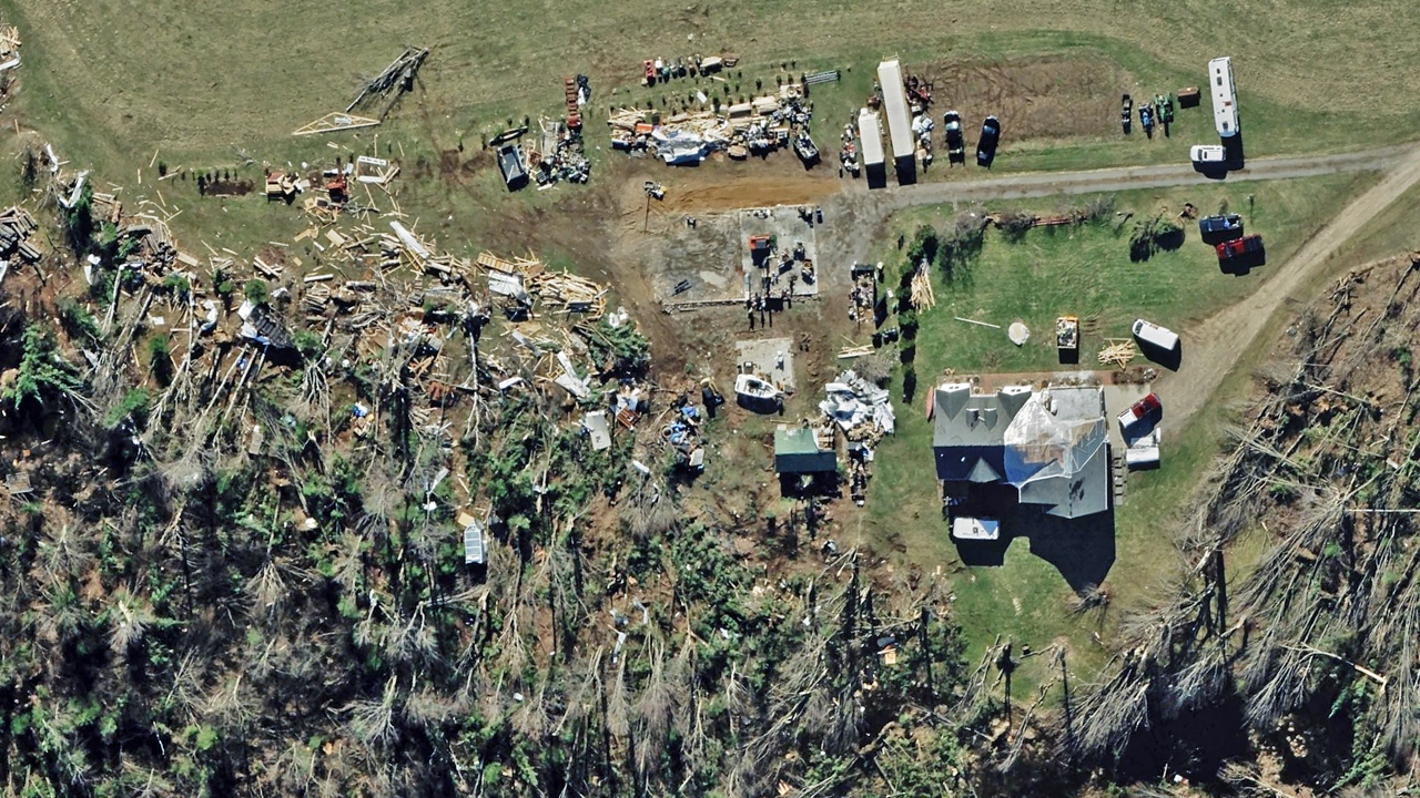
We’ve released damage assessments from the tornado that impacted Lena, IL. The collection covers 3,553 buildings, with 259 structures showing measurable damage and 110 flagged with tarp coverage. Property-level reports are available for every building in the collection area.
In addition, our crew plans to collect Wisconsin today, weather permitting.

Sunday, April 19
Update: Due to weather, we’ll now collect in Wisconsin on Monday.
Gray Sky tornado imagery from Lena, IL is now published in the Vexcel Platform (Vexcel Viewer, Vexcel APIs) and select partner sites. Color-coded damage assessments for every property within the Lena collection area are also available.
More today: Weather permitting, we plan to collect additional imagery near Ringle, WI, focusing on areas with significant building and property damage.
Saturday, April 18
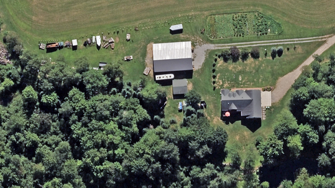
On Saturday, our Gray Sky team collected high-resolution aerial imagery over Lena, IL in Stephenson County, covering approximately 21 sq mi (54 km²). The collection focused on populated areas with significant property damage.