
Gray Sky: Wisconsin Tornado
Imagery published for tornado-damaged areas in Neenah, Menasha, and Appleton
Overview
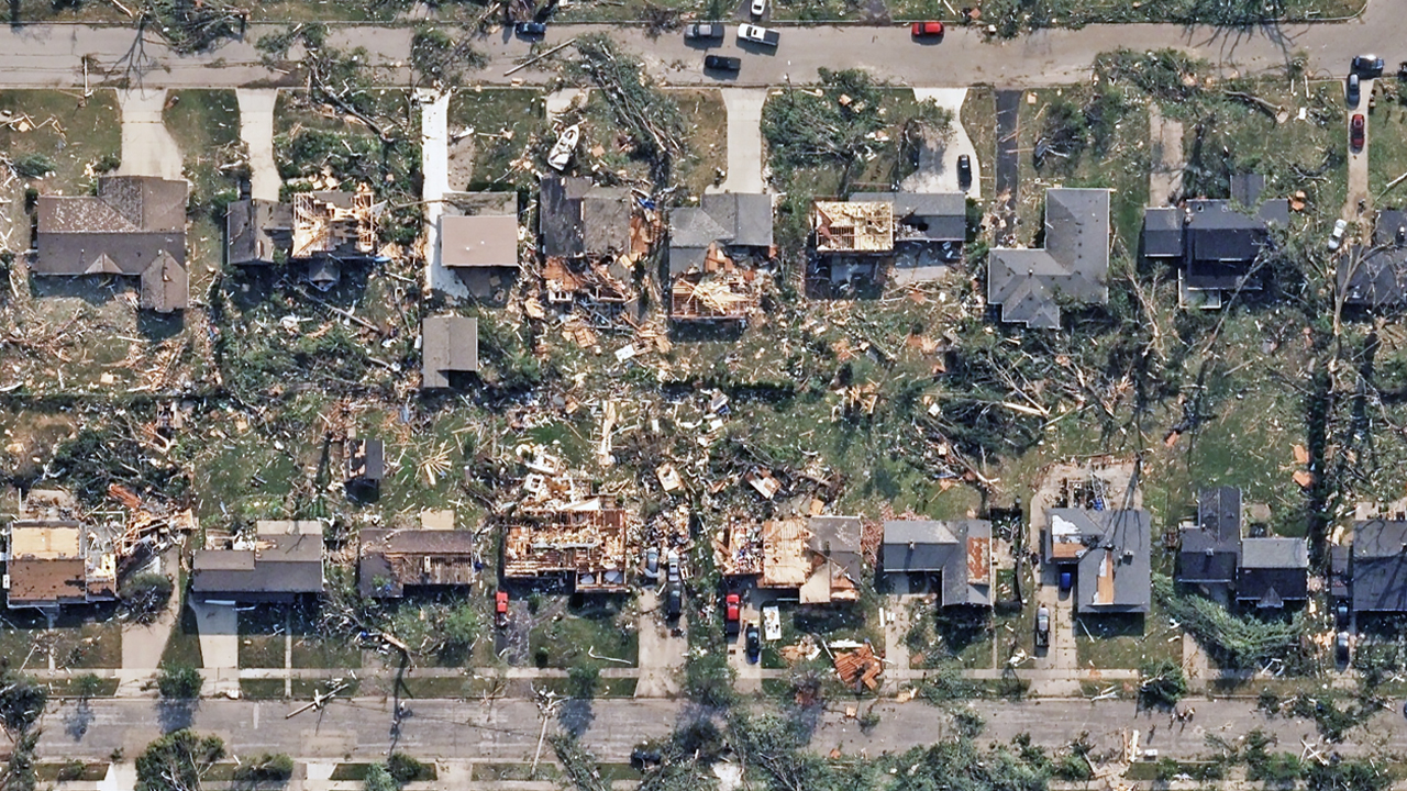
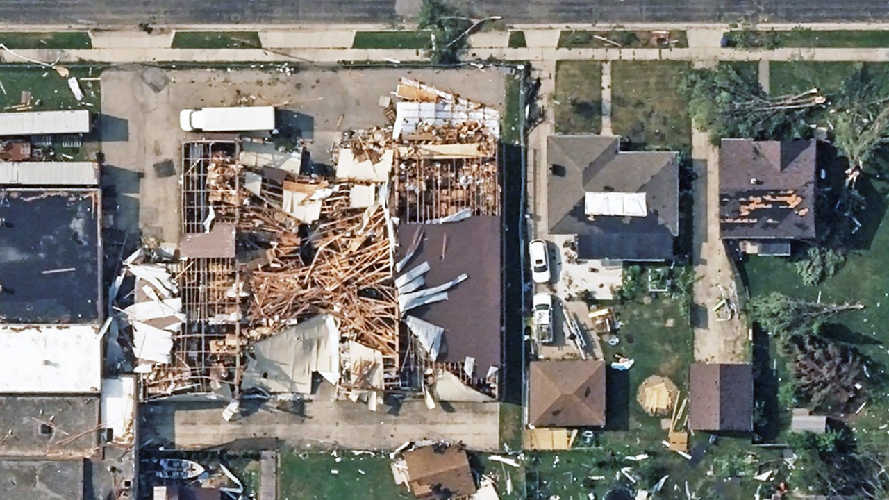
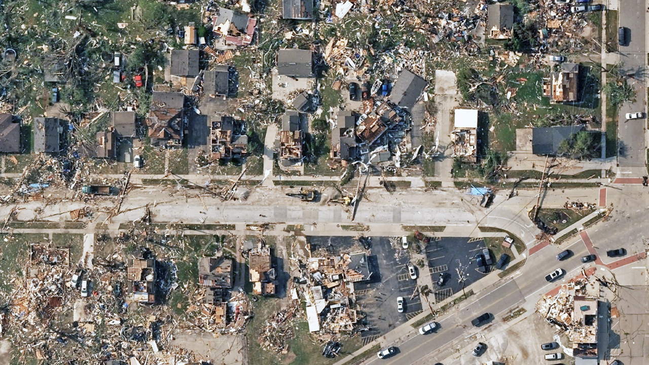
On Tuesday, July 28, the Vexcel Gray Sky team activated to collect high-resolution aerial imagery in response to the tornado that impacted Wisconsin’s Fox Cities region on Monday.
The post-disaster collection covers approximately 214 km² (82 sq mi) across portions of Winnebago and Outagamie counties. The collection footprint extends from northern Oshkosh through Neenah, Menasha, and Appleton.
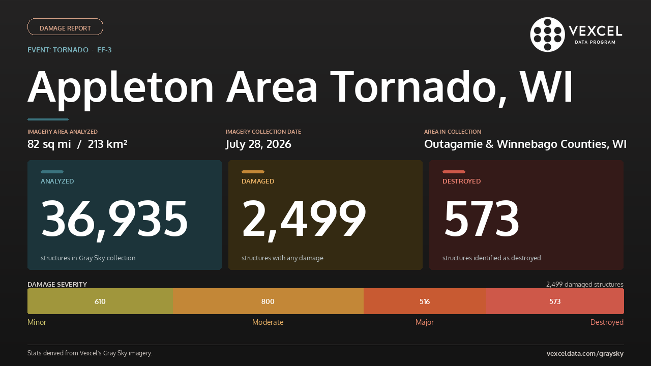
Using its Damage Intelligence, Vexcel reviewed nearly 37,000 structures across the collected imagery to assess the extent of the damage. The analysis identified 2,499 damaged structures, including 573 structures classified as destroyed. The chart below shows the distribution of damage severity across affected structures. Our thoughts are with everyone affected by this event.
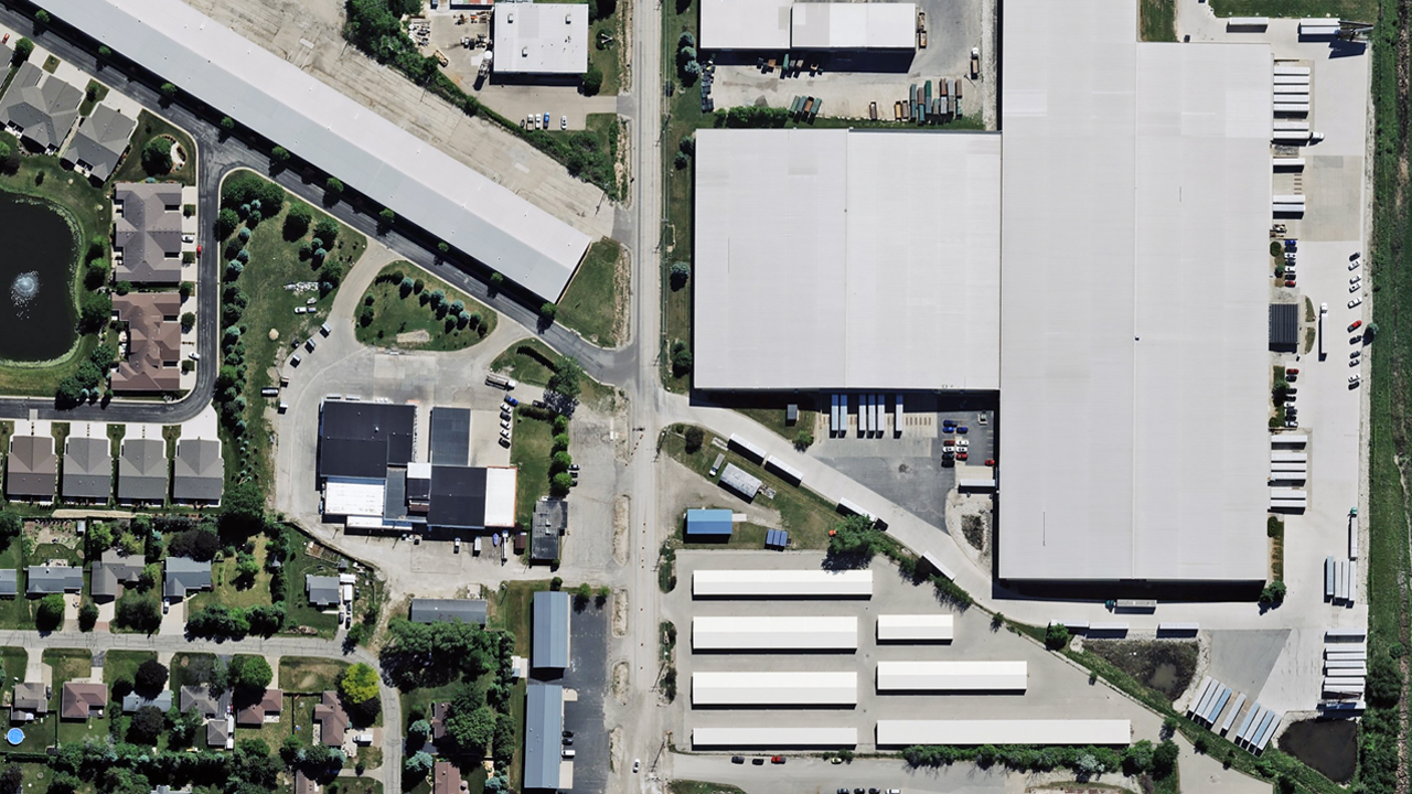
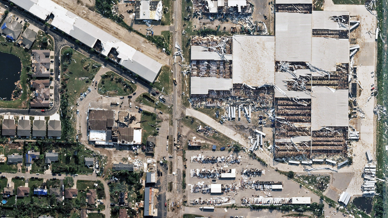
Ortho and multispectral imagery is now available in Vexcel Platform and select partner platforms. Property-level damage assessments and before-and-after imagery are also available to support damage assessment, infrastructure evaluation, and recovery planning.
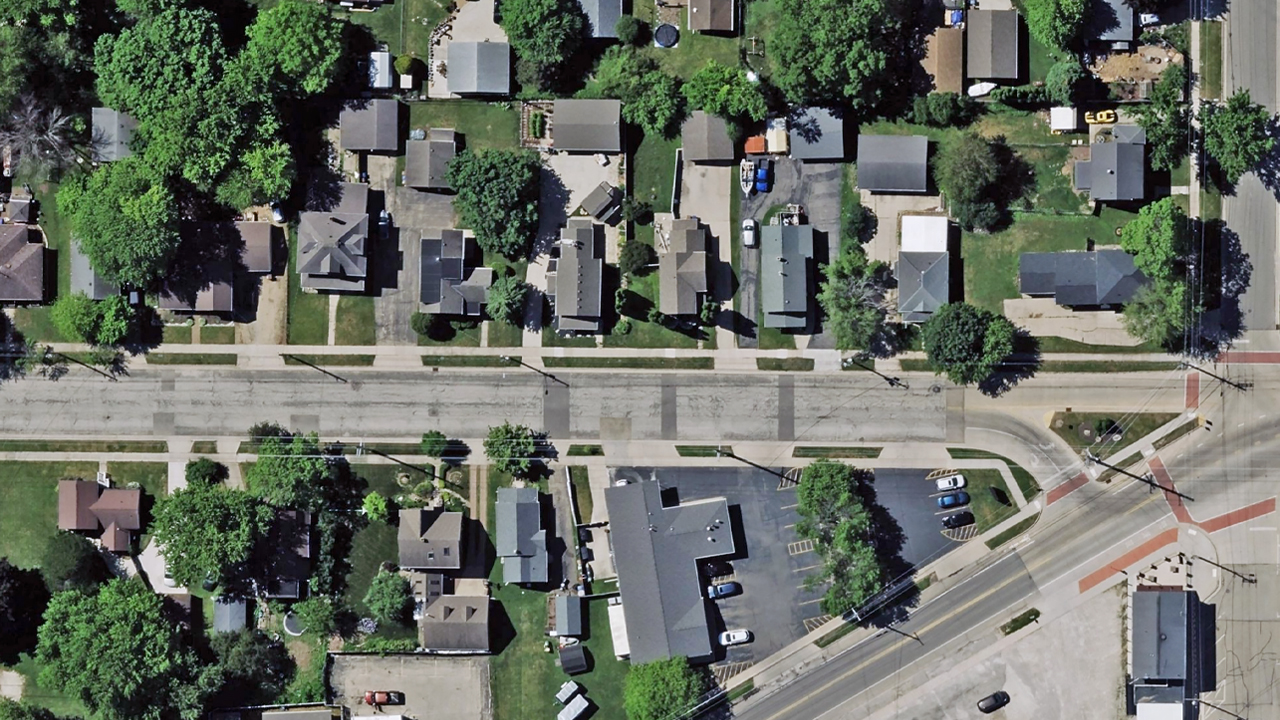
Before and After Imagery
Request Access
Please let us know if you need imagery for your response and recovery. Please fill out our contact form below.





