The Slope You Can’t See Is The Risk You Can’t Price
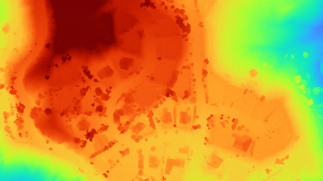
Insurers are familiar with Gray Sky imagery, which captures the visible aftermath of a fire. Digital Surface Models (DSM) and Digital Terrain Models (DTM) offer a different kind of insight, capturing high-resolution elevation data from the built and natural surface down to the bare earth. That data shows slope and aspect, two conditions behind how and where fire spreads.
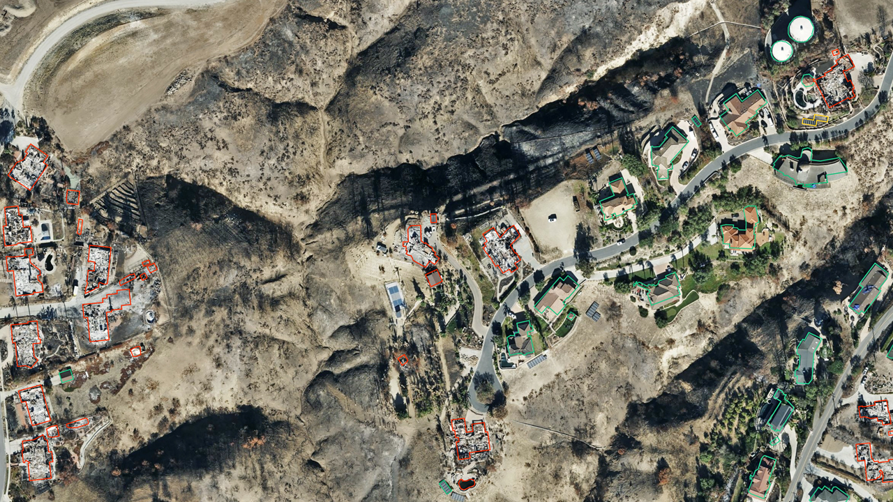
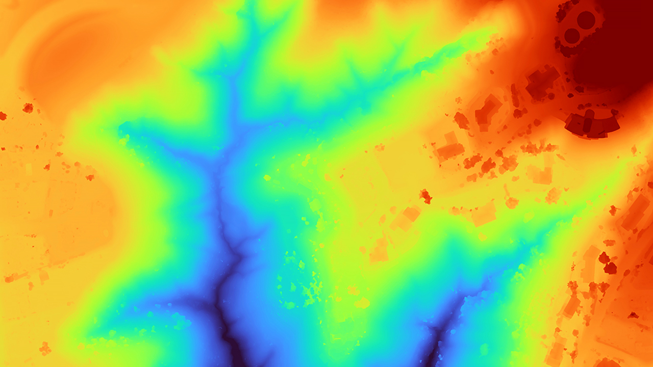
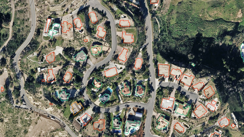
An extreme Santa Ana wind event contributed to the 2024 Mountain Fire in Camarillo, CA. On the left, an ortho image with a damage footprint shows the destroyed structures outlined in red and remaining structures outlined in green. On the right, a DSM of the same longitude and latitude shows its elevation data. The red areas have the highest relative elevation; blue the lowest.
Los Angeles: What Two Fires Reveal About Terrain
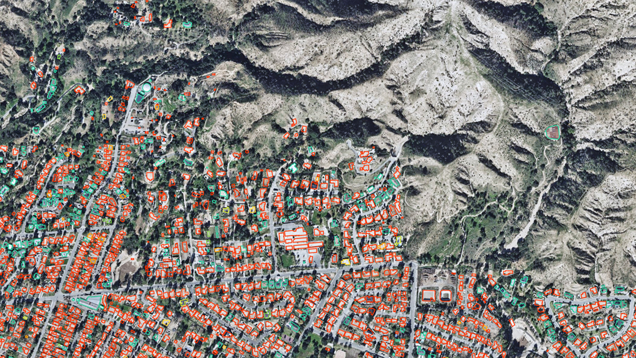
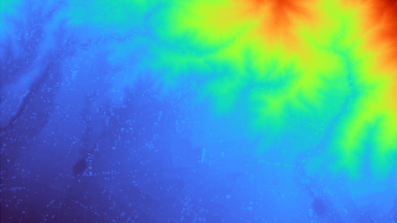
The 2025 Eaton Fire began in a canyon. Wind drove into the foothill communities along the San Gabriel Mountains, ultimately destroying more than 9,400 structures. On the left, the damage footprint shows destroyed structures in Altadena. On the right, the DSM shows Altadena sits at relatively low elevation along and below the San Gabriel foothills.
The steeper the ground, the faster fire climbs. It doubles in speed for every 10-degree increase in slope, according to South Australia’s Department for Environment and Water. A structure on a ridgeline, or on a slope, sits in the path where fire is most likely to travel. Terrain also funnels wind, accelerating it and driving fire faster.
Canyon systems act as corridors that channel wind and dry out vegetation. In the January 2025 Los Angeles fires, this dynamic helped drive winds exceeding 100 mph in some areas, according to the Los Angeles Regional Fire Safe Council (MySafe:LA). This type of dynamic shaped the Palisades and Eaton fires in January 2025. Damage in both fires tracked closely to canyon and coastal-slope topography and wind channeling.
Combined, the two fires destroyed more than 16,000 structures. Modeling this kind of risk requires elevation data precise enough to capture slope, aspect, and terrain funneling at the property level.
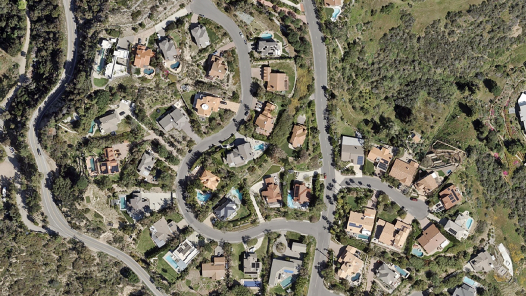
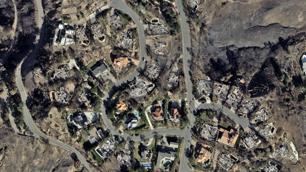
Below, a gallery of one Malibu community shows before and after imagery of the Palisades fire, a DSM, and its damage footprint.