 https://vexceldata.com/wp-content/uploads/2022/10/GIC-Aerial-Imagery-5.jpg
1080
1920
vexcel
https://vexceldata.com/wp-content/uploads/2021/12/VEXCEL-Data-Program.png
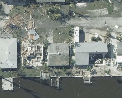
vexcel2022-10-05 17:03:042026-04-14 15:50:12Capturing Hurricane Ian’s Destructive Path
https://vexceldata.com/wp-content/uploads/2022/10/GIC-Aerial-Imagery-5.jpg
1080
1920
vexcel
https://vexceldata.com/wp-content/uploads/2021/12/VEXCEL-Data-Program.png
vexcel2022-10-05 17:03:042026-04-14 15:50:12Capturing Hurricane Ian’s Destructive Path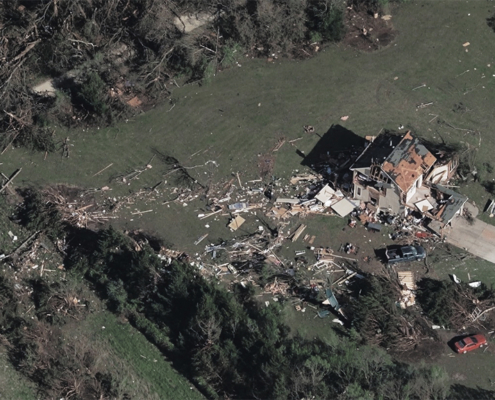 https://vexceldata.com/wp-content/uploads/2022/05/Tornado_Andover-_US-KS-9.jpeg
576
1024
vexcel
https://vexceldata.com/wp-content/uploads/2021/12/VEXCEL-Data-Program.png
vexcel2022-05-27 21:18:202026-04-14 15:30:22Aerial Imagery for Catastrophic Weather
https://vexceldata.com/wp-content/uploads/2022/05/Tornado_Andover-_US-KS-9.jpeg
576
1024
vexcel
https://vexceldata.com/wp-content/uploads/2021/12/VEXCEL-Data-Program.png
vexcel2022-05-27 21:18:202026-04-14 15:30:22Aerial Imagery for Catastrophic Weather
