This post originally appeared on GIC.org.
Together, Vexcel and GIC have fully aligned their strengths to streamline efforts and enhance innovation, while continuing to provide the high-quality aerial imagery and coverage that insurers trust.
This post originally appeared on GIC.org.
Together, Vexcel and GIC have fully aligned their strengths to streamline efforts and enhance innovation, while continuing to provide the high-quality aerial imagery and coverage that insurers trust.
Imagery Collections & Damage Assessments in 5 States
As Hurricane Helene made landfall in Florida, our Gray Sky team quickly mobilized to capture high-resolution aerial imagery of the hardest-hit areas. On Friday, September 27, we activated five aircraft crews to collect nearly 6,000 square kilometers across Florida and Georgia. Throughout the week following Helene, we collaborated with insurers, partners, emergency managers, and government agencies to prioritize and capture additional areas to support response efforts.
In total, and in collaboration with our operations partner Vexcel, we have collected imagery covering more than 10,000 square kilometers in five states.
Collection Areas:
We have published ortho and multispectral imagery (7.5cm-10cm resolution) in all locations, with oblique imagery (7.5cm) available in more populated areas, focusing on buildings and regions affected by hurricane winds and severe flooding. To help understand the extent of the damage, we also have imagery from previous collections for before and after comparisons.
Our thoughts are with the communities impacted by Hurricane Helene. If you need access to this imagery to support your response and recovery efforts, please reach out below.
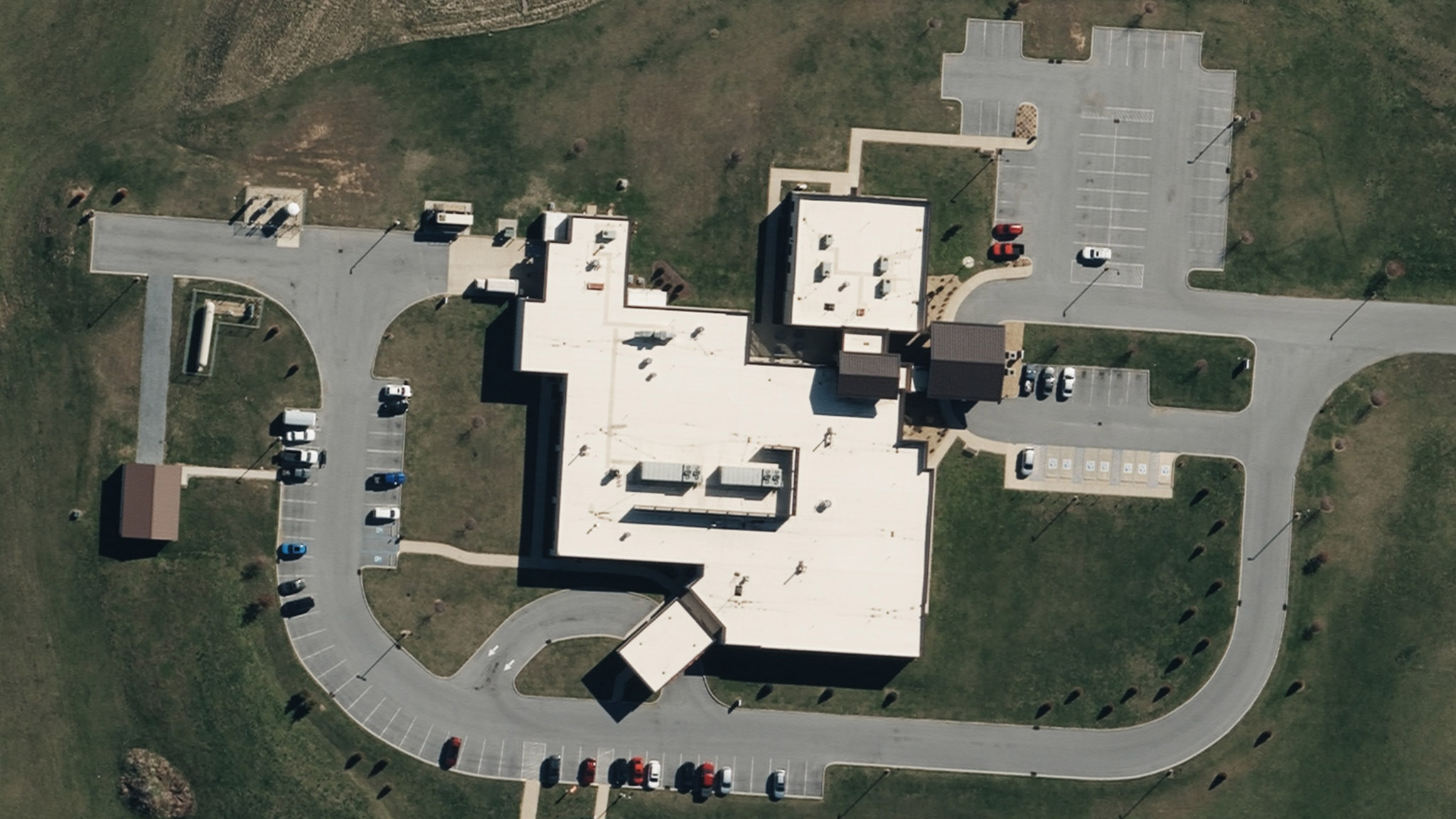
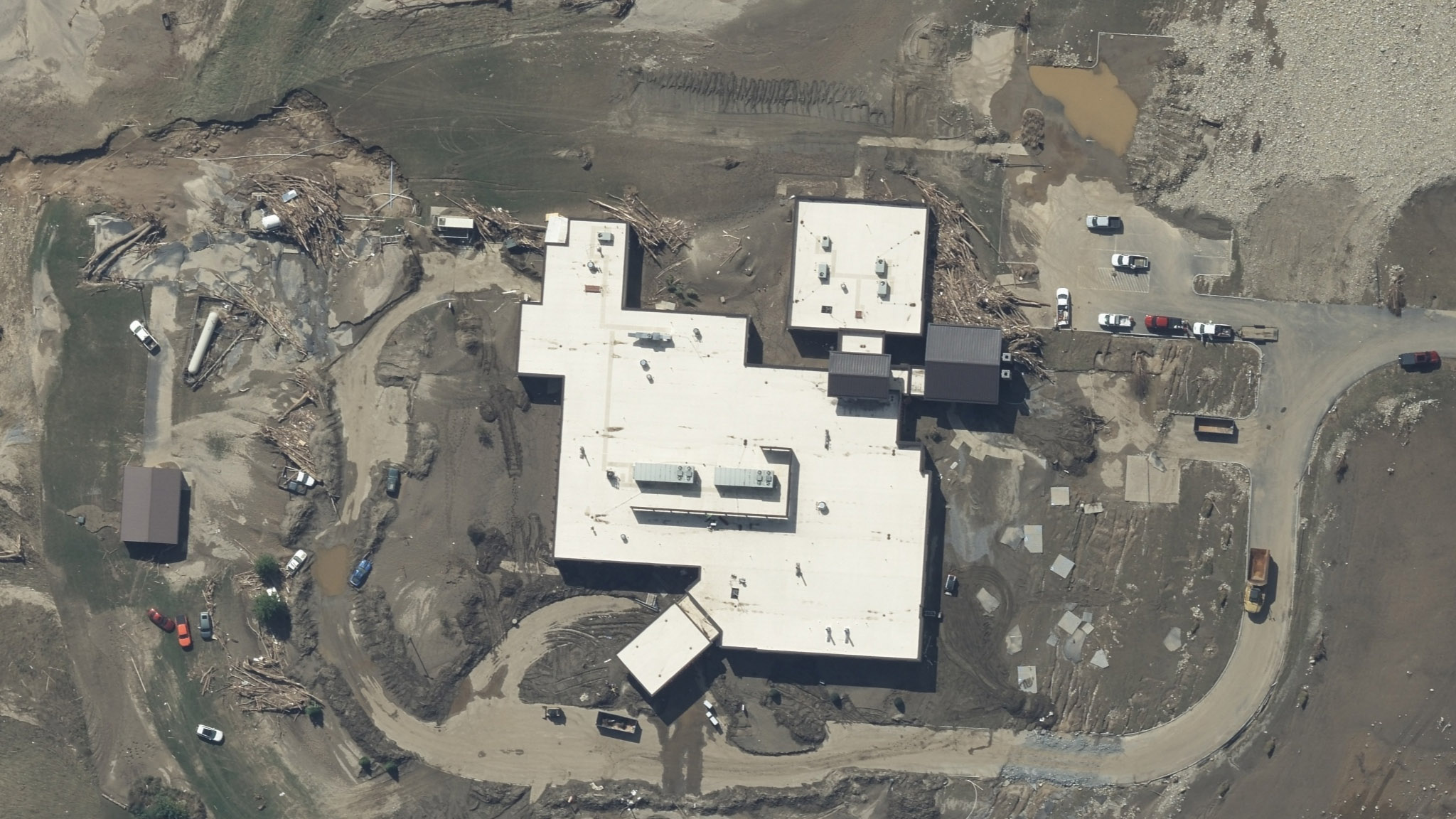
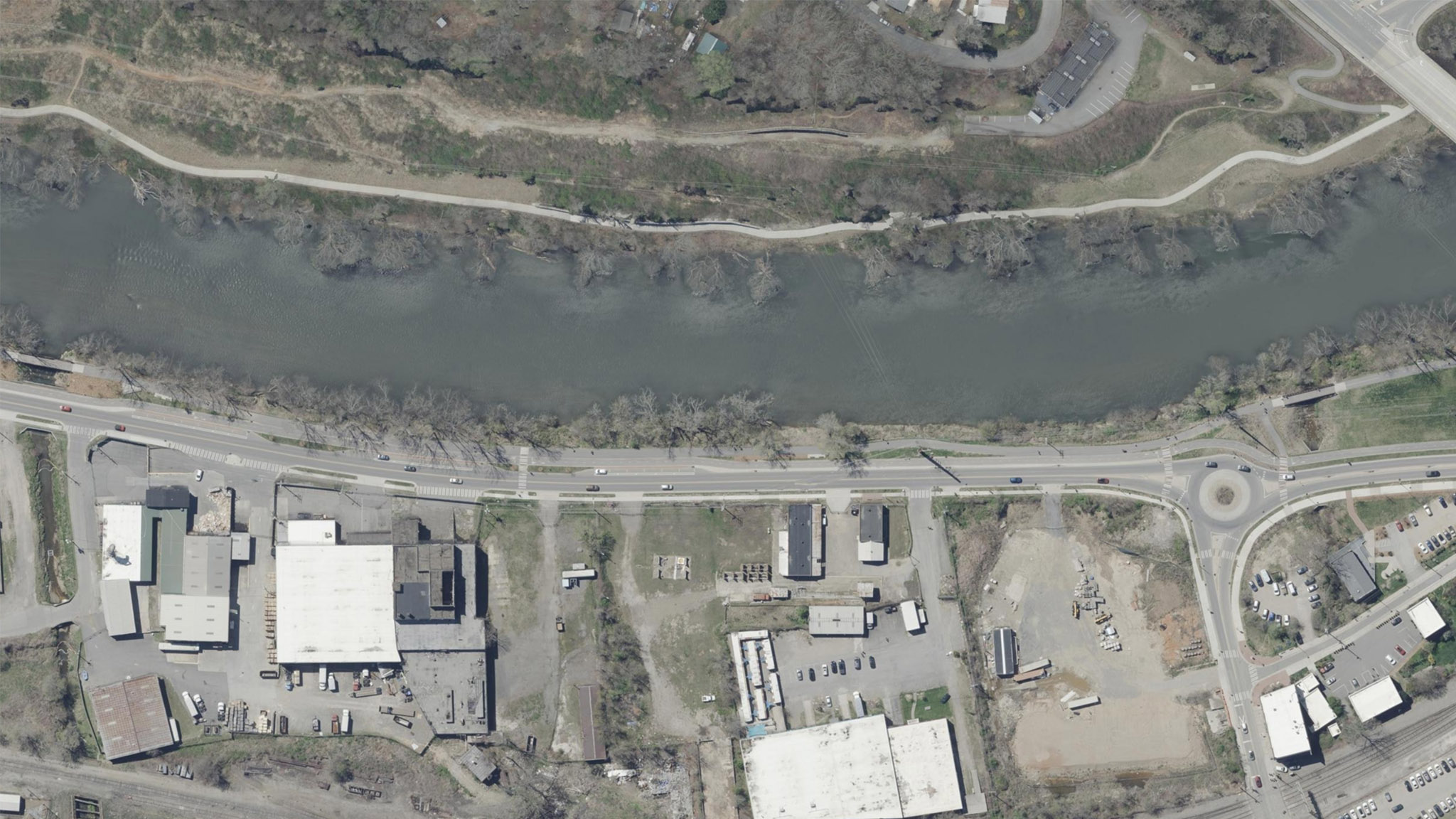
Understand the full scope of the damage with timestamped before-and-after imagery. Below are examples of before-and-after images from Asheville, NC, and Erwin, TN.


Friday, October 4
We are working alongside lots of private and public agencies. Over the past several days and as weather permitted, our Gray Sky team has collected and published high-resolution imagery in more areas. This imagery as well as AI-derived damaged assessments have been rolling out to Vexcel Platform.
Wednesday, October 2
We’ve been working closely with insurers, partners, emergency managers, and state agencies throughout the week after the devastating impact of Hurricane Helene. We have activated more planes to collect more imagery and damage assessments throughout the week, covering additional areas in Florida, Georgia, North Carolina, South Carolina, and Tennessee.
Sunday, September 29
As of early this morning, Hurricane Helene imagery has been rolling out and is available in the Vexcel Platform. Damage Assessments of all properties in our Gray Sky Collection areas are also being published.
Saturday, September 28
Our team has been processing Gray Sky imagery throughout the night and today, and high-resolution ortho and oblique imagery will start to roll out for Hurricane Helene tonight and continue throughout Sunday.
Imagery will be available in the Vexcel Platform via the GIC/Vexcel Viewer, Vexcel APIs, Vexcel Image Services for ArcGIS, and select partner platforms.
Friday, September 27
Today, we activated a total of 5 aircraft crews to collect nearly 6,000 sq kilometers (~2,300 sq miles) across 23 areas of interest, including Perry, Mexico Beach, Tallahassee, Hosford, and Crawfordville. Despite remnant weather and cloud bands, the flight teams captured ortho and multispectral imagery across all high-priority collection areas, as well as oblique imagery in populated regions, focusing on areas with high wind damage from the storm.
From here, our Gray Sky imagery collections are being transported to our processing center, where the team will work through the night and into tomorrow to edit, stitch, and publish the collection areas. Imagery will roll out in waves, and we’ll provide ongoing updates tomorrow.
Friday, September 27
Hurricane Helene made landfall as a Category 4 hurricane overnight in Florida and is now moving inland. Our crews are fully activated, and aircraft are now collecting imagery of impacted areas. Today’s collection will depend on weather bands, residual cloud cover, and whether it is safe to fly. Currently, we have identified 23 areas of interest, focusing on regions with populations and buildings that were hardest hit by the hurricane’s winds.
Thursday, September 26
Our Gray Sky team has been meeting regularly this week to plan and prepare for Hurricane Helene. We have positioned several teams and aircraft equipped with Vexcel UltraCam sensors, ready to respond after the hurricane moves through Florida.
Our focus is on collecting high-resolution aerial imagery of impacted buildings and properties across multiple cities and areas.
We will continue to monitor the storm throughout the evening and adjust our collection plans based on Helene’s final path. Weather permitting, we plan to have our aircraft in the air and begin collecting imagery as early as Friday morning. Our current plan includes capturing orthos and multispectral imagery across all collection areas, as well as oblique imagery in more populated regions.
We will keep you updated as things progress tomorrow.
Please let us know if you need imagery for your response and recovery. You can learn more about how the GIC captures Gray Sky events here. Please fill out our contact form below.

 The Importance of Ground Control Points and Accuracy in Aerial Imagery