Gray Sky: Tornadoes in Arkansas and Missouri


Additional Imagery Published
Tuesday, March 18
Yesterday, our crew captured additional aerial imagery of tornado-damaged areas in Rolla and Villa Ridge, Missouri. This imagery is now available in the Vexcel Platform.
Imagery & Damage Assessments Now Available
Monday, March 17
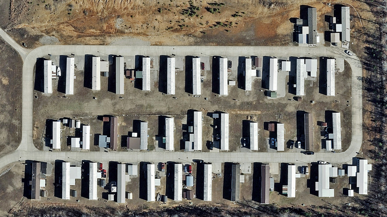
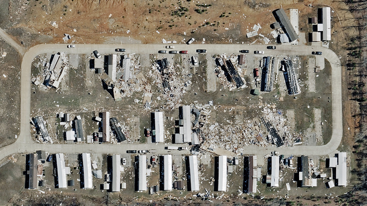
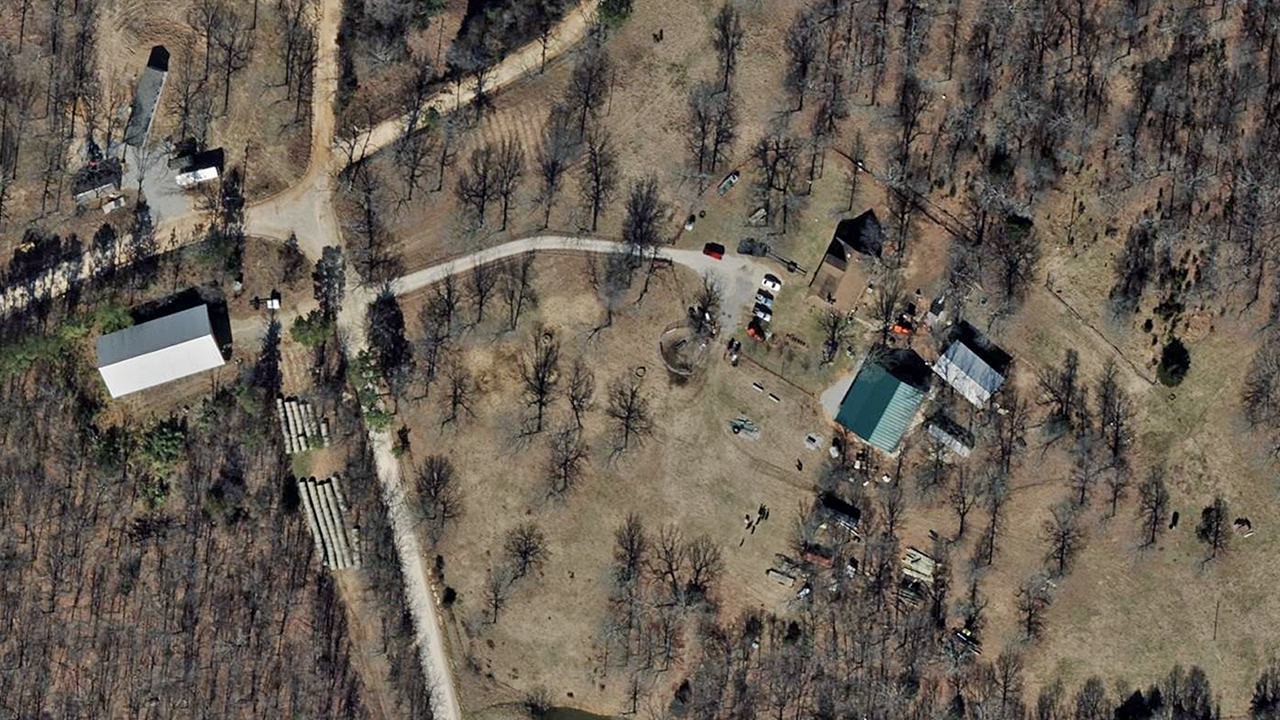
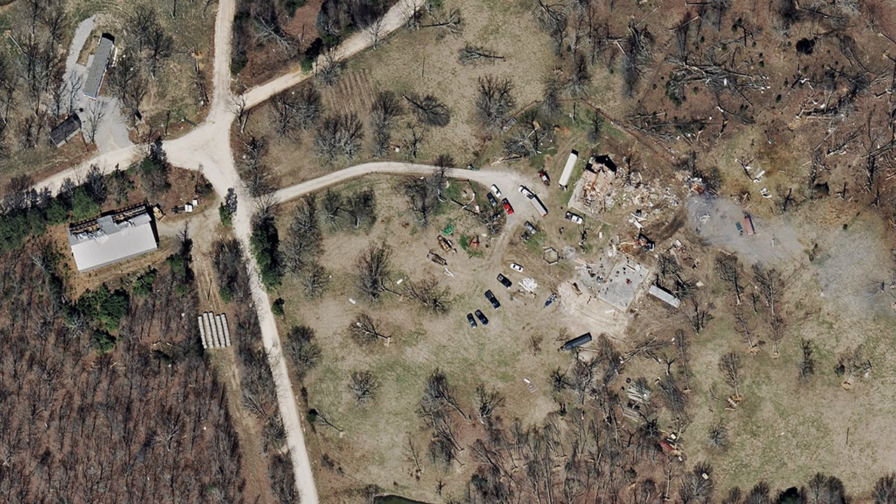
High-resolution ortho and multispectral imagery and property-level damage assessments from the recent tornado damage in Missouri and Arkansas have been published on the Vexcel Platform and select partner sites.
Five areas have been published, focusing on wind-damaged properties. Government agencies, emergency managers, insurers, and utilities can access this data to support tornado response, recovery, and assessment efforts.
Before are some samples from the Gray Sky collections as well as before and after imagery.