This post originally appeared on GIC.org.
Together, Vexcel and GIC have fully aligned their strengths to streamline efforts and enhance innovation, while continuing to provide the high-quality aerial imagery and coverage that insurers trust.
This post originally appeared on GIC.org.
Together, Vexcel and GIC have fully aligned their strengths to streamline efforts and enhance innovation, while continuing to provide the high-quality aerial imagery and coverage that insurers trust.
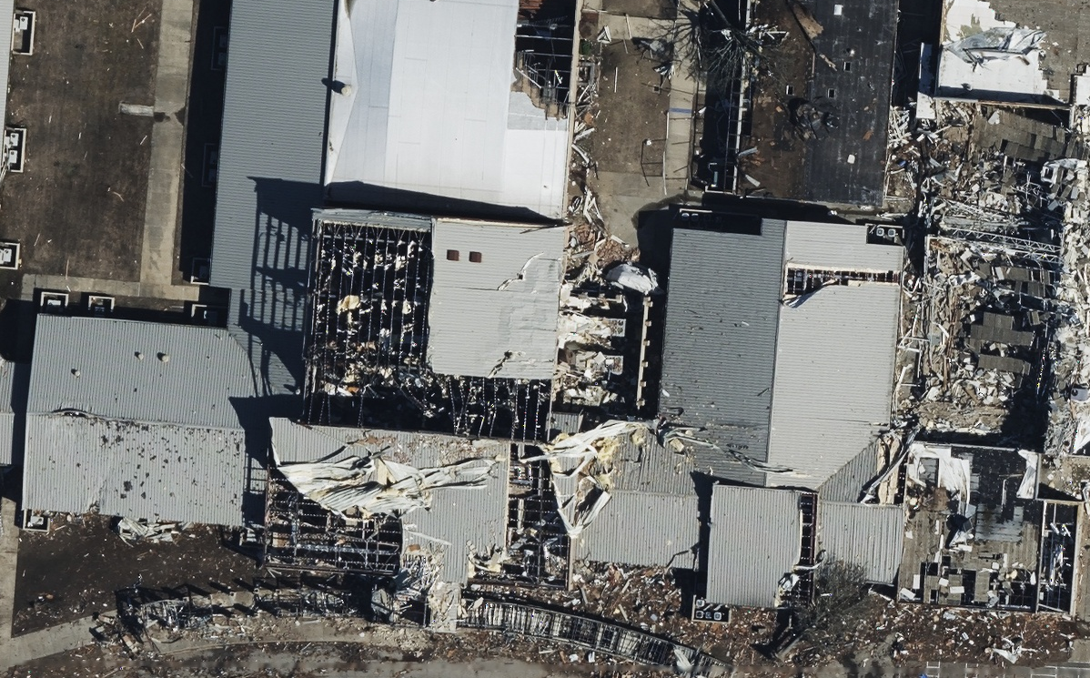
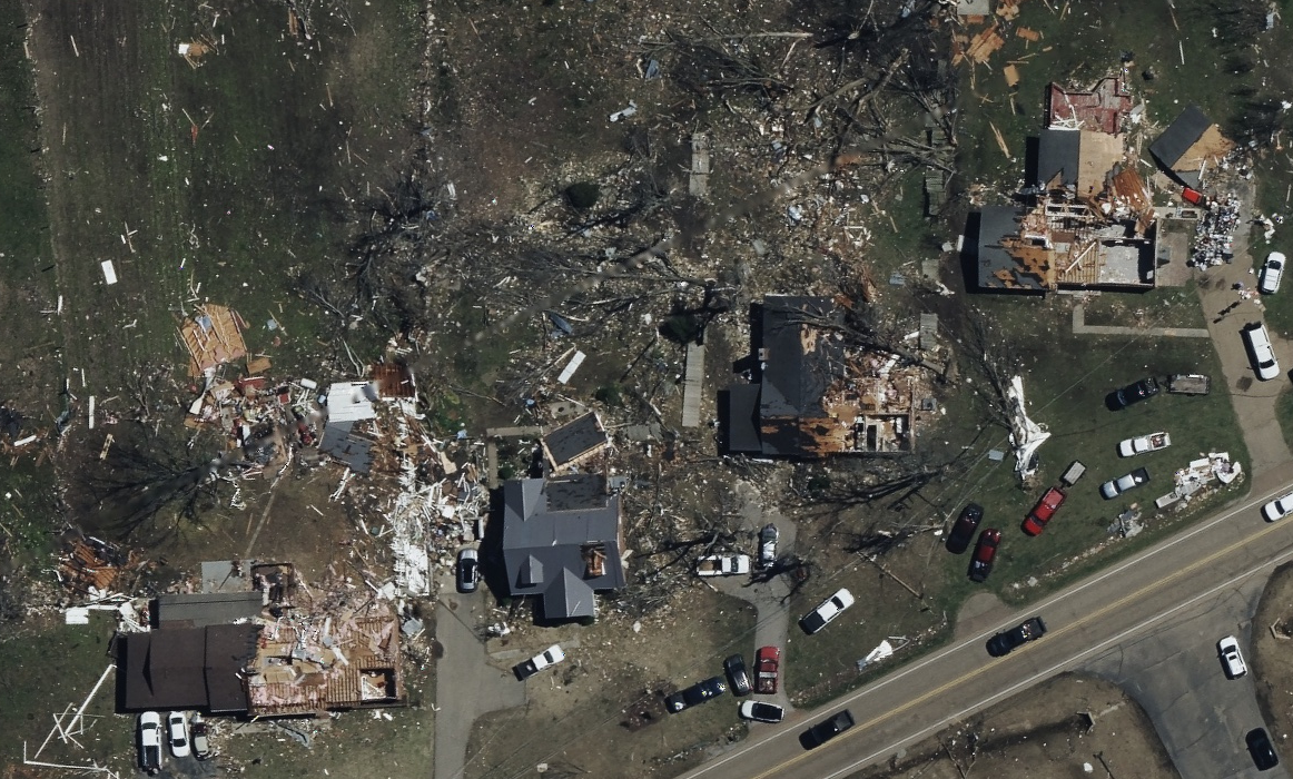
For a second week in a row, multiple tornadoes touched down in areas across the Midwest, South, and Northeast in the U.S. The hardest hit locations were found in Arkansas in Tennessee. Across areas in Little Rock, Arkansas, the western part of the city was hit hard, homes were destroyed, shopping centers shredded, and multiple fatalities were reported. In Wynne, Arkansas, massive tornado damage was reported leaving the small city without power and roads full of debris. In Covington, Tennessee, schools, buildings, and neighborhoods were impacted with multiple road closures and damaged infrastructure.
We connected with our GIC members shortly after the tornadoes impact to align on what they needed to see to help their customers who suffered loss from the storms. Additionally, we communicated with emergency relief agencies to understand their aerial imagery needs so they could put together more informed plans for assisting those on the ground.
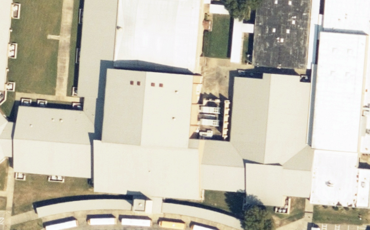
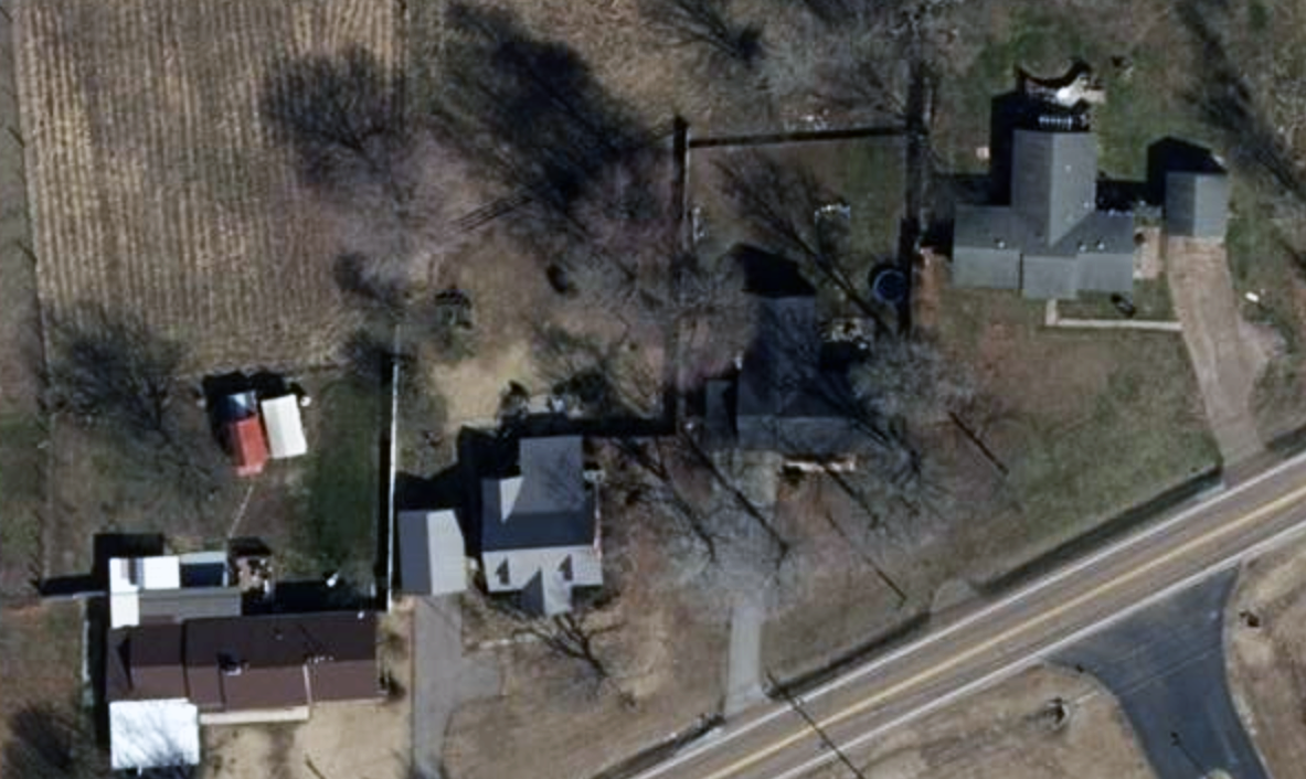
Our planes were able to collect imagery quickly, as soon as it was safe to do so, and that imagery is now available to our GIC members and emergency managers. Below is just a small glimpse into the devastation and destruction left on the ground.
The GIC also has before images of the properties struck by the tornadoes. These help with before and after comparisons, showcasing the level of damage suffered by residents in these communities. In addition, Damage Assessment will be available to help GIC members remotely review property damage so they can triage and proactively begin the claims process to help those in greatest need.


Request Access
Please let us know if you need imagery for your response and recovery. You can learn more about how the GIC captures Gray Sky events here. No one captures more disasters than the GIC. To request access to imagery from the tornadoes that touched down in Arkansas and Tennessee, please fill out our contact form below.

 Gray Sky: Tornado in Shawnee, Oklahoma