The LA Wildfires: Insights and a Report
Learn how Vexcel imagery is being used to gain further insight into the aftermath of the LA wildfires and download a free report on our coverage of the LA wildfires
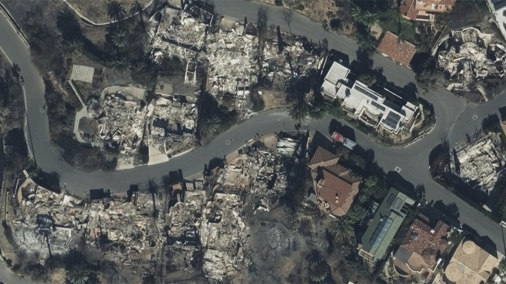
The wildfires that tore through the greater Los Angeles area caused significant destruction, taking neighborhoods down to ash, drastically altering communities for the foreseeable future. What happened is still being reviewed and evaluated as the spread of the fires impacted thousands of homes. And what’s been needed is high-resolution imagery and data to assist in those evaluation efforts, imagery such as oblique, ortho, and multispectral views to provide context and clarity of the ground situation. Vexcel’s coverage of the LA wildfires was extensive with multiple collections and has and will continue to support various entities from insurance to government and more in their response to this disaster.
One of the entities supported by this imagery includes the US Army Corp of Engineers (USACE). After major disasters, FEMA assigns USACE to conduct various debris removal missions. Having the ability to rely on high quality aerial imagery to assess before-and-after conditions following a disaster has greatly improved efficiency in assessing areas and debris information. It used to require teams deployed on the ground to manually assess and estimate debris volumes, but now ready access to this imagery significantly impacts their ability to improve their execution and response. And with imagery available so quickly following a major disaster, USACE is able to assist with greater urgency.
High-resolution imagery & data continue to provide insight
Even with weeks gone by after the fires have dissipated, imagery and data are still being highlighted as a critical need to assess the impact to affected areas. In a recent plenary session during the Esri Federal User Conference on February 25th, presenters showcased how Vexcel’s high-resolution disaster imagery paired with AI in ArcGIS was used to run a model and identify structures left untouched by wildfire damage in the Pacific Palisades. The successful output of these types of models are dependent on reliable, accurate imagery to quickly gauge the level of destruction. You can view the presentation starting at the 2:00 min mark here.
Download Report on LA Wildfire Coverage
Get access to Vexcel’s full coverage of the LA wildfires, from the number of structures analyzed and damaged, the damage assessment examples, the before-and-after imagery, and much more to understand how our Gray Sky program supports collection of major disasters. Feel free to share it with those who will find the information useful and are looking for connection to coverage for this disaster.
You can also learn more about our Gray Sky program and how we are constantly monitoring weather conditions in the U.S. to stay aware of potential disasters. We understand how important it is to provide high-resolution imagery at scale as quickly as possible following catastrophes to support insurers and government entities who provide relief to those impacted.


