 https://vexceldata.com/wp-content/uploads/2021/02/Redmond_WA_Aerial_Image_Neighborhood_Block.jpg
576
1024
vexcel
https://vexceldata.com/wp-content/uploads/2021/12/VEXCEL-Data-Program.png
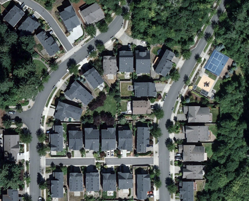
vexcel2021-06-30 18:57:192026-04-14 15:55:39New Data Search Functionality in Viewer
https://vexceldata.com/wp-content/uploads/2021/02/Redmond_WA_Aerial_Image_Neighborhood_Block.jpg
576
1024
vexcel
https://vexceldata.com/wp-content/uploads/2021/12/VEXCEL-Data-Program.png
vexcel2021-06-30 18:57:192026-04-14 15:55:39New Data Search Functionality in Viewer https://vexceldata.com/wp-content/uploads/2021/06/Instasquare.jpg
400
393
vexcel
https://vexceldata.com/wp-content/uploads/2021/12/VEXCEL-Data-Program.png
vexcel2021-06-25 15:27:322021-06-25 15:27:32Looking for a Bit of Global Eye Candy?
https://vexceldata.com/wp-content/uploads/2021/06/Instasquare.jpg
400
393
vexcel
https://vexceldata.com/wp-content/uploads/2021/12/VEXCEL-Data-Program.png
vexcel2021-06-25 15:27:322021-06-25 15:27:32Looking for a Bit of Global Eye Candy?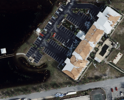 https://vexceldata.com/wp-content/uploads/2021/06/Perdido-Key-FL_Aerial_Image_Hurricane_3-scaled-1.jpg
1126
2560
vexcel
https://vexceldata.com/wp-content/uploads/2021/12/VEXCEL-Data-Program.png
vexcel2021-06-25 13:26:022024-10-08 08:37:11Boosting Innovation in Managing Claims with High-Res Aerial Imagery
https://vexceldata.com/wp-content/uploads/2021/06/Perdido-Key-FL_Aerial_Image_Hurricane_3-scaled-1.jpg
1126
2560
vexcel
https://vexceldata.com/wp-content/uploads/2021/12/VEXCEL-Data-Program.png
vexcel2021-06-25 13:26:022024-10-08 08:37:11Boosting Innovation in Managing Claims with High-Res Aerial Imagery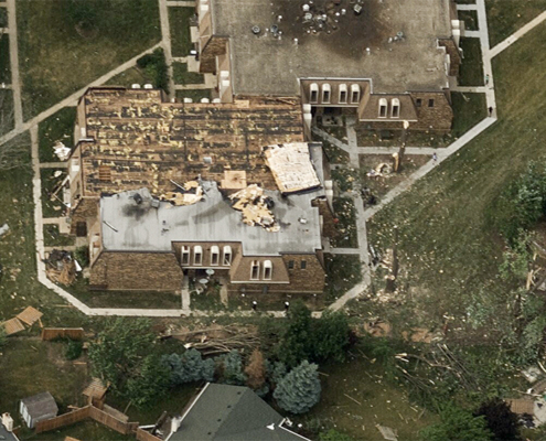 https://vexceldata.com/wp-content/uploads/2021/06/Chicago_Aerial_Image_Tornado_1_1.jpg
563
1000
vexcel
https://vexceldata.com/wp-content/uploads/2021/12/VEXCEL-Data-Program.png
vexcel2021-06-23 09:18:152024-10-08 08:37:11Powerful EF-3 Tornado Rips Through Southside of Chicago
https://vexceldata.com/wp-content/uploads/2021/06/Chicago_Aerial_Image_Tornado_1_1.jpg
563
1000
vexcel
https://vexceldata.com/wp-content/uploads/2021/12/VEXCEL-Data-Program.png
vexcel2021-06-23 09:18:152024-10-08 08:37:11Powerful EF-3 Tornado Rips Through Southside of Chicago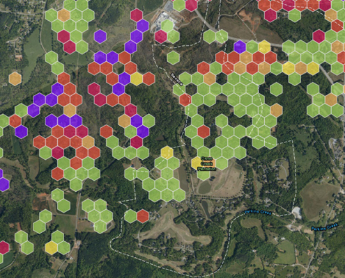 https://vexceldata.com/wp-content/uploads/2020/12/Seneca_SouthCarolina_Aerial_Image_MunichRe.jpg
500
650
vexcel
https://vexceldata.com/wp-content/uploads/2021/12/VEXCEL-Data-Program.png
vexcel2021-06-17 13:23:282026-04-14 15:38:02Pairing GIC imagery with advanced analytics
https://vexceldata.com/wp-content/uploads/2020/12/Seneca_SouthCarolina_Aerial_Image_MunichRe.jpg
500
650
vexcel
https://vexceldata.com/wp-content/uploads/2021/12/VEXCEL-Data-Program.png
vexcel2021-06-17 13:23:282026-04-14 15:38:02Pairing GIC imagery with advanced analytics https://vexceldata.com/wp-content/uploads/2021/06/SeasideHomes-PR.png
779
1594
vexcel
https://vexceldata.com/wp-content/uploads/2021/12/VEXCEL-Data-Program.png
vexcel2021-06-02 15:09:412024-10-08 08:37:43Introducing Puerto Rico–Both Blue & Gray Sky Imagery
https://vexceldata.com/wp-content/uploads/2021/06/SeasideHomes-PR.png
779
1594
vexcel
https://vexceldata.com/wp-content/uploads/2021/12/VEXCEL-Data-Program.png
vexcel2021-06-02 15:09:412024-10-08 08:37:43Introducing Puerto Rico–Both Blue & Gray Sky Imagery https://vexceldata.com/wp-content/uploads/2021/05/200CocoBeachBoulevard-RioGrand-00745-PR.jpg
777
1362
vexcel
https://vexceldata.com/wp-content/uploads/2021/12/VEXCEL-Data-Program.png
vexcel2021-05-27 16:42:242026-04-14 15:51:02Introducing Puerto Rico: The Latest Addition to Our Capture Program
https://vexceldata.com/wp-content/uploads/2021/05/200CocoBeachBoulevard-RioGrand-00745-PR.jpg
777
1362
vexcel
https://vexceldata.com/wp-content/uploads/2021/12/VEXCEL-Data-Program.png
vexcel2021-05-27 16:42:242026-04-14 15:51:02Introducing Puerto Rico: The Latest Addition to Our Capture Program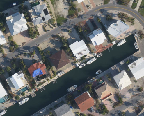 https://vexceldata.com/wp-content/uploads/2021/05/BuenaVistaCT_Islamorada_FL_Sep2017.png
821
1306
vexcel
https://vexceldata.com/wp-content/uploads/2021/12/VEXCEL-Data-Program.png
vexcel2021-05-18 11:01:402026-04-14 15:52:25Uncovering a $2.5M Property Claims Fraud Scheme with High-Res Imagery
https://vexceldata.com/wp-content/uploads/2021/05/BuenaVistaCT_Islamorada_FL_Sep2017.png
821
1306
vexcel
https://vexceldata.com/wp-content/uploads/2021/12/VEXCEL-Data-Program.png
vexcel2021-05-18 11:01:402026-04-14 15:52:25Uncovering a $2.5M Property Claims Fraud Scheme with High-Res Imagery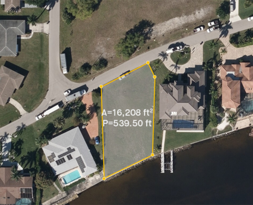 https://vexceldata.com/wp-content/uploads/2021/02/cape_coral_florida_ortho_aerameasurement.jpg
576
1024
vexcel
https://vexceldata.com/wp-content/uploads/2021/12/VEXCEL-Data-Program.png
vexcel2021-05-06 20:56:582026-04-14 15:51:04Fast-track Property Valuations with High-Res Aerial Imagery
https://vexceldata.com/wp-content/uploads/2021/02/cape_coral_florida_ortho_aerameasurement.jpg
576
1024
vexcel
https://vexceldata.com/wp-content/uploads/2021/12/VEXCEL-Data-Program.png
vexcel2021-05-06 20:56:582026-04-14 15:51:04Fast-track Property Valuations with High-Res Aerial Imagery
