Gray Sky: TCU Lightning Complex Fires

Update: Imagery Published
Tuesday, September 9, 2025
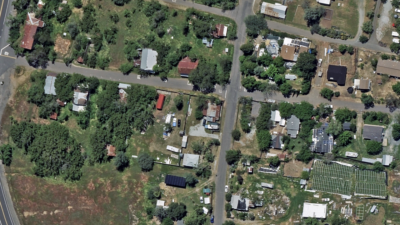
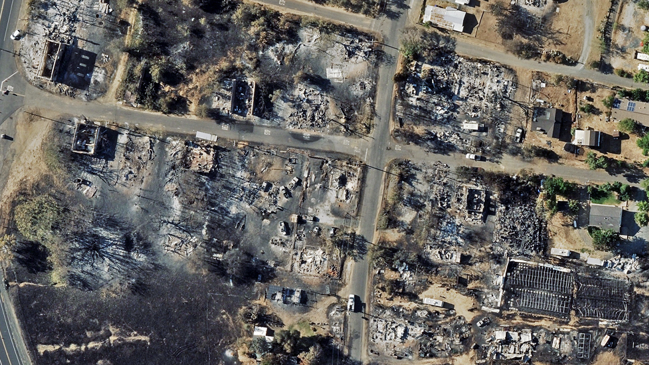
High-resolution aerial imagery from our Gray Sky response to the wildfires burning in Tuolumne and Calaveras counties is now available via the Vexcel Platform and partner sites. This 10cm ortho and multispectral imagery focuses on the most severely damaged areas where nearly 100 structures have been destroyed.
The fires started on September 2 when a series of dry lightning strikes hit the Sierra Nevada foothills in California. The fires are currently active and 66% contained. Three of the 22 wildfires sparked from this event have burned nearly 14,000 acres. Our Gray Sky team worked around smoky conditions to capture this imagery.
Customers can now view and analyze the fire imagery plus Damage Assessment analytics to support response, recovery, and assessment efforts. We’ll continue to monitor the fire.
The image above showcases our damage footprints highlighting the destroyed structures. Below is a before-and-after ortho image of an impacted area and additional imagery of the destroyed areas. If you need imagery from this event, please connect with our team via the form below.