 https://vexceldata.com/wp-content/uploads/2025/09/VEX-623-GRA-Satellite-vs-Aerial-Graphic_Light-BG_Aerial-Drone.png
576
1024
vexcel
https://vexceldata.com/wp-content/uploads/2021/12/VEXCEL-Data-Program.png
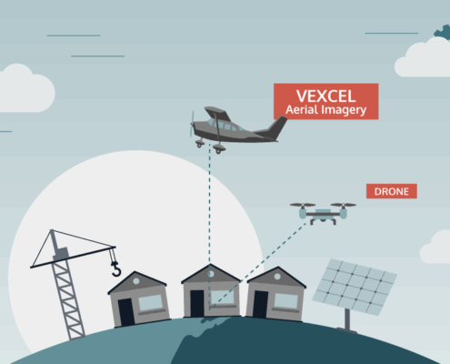
vexcel2025-09-30 09:01:522026-04-14 15:46:27Aerial vs. Drone: What the Power of Scale Can Do
https://vexceldata.com/wp-content/uploads/2025/09/VEX-623-GRA-Satellite-vs-Aerial-Graphic_Light-BG_Aerial-Drone.png
576
1024
vexcel
https://vexceldata.com/wp-content/uploads/2021/12/VEXCEL-Data-Program.png
vexcel2025-09-30 09:01:522026-04-14 15:46:27Aerial vs. Drone: What the Power of Scale Can Do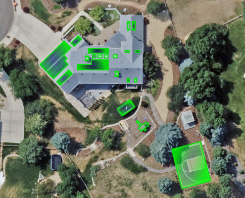 https://vexceldata.com/wp-content/uploads/2025/09/Littleton-CO-39.580492-105.169218.jpg
720
1280
vexcel
https://vexceldata.com/wp-content/uploads/2021/12/VEXCEL-Data-Program.png
vexcel2025-09-23 11:25:562025-09-23 12:17:37Keeping Up with Change: How Vexcel Helps Tax Assessors Modernize Property Assessment
https://vexceldata.com/wp-content/uploads/2025/09/Littleton-CO-39.580492-105.169218.jpg
720
1280
vexcel
https://vexceldata.com/wp-content/uploads/2021/12/VEXCEL-Data-Program.png
vexcel2025-09-23 11:25:562025-09-23 12:17:37Keeping Up with Change: How Vexcel Helps Tax Assessors Modernize Property Assessment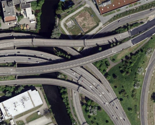 https://vexceldata.com/wp-content/uploads/2025/09/Berlin-Germany-52.463780-13.453301.jpg
576
1024
vexcel
https://vexceldata.com/wp-content/uploads/2021/12/VEXCEL-Data-Program.png
vexcel2025-09-05 14:09:032026-04-14 15:46:27Seeing the Road Ahead: How Vexcel Supports Smarter Transportation Planning
https://vexceldata.com/wp-content/uploads/2025/09/Berlin-Germany-52.463780-13.453301.jpg
576
1024
vexcel
https://vexceldata.com/wp-content/uploads/2021/12/VEXCEL-Data-Program.png
vexcel2025-09-05 14:09:032026-04-14 15:46:27Seeing the Road Ahead: How Vexcel Supports Smarter Transportation Planning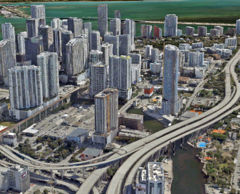 https://vexceldata.com/wp-content/uploads/2025/08/Miami_3D_City_1.jpg
720
1280
vexcel
https://vexceldata.com/wp-content/uploads/2021/12/VEXCEL-Data-Program.png
vexcel2025-08-20 08:07:282025-08-25 12:21:41See It. Plan It. Perfect It. How Vexcel Data Elevates AEC Projects
https://vexceldata.com/wp-content/uploads/2025/08/Miami_3D_City_1.jpg
720
1280
vexcel
https://vexceldata.com/wp-content/uploads/2021/12/VEXCEL-Data-Program.png
vexcel2025-08-20 08:07:282025-08-25 12:21:41See It. Plan It. Perfect It. How Vexcel Data Elevates AEC Projects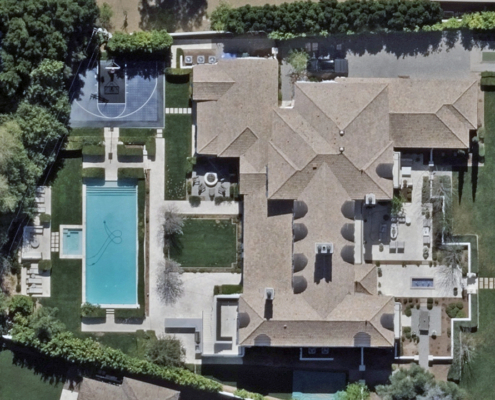 https://vexceldata.com/wp-content/uploads/2025/08/4615-N-Launfal-Ave-Phoenix-AZ-85018-USA.jpg
720
1280
vexcel
https://vexceldata.com/wp-content/uploads/2021/12/VEXCEL-Data-Program.png
vexcel2025-08-07 17:57:332025-08-18 12:33:592025 U.S. Collection Update
https://vexceldata.com/wp-content/uploads/2025/08/4615-N-Launfal-Ave-Phoenix-AZ-85018-USA.jpg
720
1280
vexcel
https://vexceldata.com/wp-content/uploads/2021/12/VEXCEL-Data-Program.png
vexcel2025-08-07 17:57:332025-08-18 12:33:592025 U.S. Collection Update https://vexceldata.com/wp-content/uploads/2025/07/Tokyo-Japan-35.693893-139.701289.jpg
720
1280
vexcel
https://vexceldata.com/wp-content/uploads/2021/12/VEXCEL-Data-Program.png
vexcel2025-07-30 19:46:292025-08-25 12:25:26We’re Big in Japan: Vexcel’s High-res Imagery Brings Cities to Life
https://vexceldata.com/wp-content/uploads/2025/07/Tokyo-Japan-35.693893-139.701289.jpg
720
1280
vexcel
https://vexceldata.com/wp-content/uploads/2021/12/VEXCEL-Data-Program.png
vexcel2025-07-30 19:46:292025-08-25 12:25:26We’re Big in Japan: Vexcel’s High-res Imagery Brings Cities to Life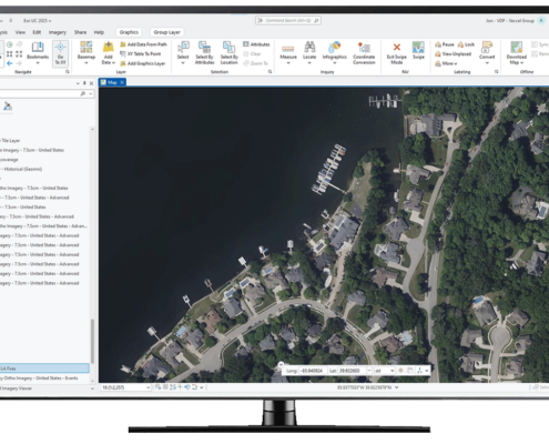 https://vexceldata.com/wp-content/uploads/2025/07/ArcGIS-Computer-Screen.png
777
1280
vexcel
https://vexceldata.com/wp-content/uploads/2021/12/VEXCEL-Data-Program.png
vexcel2025-07-09 08:06:462025-08-25 16:16:09Need Fast Access to Imagery and Data in ArcGIS? Vexcel Has You Covered
https://vexceldata.com/wp-content/uploads/2025/07/ArcGIS-Computer-Screen.png
777
1280
vexcel
https://vexceldata.com/wp-content/uploads/2021/12/VEXCEL-Data-Program.png
vexcel2025-07-09 08:06:462025-08-25 16:16:09Need Fast Access to Imagery and Data in ArcGIS? Vexcel Has You Covered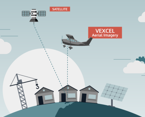 https://vexceldata.com/wp-content/uploads/2025/07/VEX-623-GRA-Satellite-vs-Aerial-Graphic_Light-BG_Satellite-Aerial.png
576
1024
vexcel
https://vexceldata.com/wp-content/uploads/2021/12/VEXCEL-Data-Program.png
vexcel2025-07-03 08:38:432025-08-25 16:17:27Aerial vs. Satellite Imagery: What’s the Difference, and Why It Matters
https://vexceldata.com/wp-content/uploads/2025/07/VEX-623-GRA-Satellite-vs-Aerial-Graphic_Light-BG_Satellite-Aerial.png
576
1024
vexcel
https://vexceldata.com/wp-content/uploads/2021/12/VEXCEL-Data-Program.png
vexcel2025-07-03 08:38:432025-08-25 16:17:27Aerial vs. Satellite Imagery: What’s the Difference, and Why It Matters https://vexceldata.com/wp-content/uploads/2025/05/870-Rosewood-Dr-Villa-Hills-KY-41017-USA.jpg
720
1280
vexcel
https://vexceldata.com/wp-content/uploads/2021/12/VEXCEL-Data-Program.png
vexcel2025-06-17 10:40:292025-08-25 16:18:53The Queen of Quality: A Q&A with VP Cali Cravens
https://vexceldata.com/wp-content/uploads/2025/05/870-Rosewood-Dr-Villa-Hills-KY-41017-USA.jpg
720
1280
vexcel
https://vexceldata.com/wp-content/uploads/2021/12/VEXCEL-Data-Program.png
vexcel2025-06-17 10:40:292025-08-25 16:18:53The Queen of Quality: A Q&A with VP Cali Cravens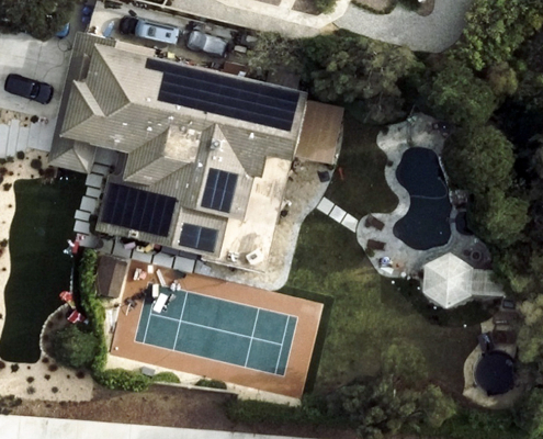 https://vexceldata.com/wp-content/uploads/2025/05/34.210502-118.907564ThousandOaks-CA.jpg
576
1024
vexcel
https://vexceldata.com/wp-content/uploads/2021/12/VEXCEL-Data-Program.png
vexcel2025-05-28 08:23:132025-08-25 16:28:12Trampolines: Provo, UT vs. Conroe, TX
https://vexceldata.com/wp-content/uploads/2025/05/34.210502-118.907564ThousandOaks-CA.jpg
576
1024
vexcel
https://vexceldata.com/wp-content/uploads/2021/12/VEXCEL-Data-Program.png
vexcel2025-05-28 08:23:132025-08-25 16:28:12Trampolines: Provo, UT vs. Conroe, TX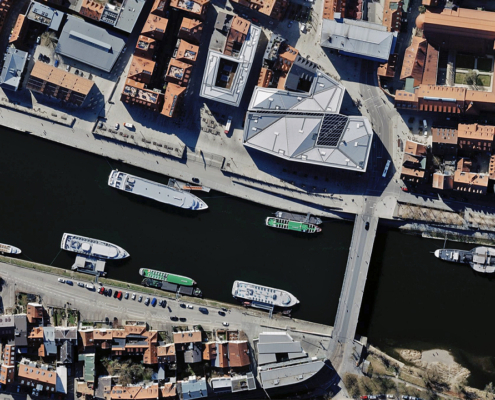 https://vexceldata.com/wp-content/uploads/2025/05/Regensburg-Germany-49.020503-12.102776-1.jpg
720
1280
vexcel
https://vexceldata.com/wp-content/uploads/2021/12/VEXCEL-Data-Program.png
vexcel2025-05-14 16:42:452025-08-25 16:29:05Collecting More Imagery in Europe in 2025
https://vexceldata.com/wp-content/uploads/2025/05/Regensburg-Germany-49.020503-12.102776-1.jpg
720
1280
vexcel
https://vexceldata.com/wp-content/uploads/2021/12/VEXCEL-Data-Program.png
vexcel2025-05-14 16:42:452025-08-25 16:29:05Collecting More Imagery in Europe in 2025 https://vexceldata.com/wp-content/uploads/2025/03/6730-E-San-Miguel-Ave-Paradise-Valley-AZ-85253-USA-East.jpg
720
1280
vexcel
https://vexceldata.com/wp-content/uploads/2021/12/VEXCEL-Data-Program.png
vexcel2025-03-18 08:56:462025-08-25 16:35:16Accelerating Property Portfolio Management with High-res Aerial Imagery
https://vexceldata.com/wp-content/uploads/2025/03/6730-E-San-Miguel-Ave-Paradise-Valley-AZ-85253-USA-East.jpg
720
1280
vexcel
https://vexceldata.com/wp-content/uploads/2021/12/VEXCEL-Data-Program.png
vexcel2025-03-18 08:56:462025-08-25 16:35:16Accelerating Property Portfolio Management with High-res Aerial Imagery
