
Gray Sky: Mississippi Tornadoes


Overview
Our Gray Sky team responded to severe storms and tornado damage in Mississippi by collecting high-resolution aerial imagery in impacted areas near Prentiss, Garden City, and Brookhaven. The collections focus on residential, commercial, and rural areas affected by the storms to support damage review, assessment, and recovery efforts.
High-resolution ortho imagery is now published and available in the Vexcel Platform, including before-and-after comparisons using existing imagery from prior collections. Property-level damage assessments are also published for all collections too.

Wednesday, May 13
More Imagery Published
High-resolution ortho imagery from our Brookhaven-area collection is now published and available in the Vexcel Platform.
The imagery includes areas near Brookhaven and Wesson in Lincoln County, Monticello in Lawrence County, and Meadville and Bude in Franklin County, expanding post-CAT coverage across south-central Mississippi.
Tuesday, May 12
More Imagery Collected
After several days of challenging weather, our Gray Sky crew was able to collect additional high-resolution aerial imagery in the Brookhaven area.
This third Mississippi collection expands coverage along the tornado track in south-central Mississippi, adding approximately 244 square miles (632 km²) of post-CAT coverage to support damage review, assessment, and recovery efforts. The collection includes areas near Brookhaven and Wesson in Lincoln County, Monticello in Lawrence County, and Meadville and Bude in Franklin County.
Saturday, May 9
Imagery Published
High-resolution ortho imagery from tornado-damaged areas near Prentiss and Garden City, Mississippi, is now published and available in the Vexcel Platform. Property level damage assessments are also in the published collection areas.
The imagery supports ongoing review and recovery efforts across impacted residential, commercial, and rural areas. Additional collections near Brookhaven are still being evaluated as weather conditions and cloud cover continue to challenge aerial operations.
Friday, May 8
Imagery Collected
Our Gray Sky team collected high-resolution aerial imagery in tornado-damaged areas near Prentiss and Garden City, Mississippi, following severe storms.
The collections focused on impacted residential, commercial, and rural areas along the tornado path to support damage review, assessment, and recovery efforts.
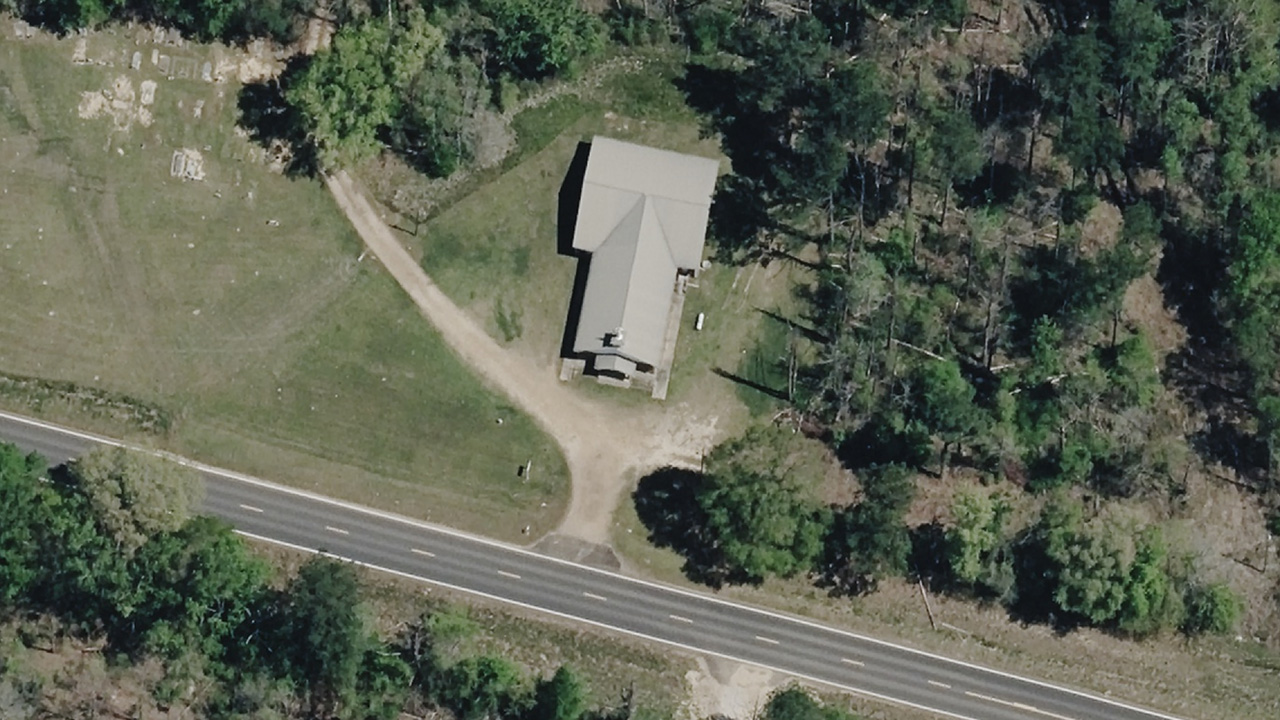
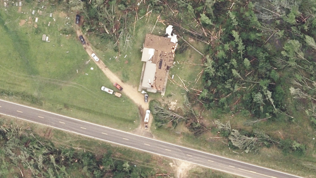
Before and After Imagery
In this comparison, the before imagery was collected on March 28, 2026. Following the tornadoes, our Gray Sky team collected new high-resolution aerial imagery of the impacted area to support damage review and recovery efforts.
Request Access
Please let us know if you need imagery for your response and recovery. Please fill out our contact form below.

